Dieser Artikel ist auch auf Deutsch verfügbar. Click here to find out more about Germany!
| Around the Eibsee | |||
| Area | Eibsee and Zugspitze, Bavaria, Germany | ||
| Start | Eibsee Station of the Bavarian Zugspitzbahn | ||
| End | Eibsee Station of the Bavarian Zugspitzbahn | ||
| Distance | 7,5 km | Duration | ~2,5 h |
| Ascent | about 80m | Descent | about 80m |
| Easy Spring Summer Fall Winter | |||
Today I have a simple and very nice hiking suggestion: we are going to hike around the Eibsee lake and then go the top of the Zugspitze using the ropeway or the rack railway! 🙂
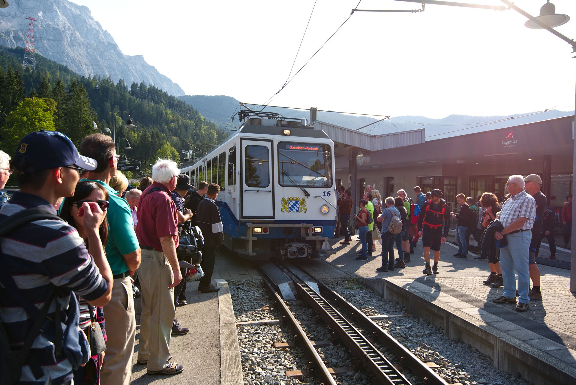
The hike begins at the Eibsee station of the Bayerische Zugspitzbahn rack railway. The best way to get there is by taking the rack railway from Garmisch-Partenkirchen, because you’ll need the 58 Euro day ticket for the later trip to the Zugspitze anyways. Garmisch-Partenkirchen can be reached quickly either by rail or via the B2 federal highway. Especially on weekends lots of tourists from North Tyrol and Munich flock to the area, though. Some of the long traffic jams on the B2 have become legendary, so I recommend taking the train 😉
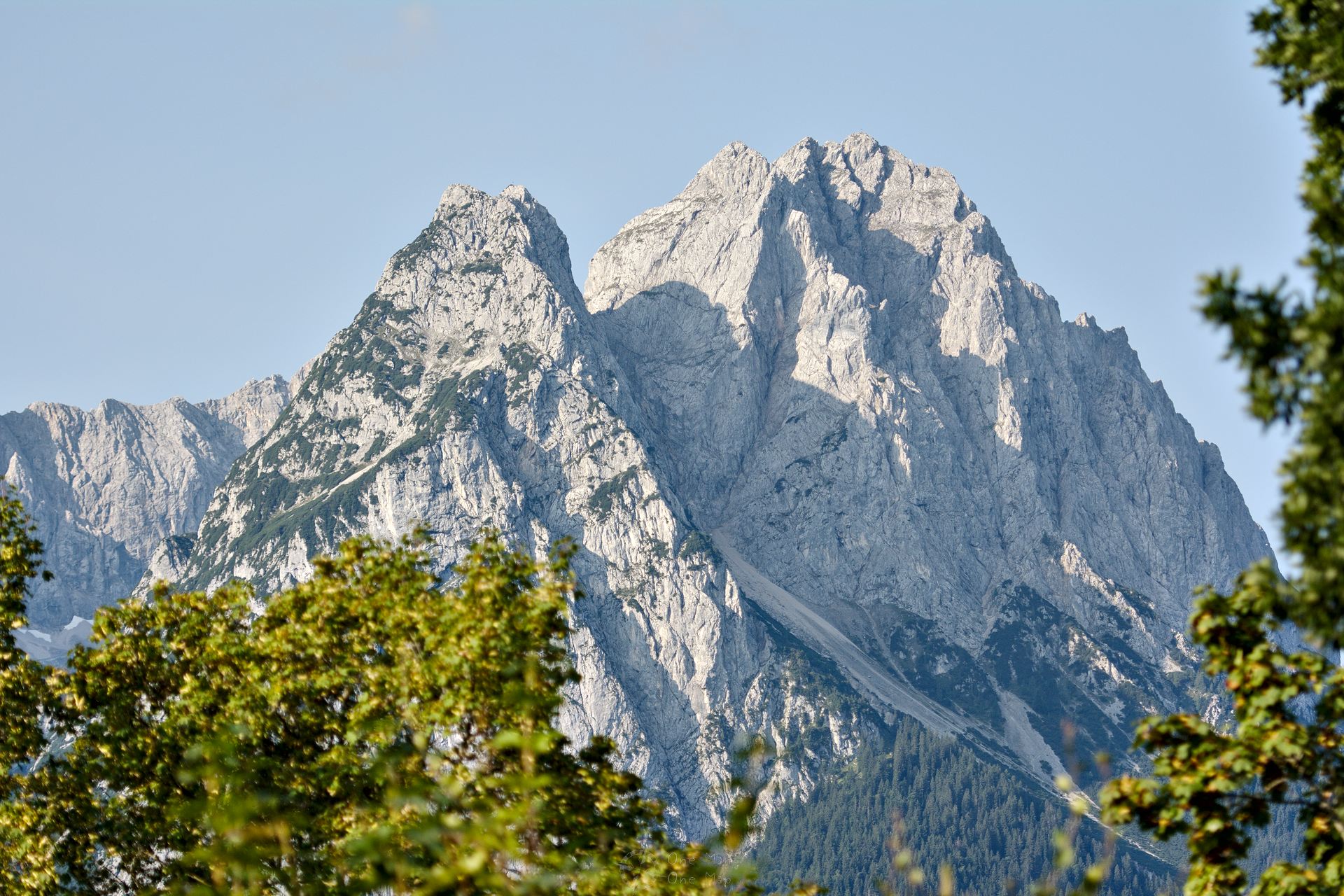
We had rented an apartment in Garmisch-Partenkirchen and could therefore comfortably walk to the next stop of the rack railway. On the way we had a good view of the Waxenstein peak at the beginning of the mountain range.
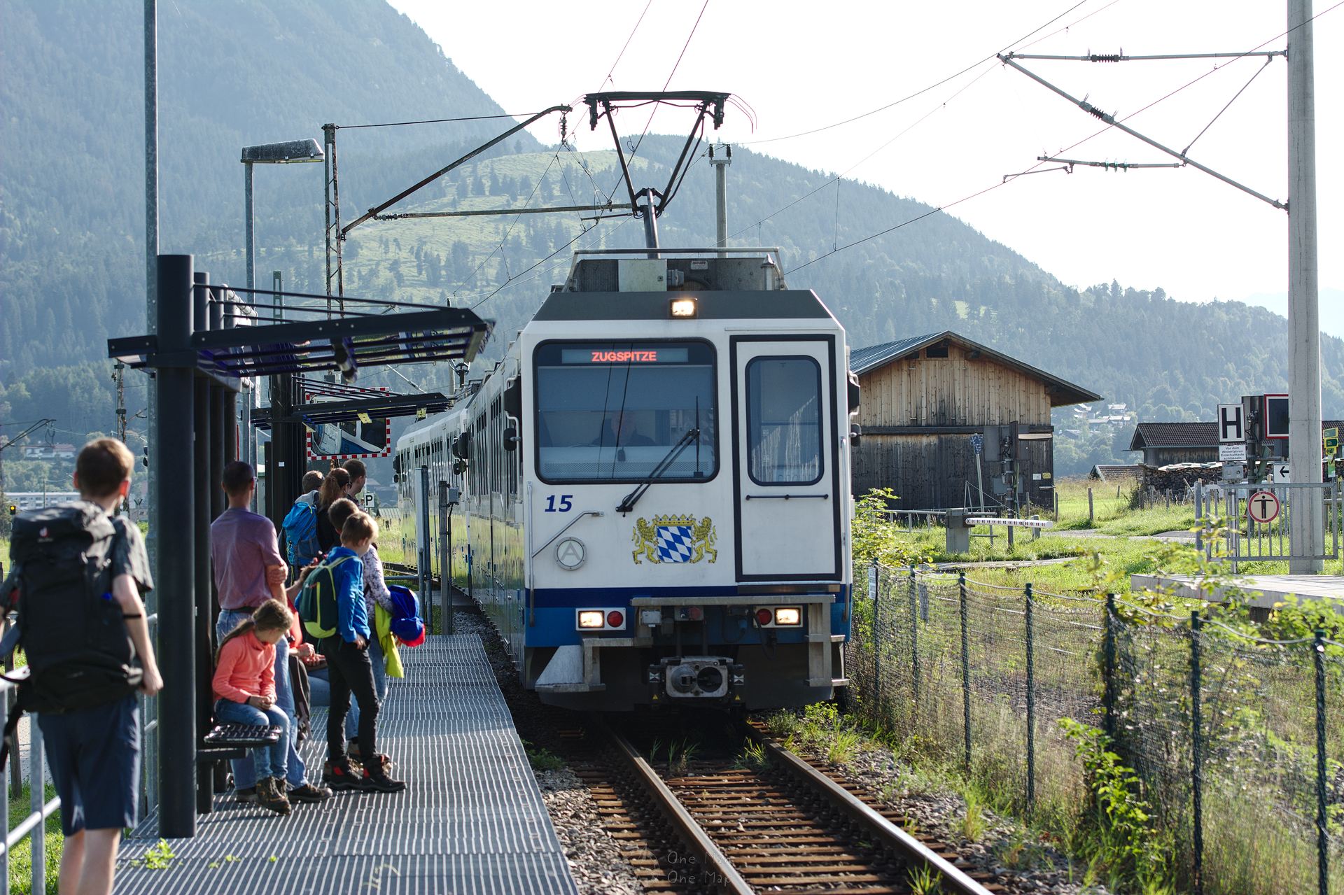
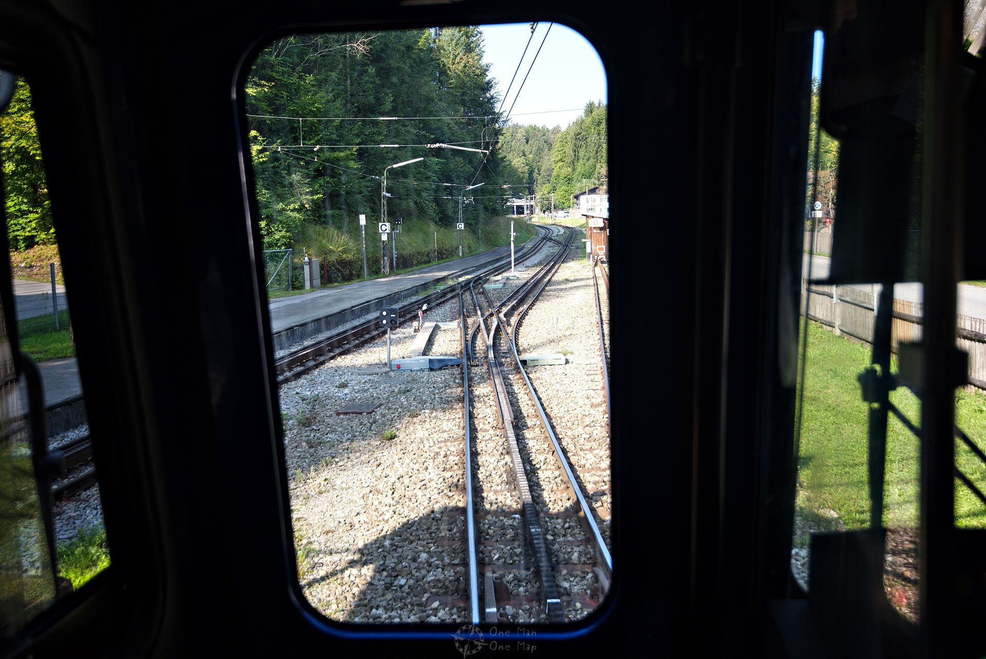
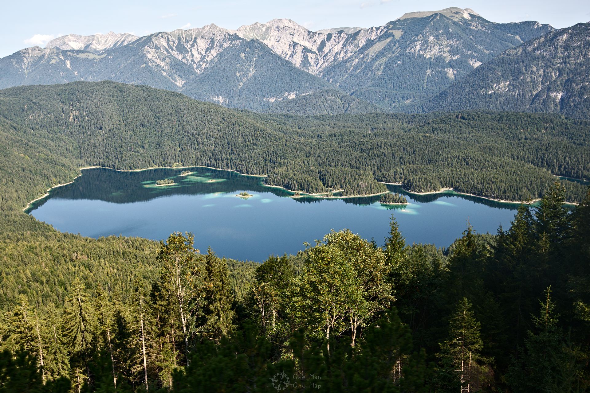
The rack railway already has to climb quite some gradients on the few kilometres to the Eibsee. No wonder: even if it may not look like it on the maps, the lake lies 265 meters above Garmisch-Partenkirchen.
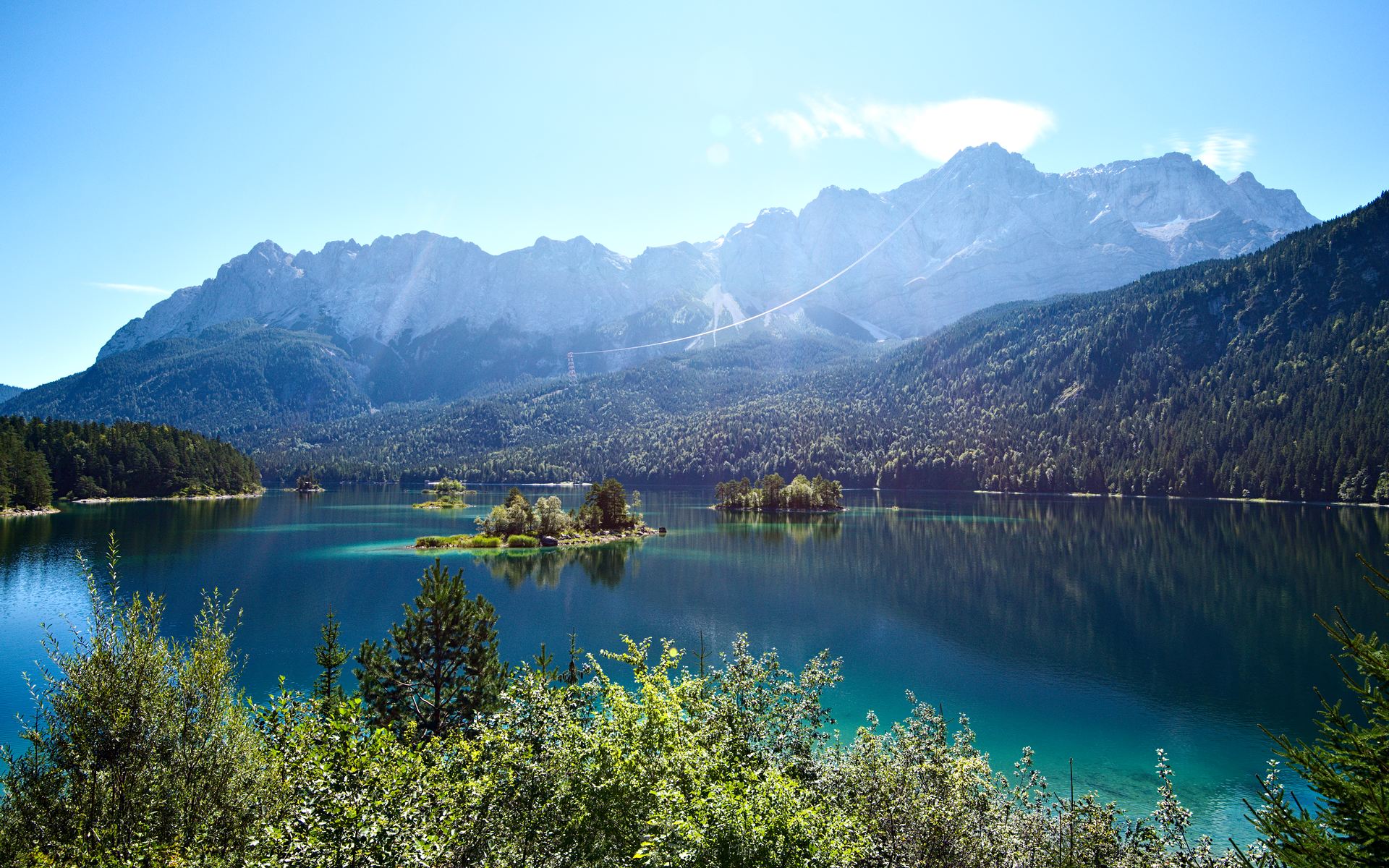
Around and on the Eibsee
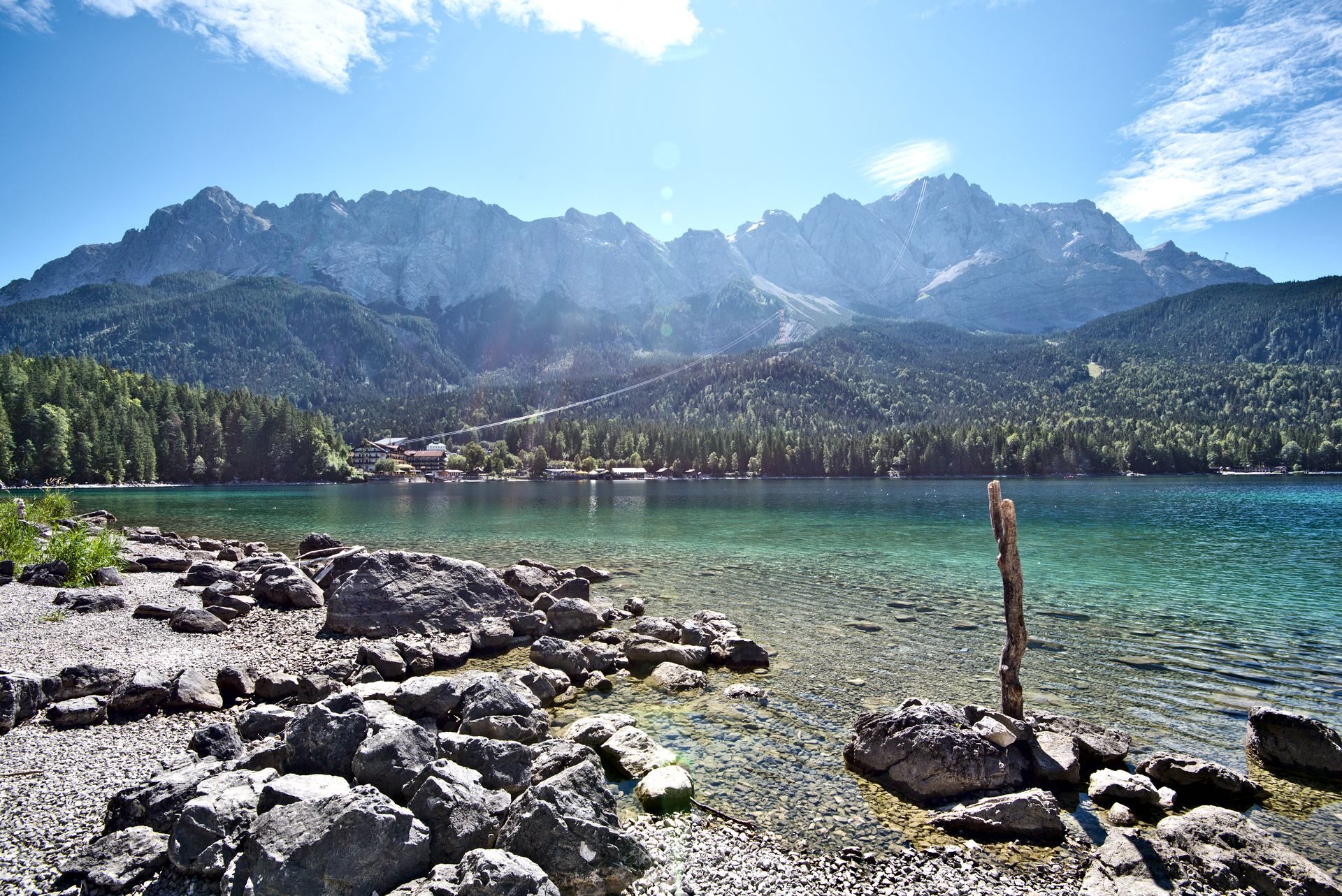
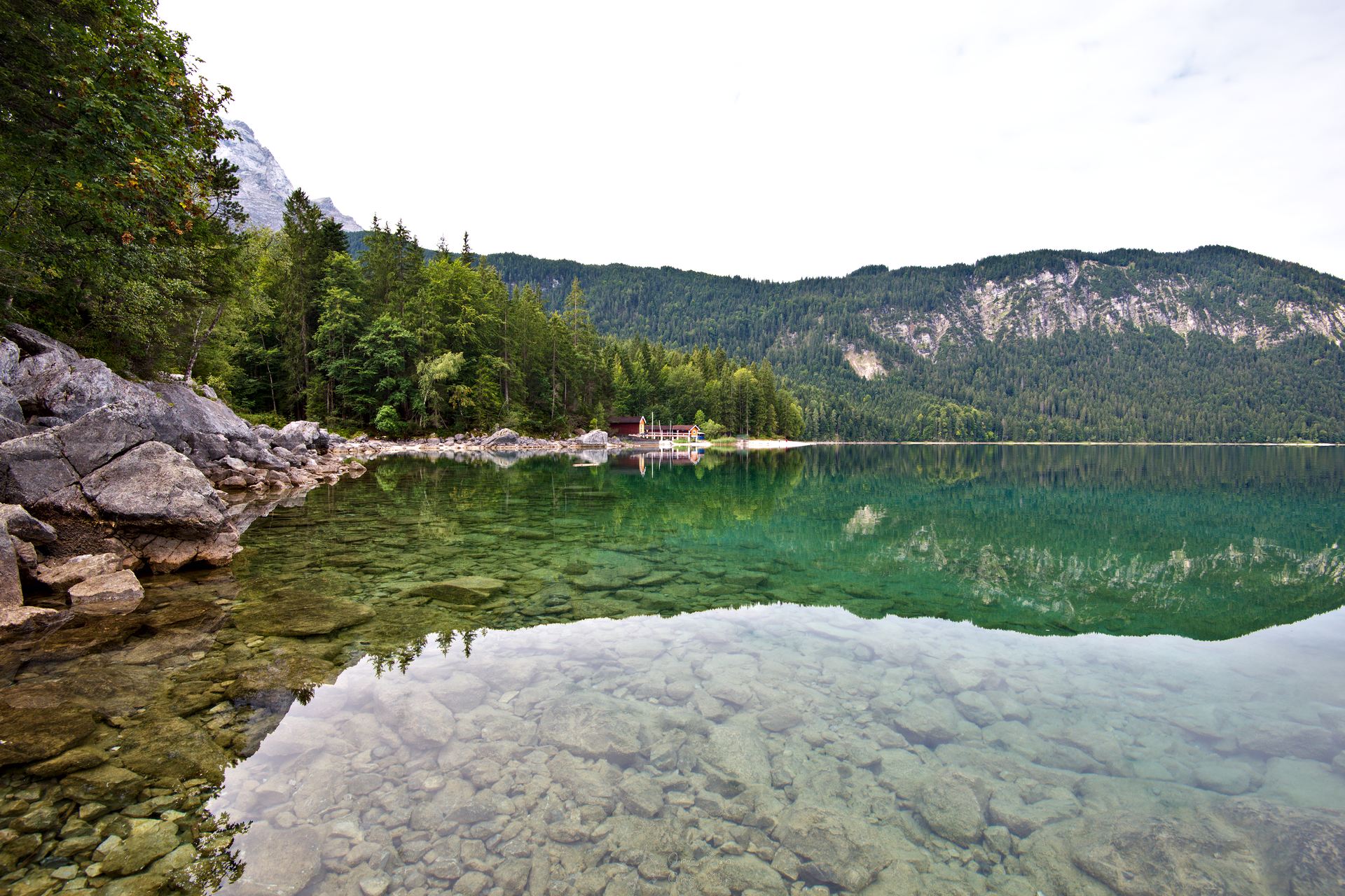
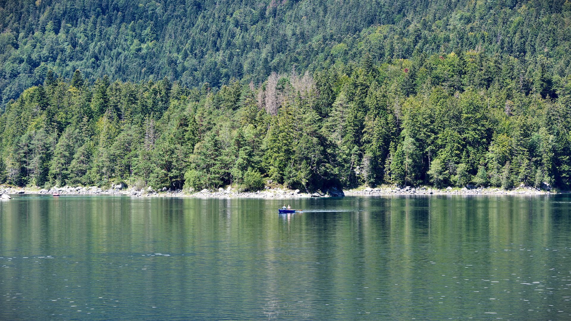
Finally arrived at the Eibsee, hikers luckily have it much easier than the rack railway. The seven and a half kilometre long circular path has only a single ascent on the southern side, otherwise it always runs at about the same elevation close to the shore.
The landscape shows itself from different sides depending on the time of day. Early in the morning, when the sun has not yet made its way through the clouds, the bathers are sitting at the breakfast table and the pedal boat rental store has not opened yet, one feels completely alone. The silence, the clear, calm water, the shades of blue and green – all this also reminded me of pictures from Canada, Sweden or other areas further north.
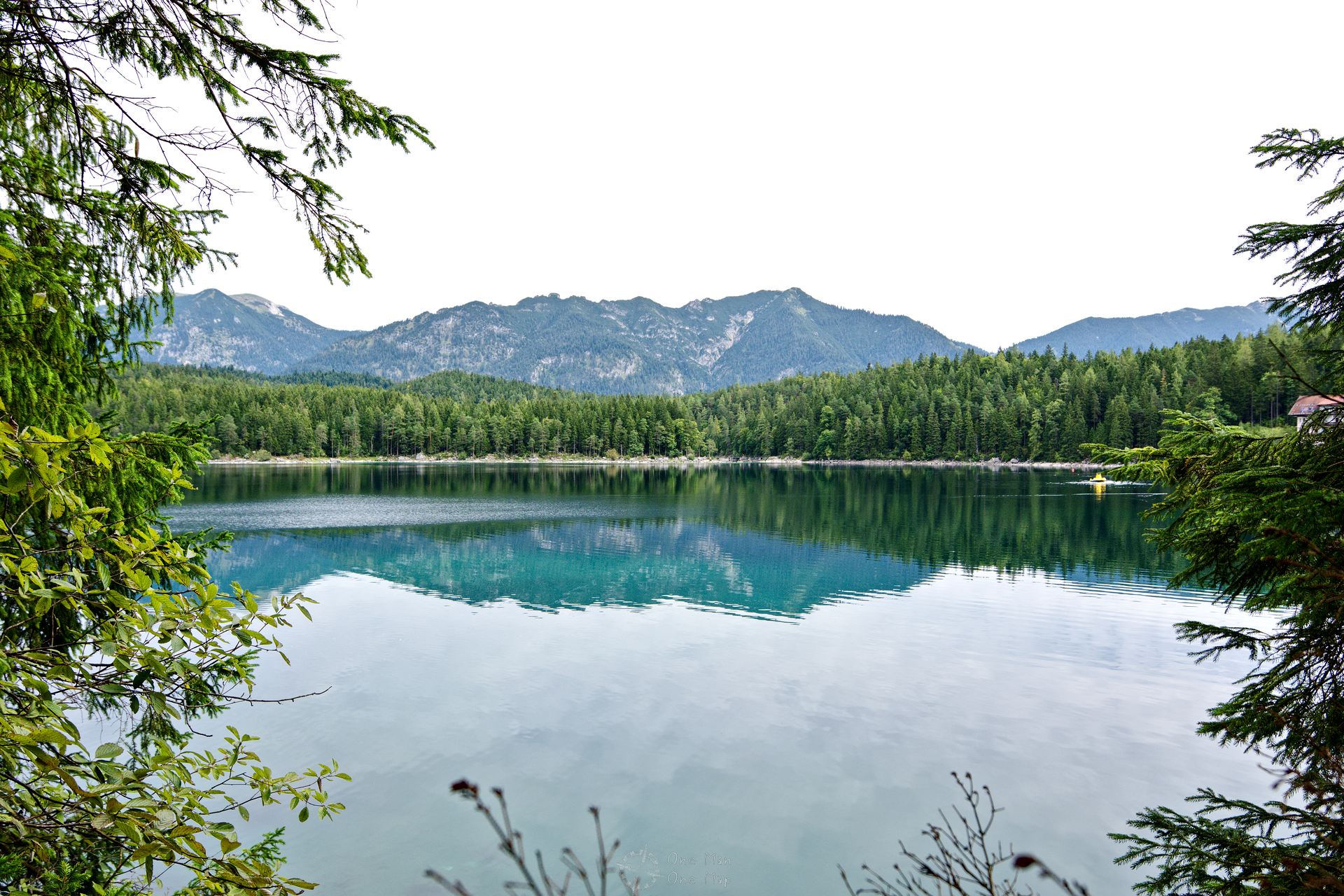
As the sun rises, the clouds disappear and slowly reveal the view of the Zugspitze massif. The clear water turns into a radiant blue surface, and trees and bushes shine in lush green.
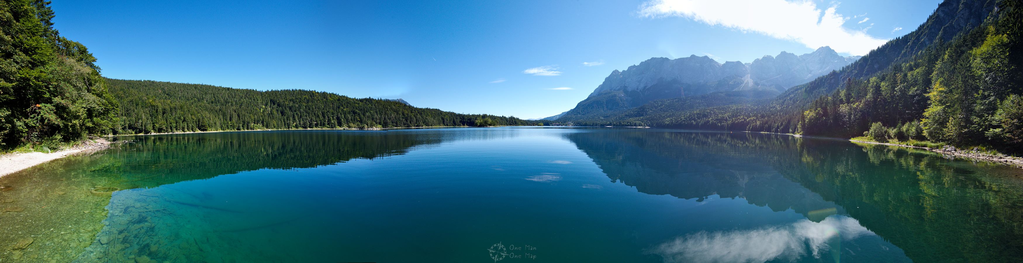
A good time for a panorama shot from the west side 🙂
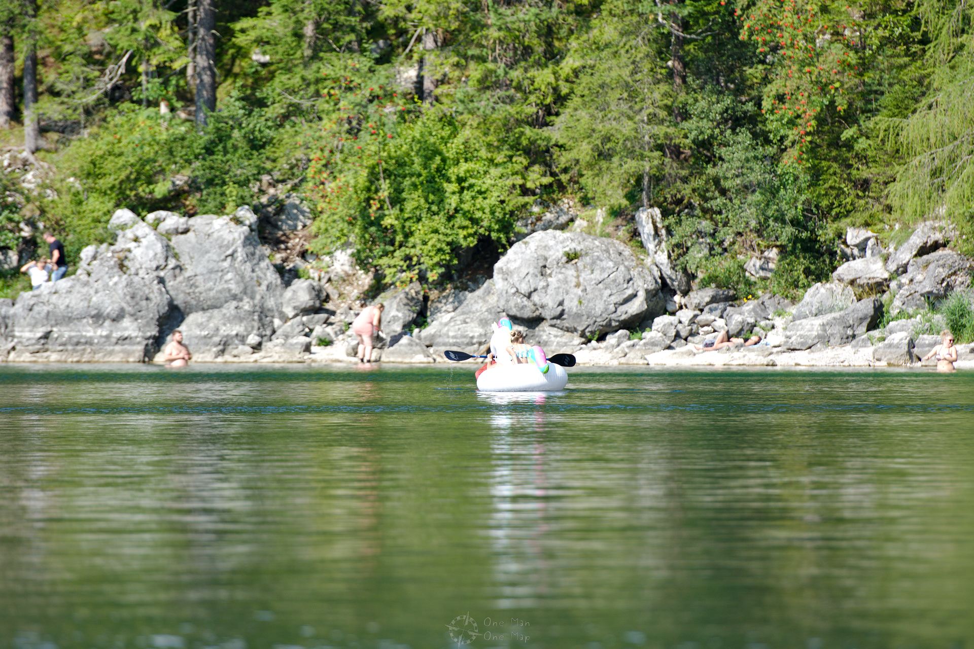
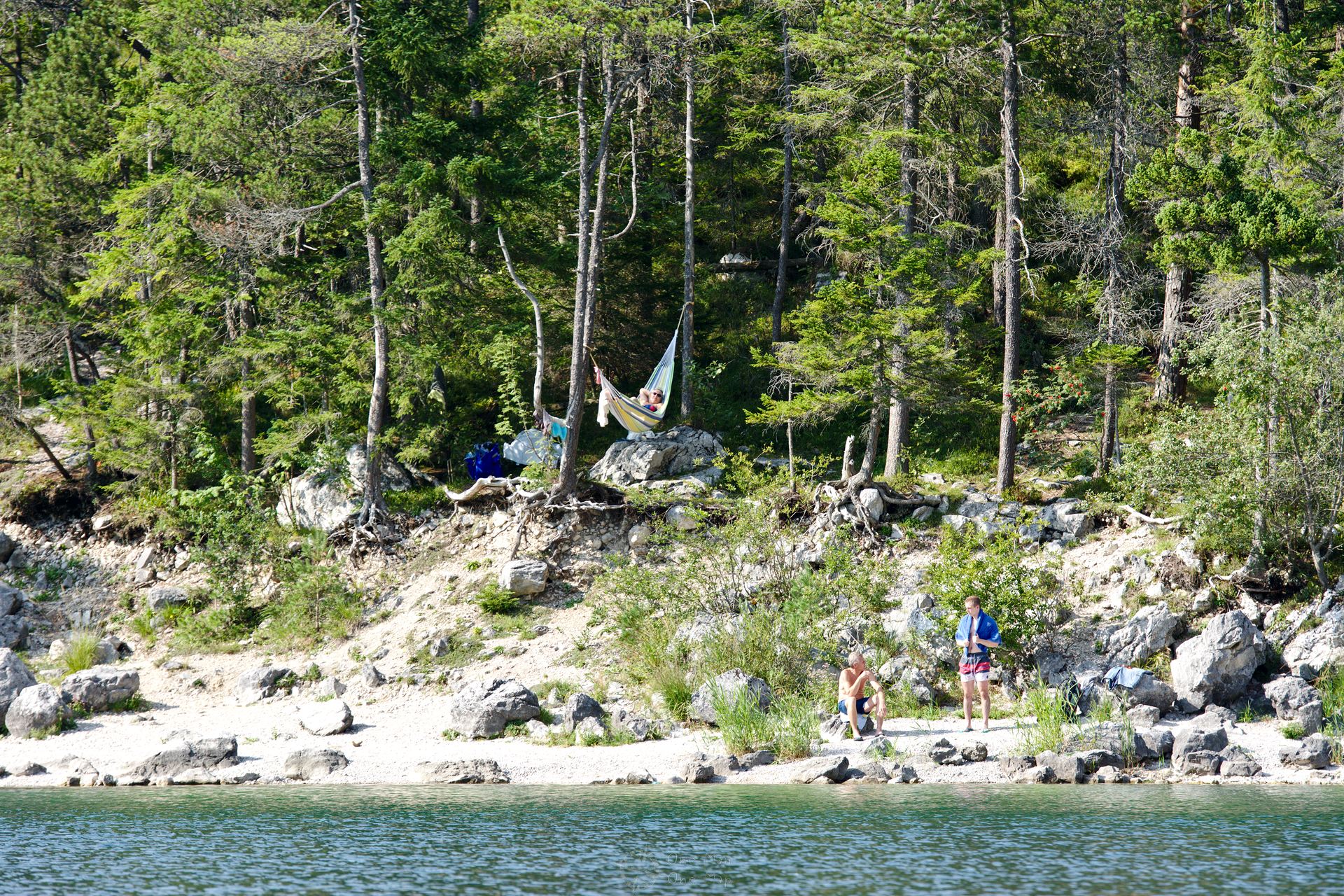
With the rising temperature the bathers start to find their way to the beach. The Eibsee has been privately owned by the Terne-Rieppel family, who also runs the only hotel in the area, for almost 150 years. Some activities such as fishing and diving are therefore reserved to the hotel guests. Pedal boats and stand-up paddling boards can be rented at a store close to the restaurant. If you prefer to let others do the work, you can set sail on the “Reserl”, the only motor ship on the Eibsee.
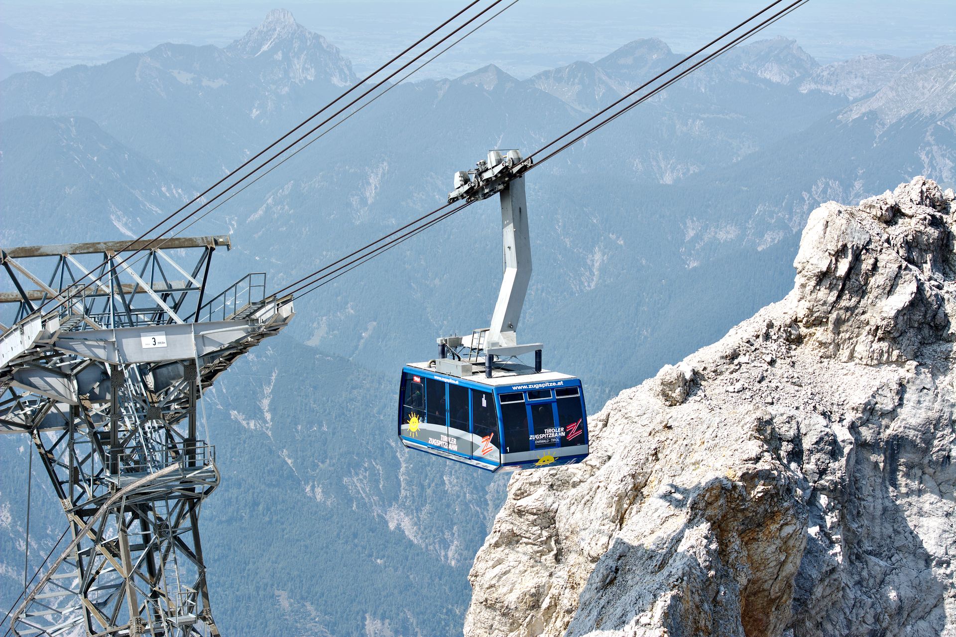
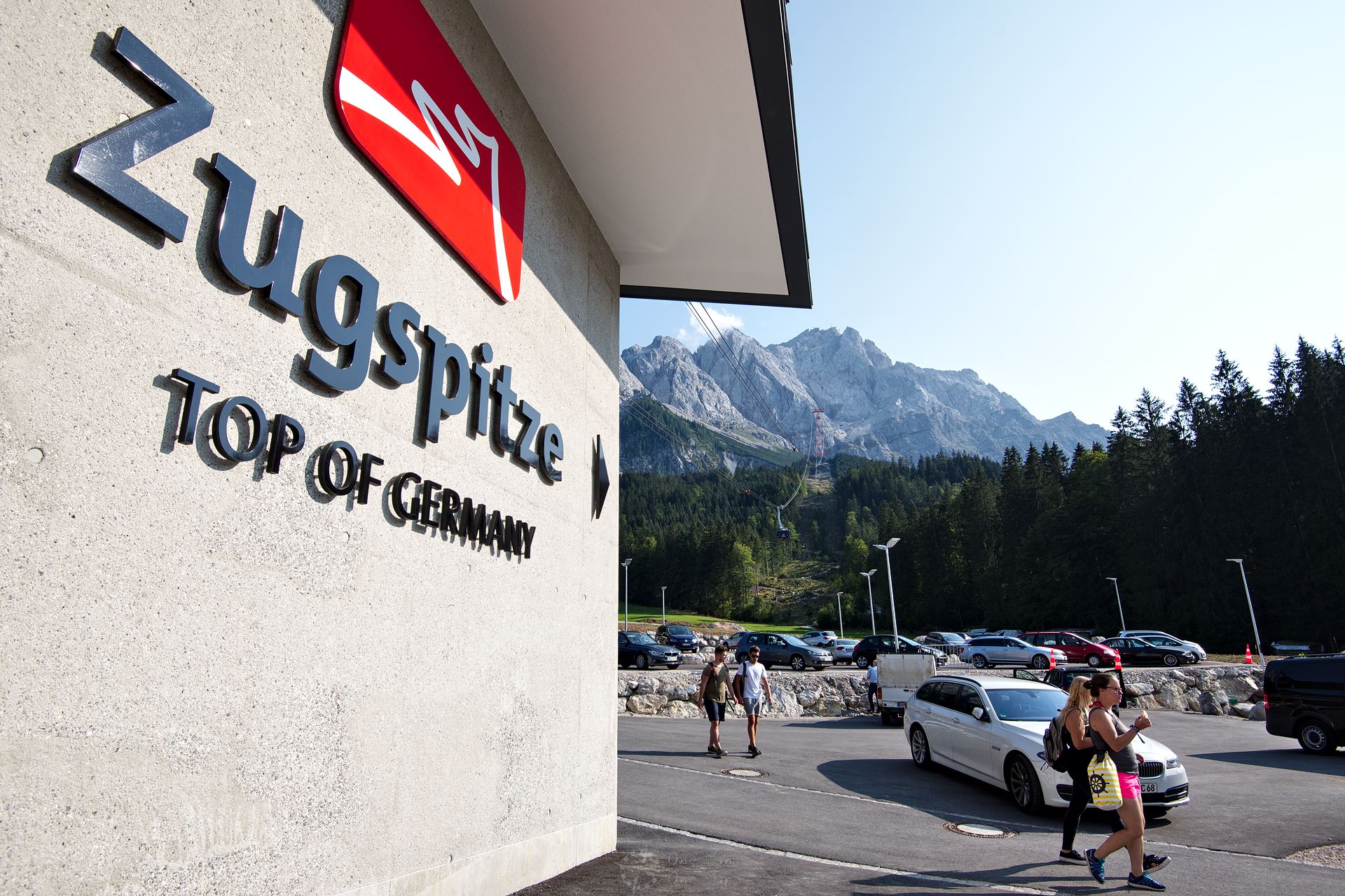
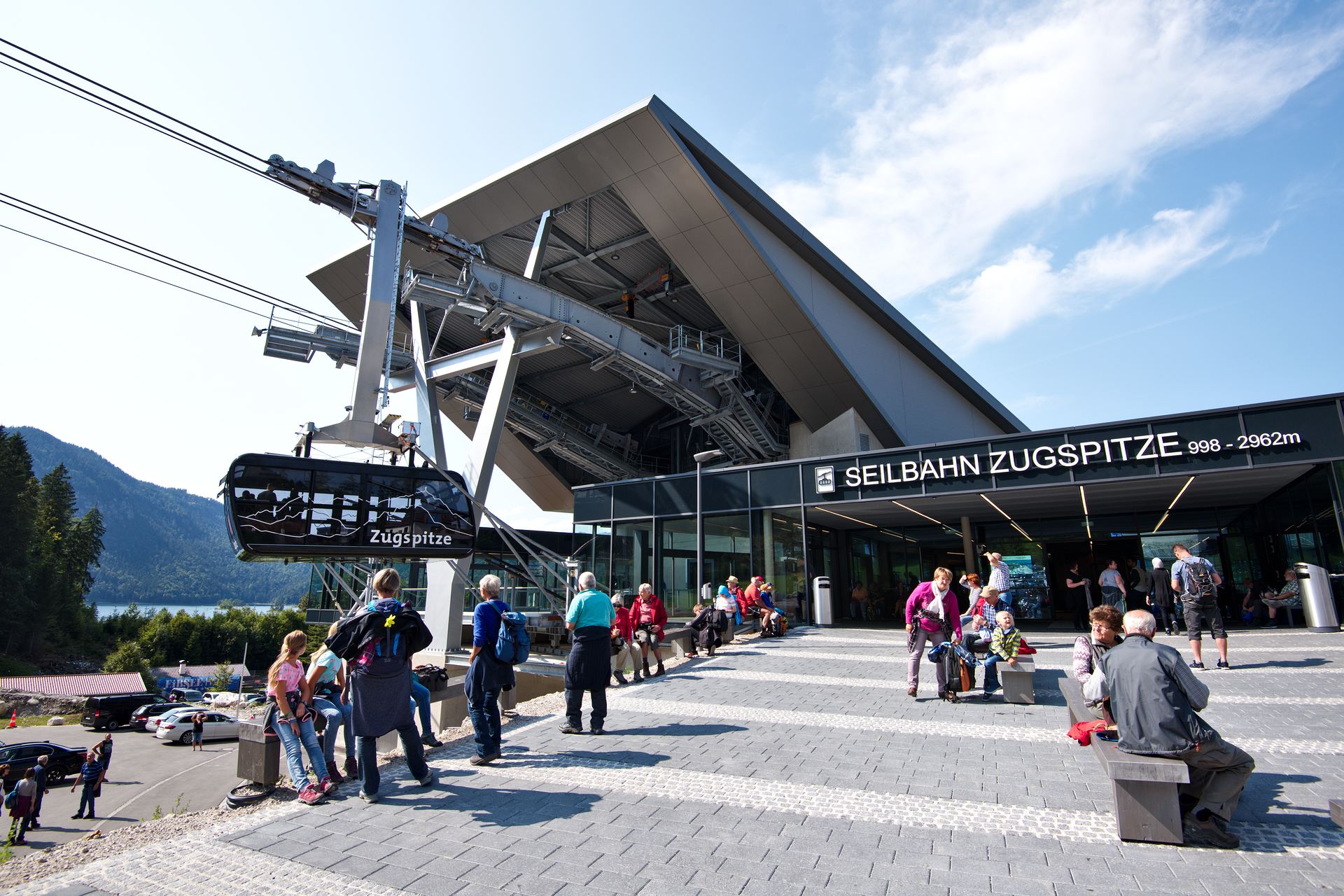
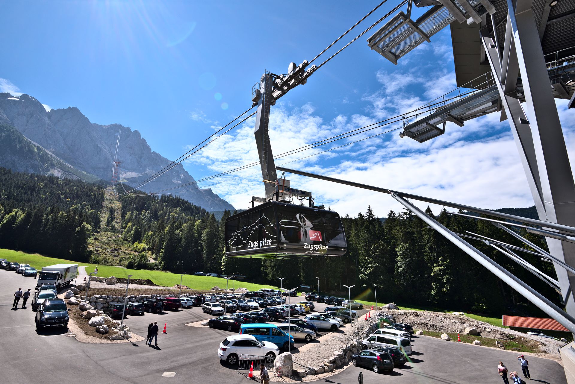
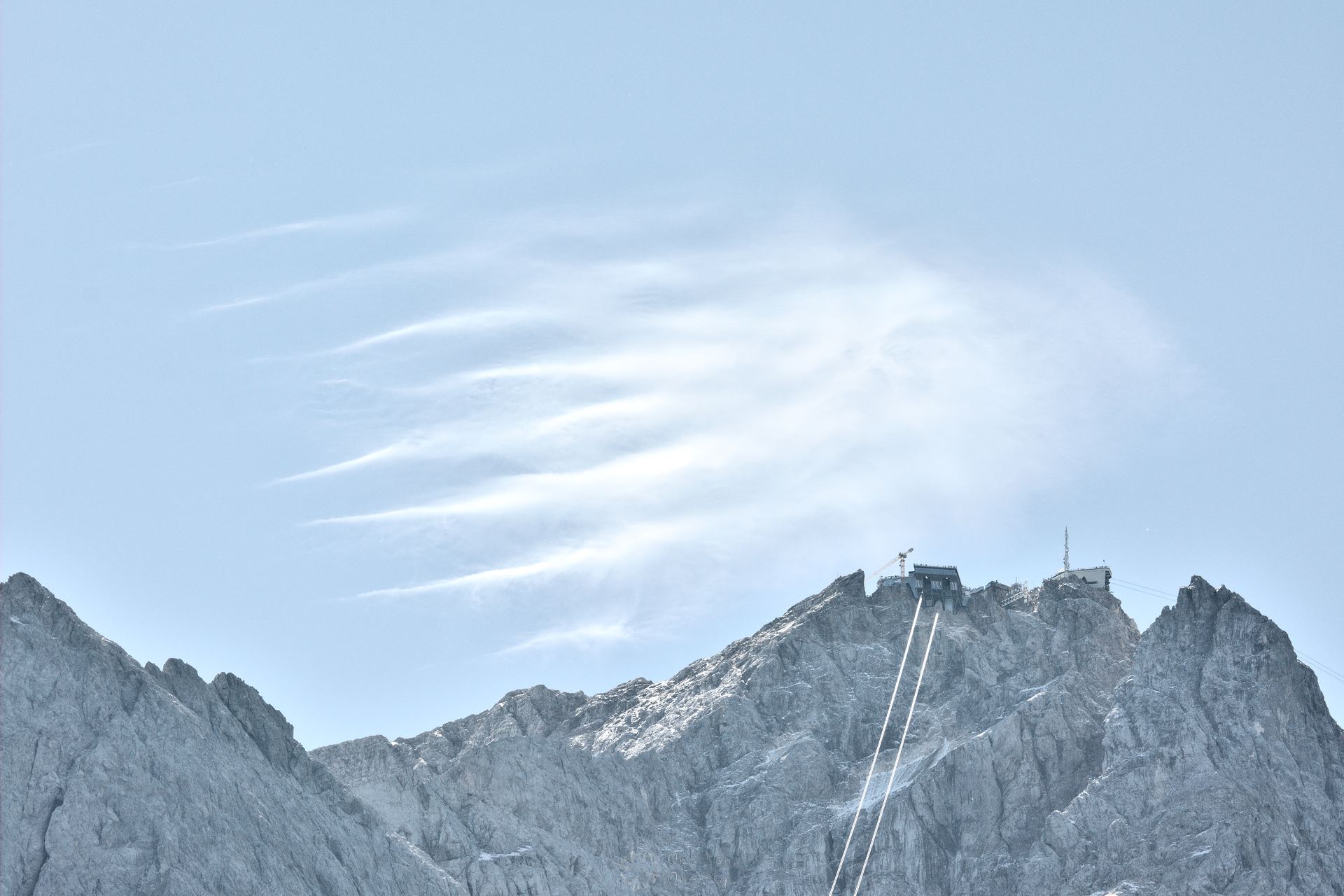
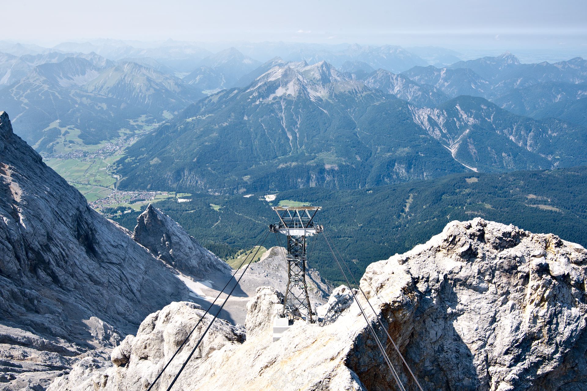
The valley station of the Zugspitz ropeway is located directly next to the Eibsee station of the Bayerische Zugspitzbahn. The new ropeway, which was opened just recently in December 2017, holds three world records: for the longest distance between the support tower and the mountain station (3213 metres), the greatest difference in elevation between mountain and valley station (1945 metres) and for the highest support tower (127 metres).
In September 2018, just a week after these photos were taken, the ropeway was severely damaged during an emergency exercise. At the current time (end of November 2018) operations have still not been resumed. The summit can currently only be reached via the rack railway from the German side, or using the other ropeway from the Austrian side.
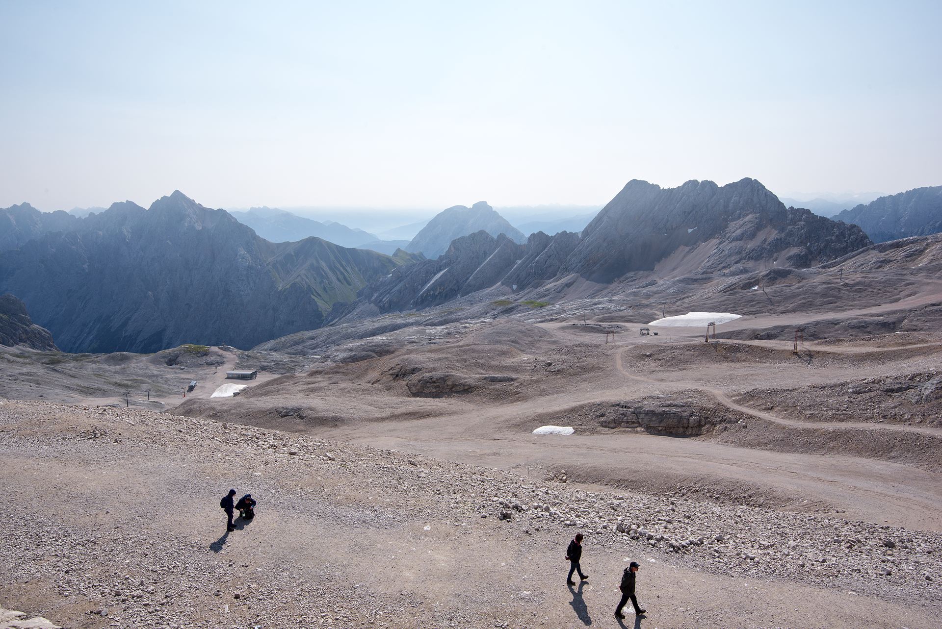
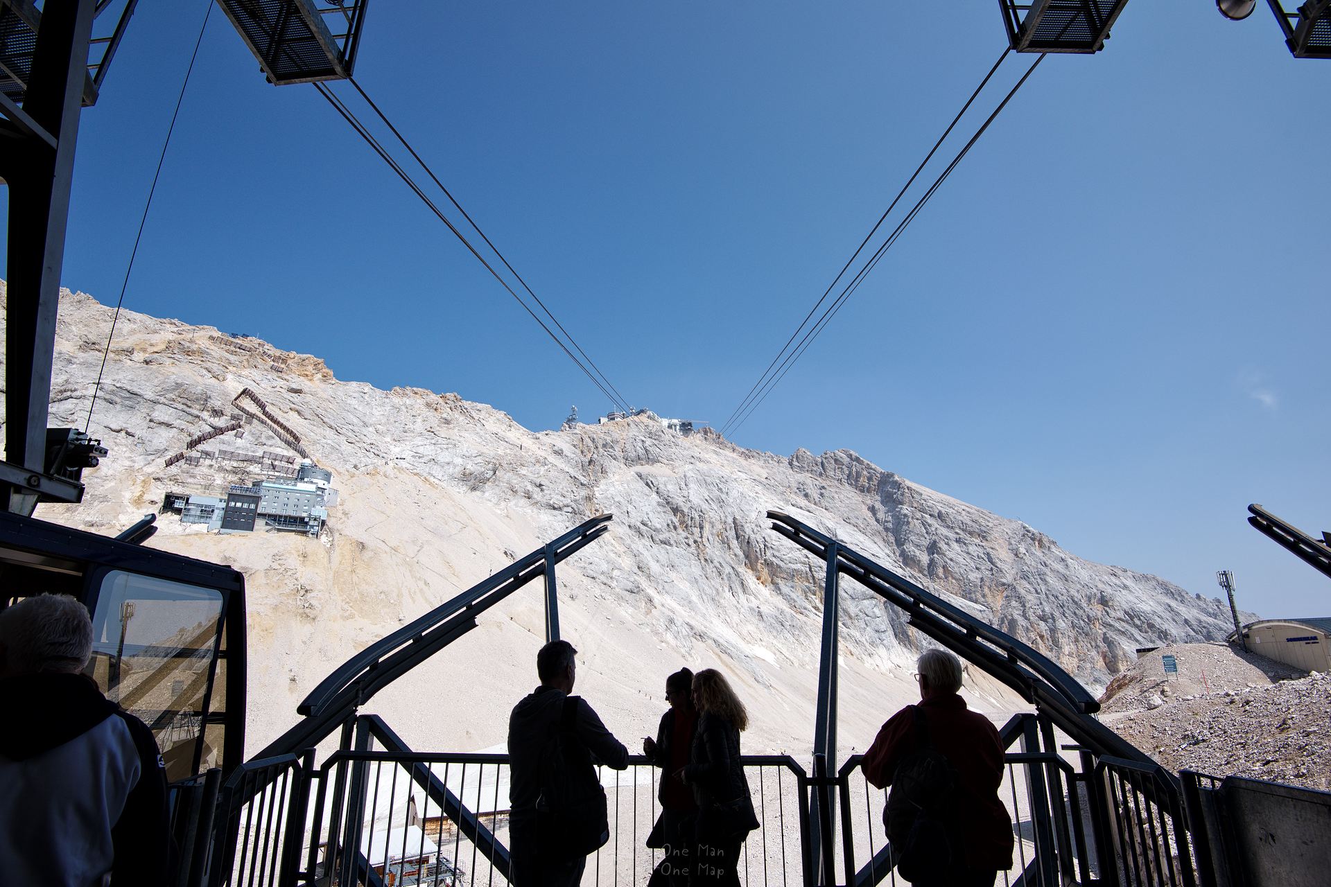
Taking the rack railway and glacier ropeway to the Zugspitzplatt
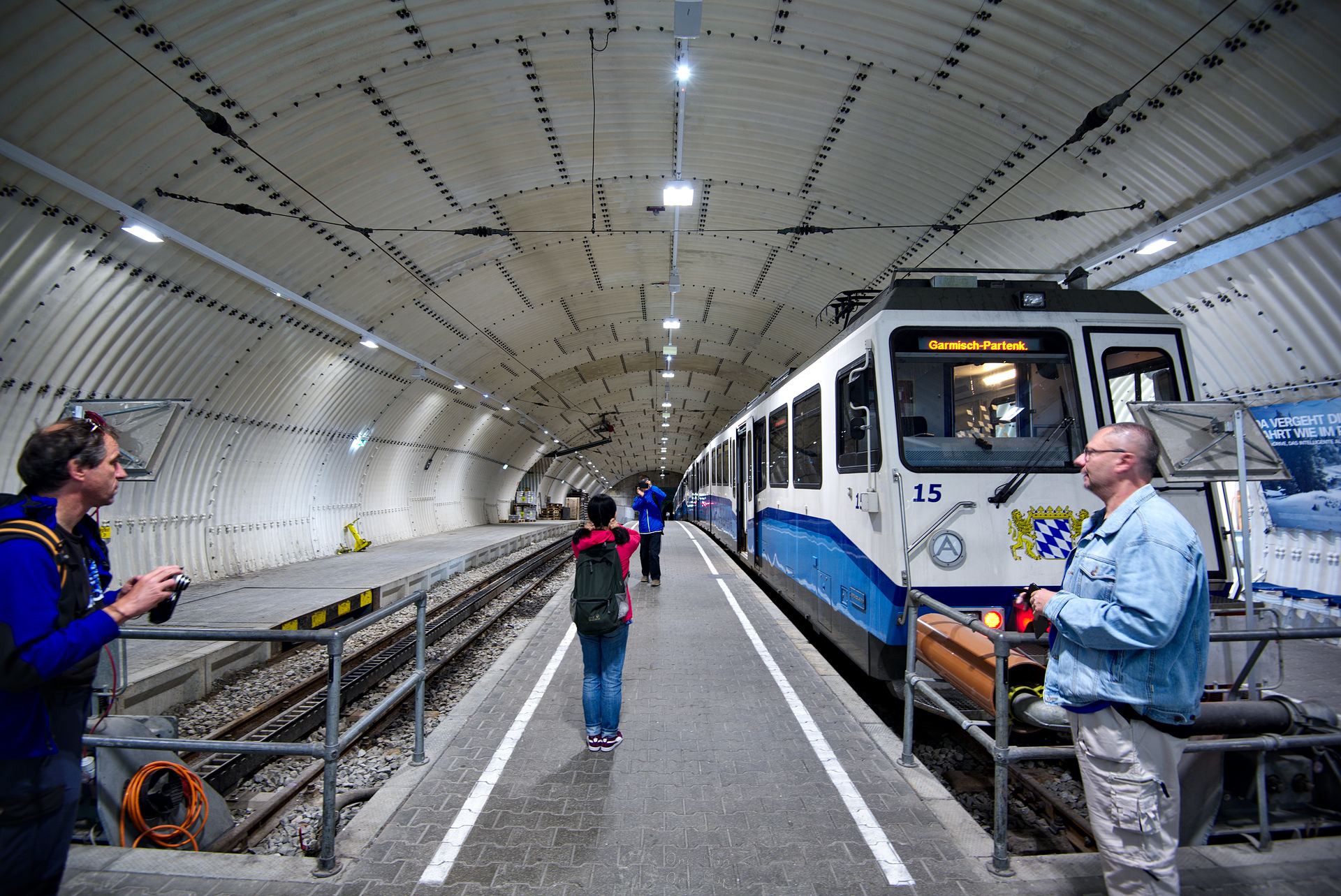
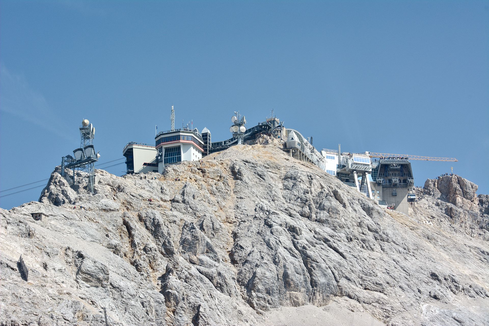
When the Zugspitze was to be developed for tourism in the 1920s, the engineers didn’t yet have any experience with ropeways of today’s dimensions. Instead they decided on a rack railway which works its way to the top through tunnels in the mountains. They also didn’t dare to build a train station directly at the summit, so the rack railway ends approximately 350 metres further down inside the glacier. The last part can be covered using the glacier ropeway or on foot.
The round trip with the Zugspitze train and ropeways can be made in either direction. You can take the rack railway and the glacier railway up and then ride the ropeway back down, or simply the other way around.
We decided to take the rack railway up the mountain. Unfortunately, in the age of gigantic panorama ropeways, it can no longer keep up with the other tourist attractions. The journey takes a full 43 minutes, but on the short stretch to the entrance tunnel trees block the view and then you sit in the dark until you reach the glacier station. A short glance at the Eibsee lake had to suffice.
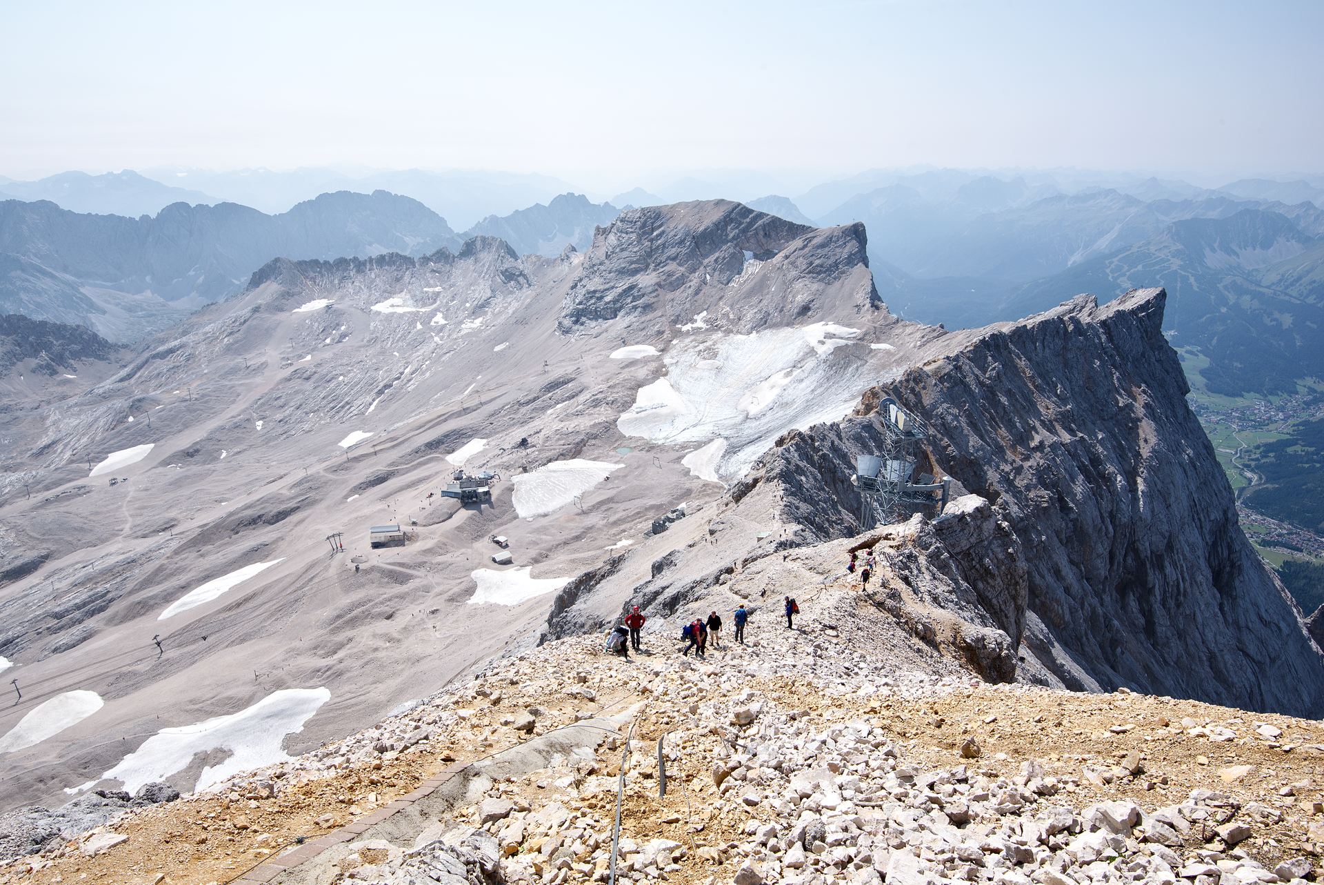
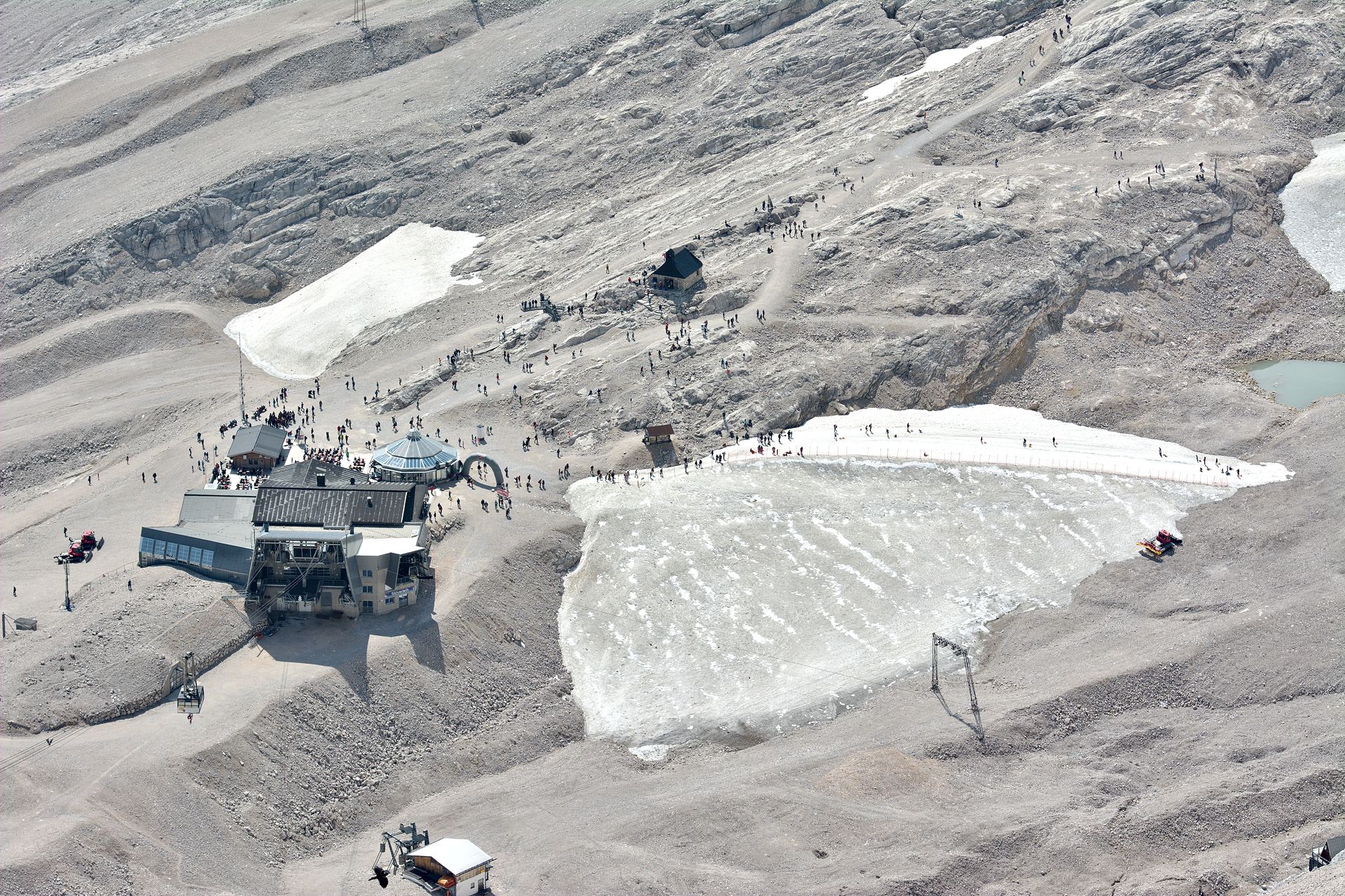
In the context of climate change, “glacier station” must be seen in relative terms. Where there was snow and ice all year round just 100 years ago, today during the warmer seasons almost only stones and boulders remain. The ski slopes are open from November to May. During the rest of the year the cold wind can only hold back a few small patches of ice.
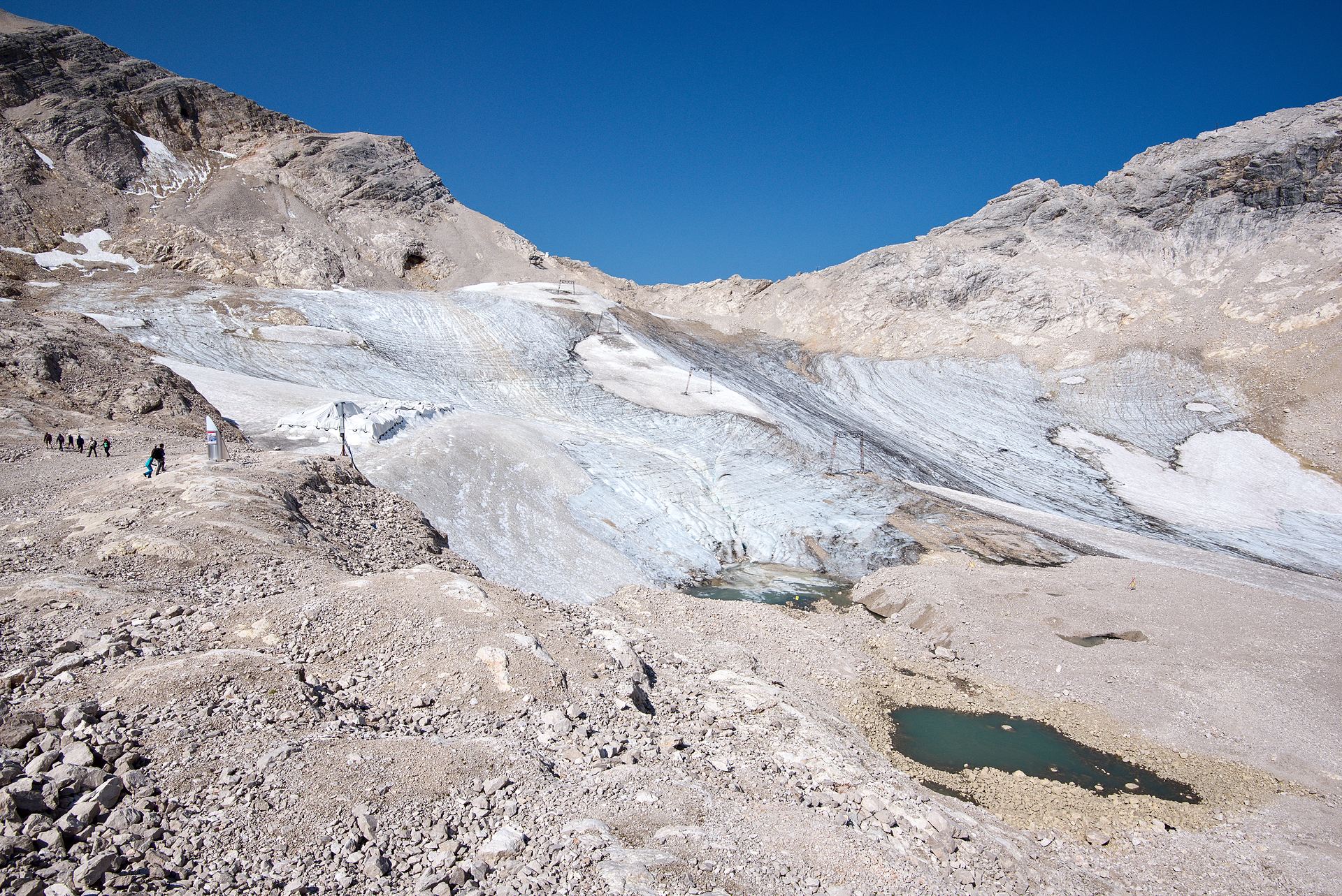
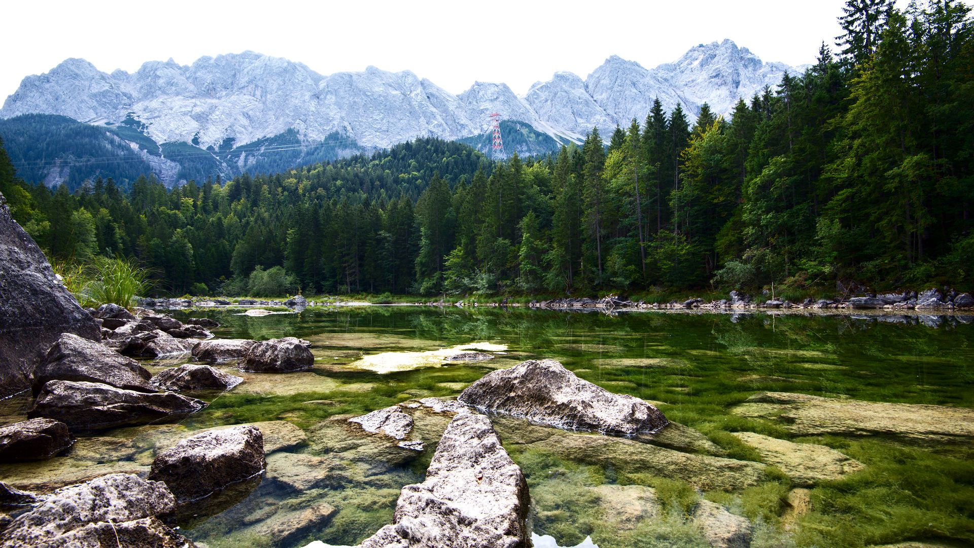
Here you can see the Schneeferner, the largest still existing glacier in Germany. Some experts do not classify it as a glacier anymore, however, as it has shrunk to less than a third of its original size. Between 1993 and 2013, the Schneeferner was covered with white plastic sheets to protect it from the sun’s rays. Sadly it didn’t have much effect.
The glacier station is also a restaurant, hotel and the valley station of the glacier ropeway at the same time. Stuck to the slope you can see the prominent building of the Environmental Research Station Schneefernerhaus, in which the German Weather Service, among others, has rented some offices. At a short distance from the restaurant is Germany’s highest church – the Chapel of the Visitation of the Virgin Mary.
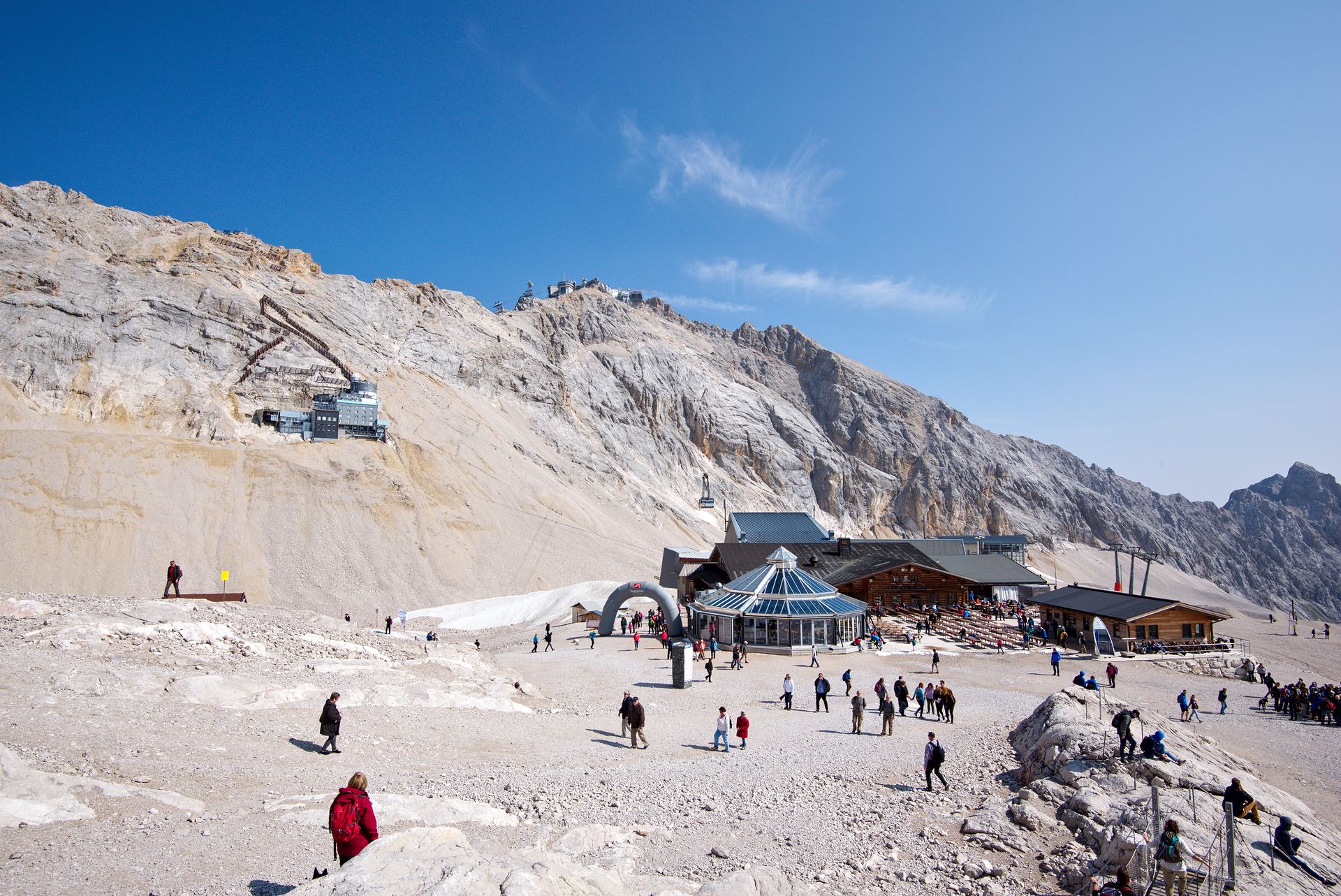
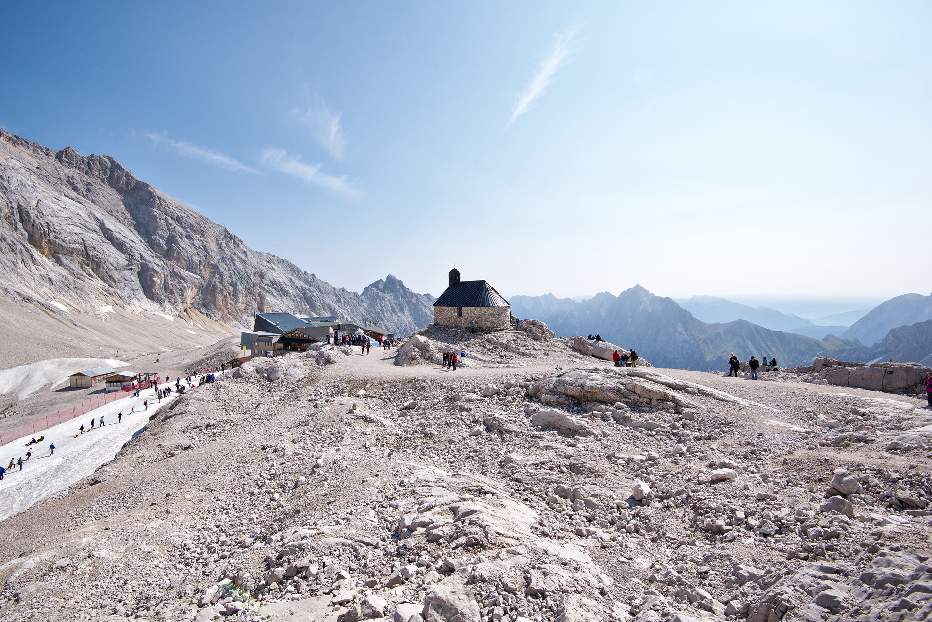
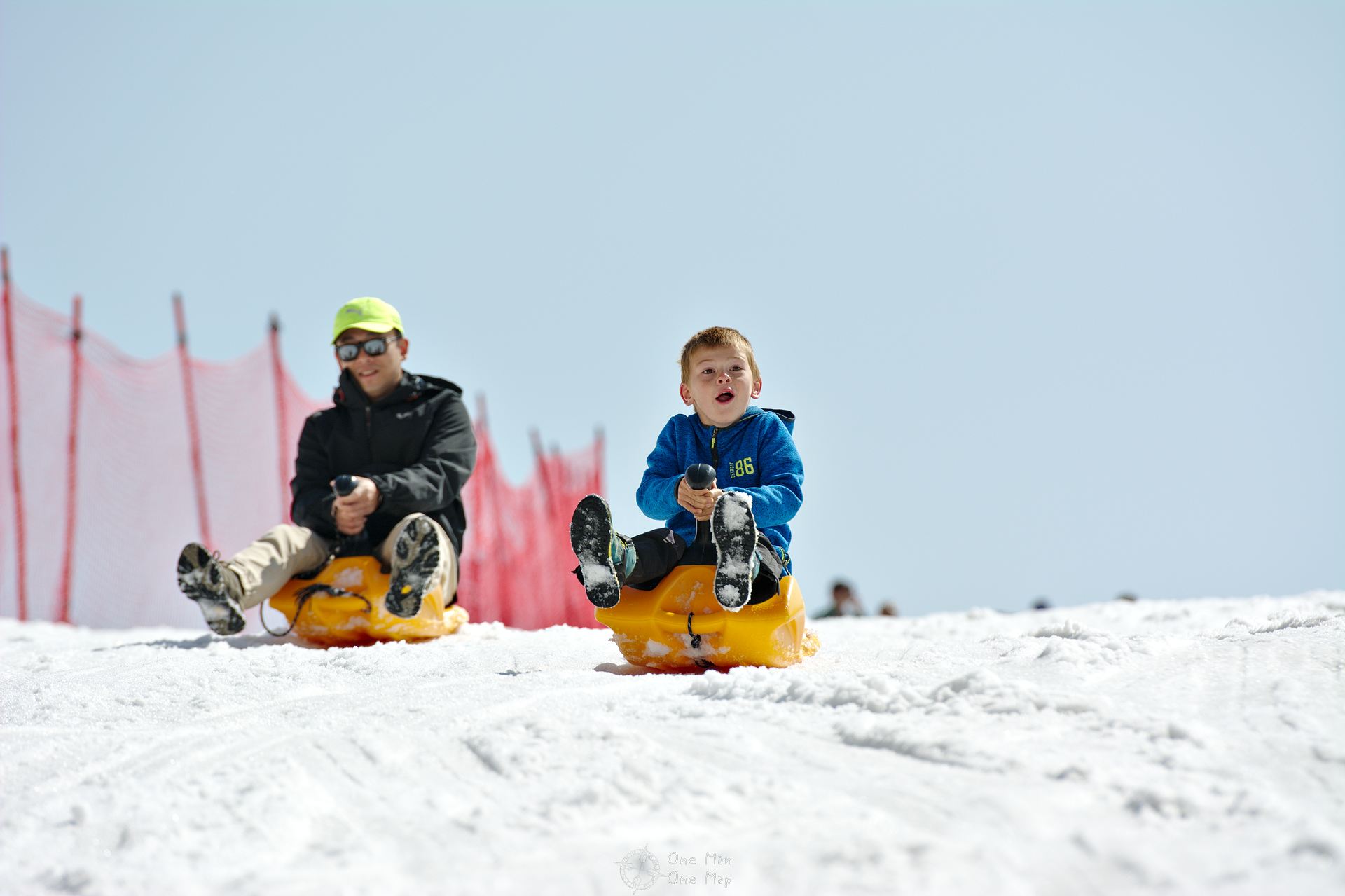
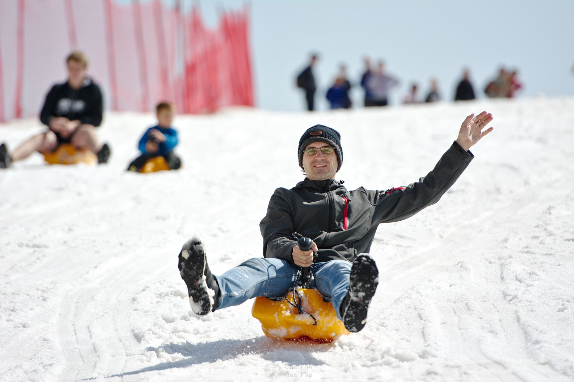
The children’s bobsleigh run behind the restaurant has to be paid for in winter, but can be used free of charge during the rest of the year. Certainly a wise decision, there wouldn’t be much else to do here except for a short hike through the stone desert. Of course we did not miss a free sleigh ride… 😉
Wet and exhausted we went to the glacier ropeway and then on to the top, to the Zugspitze.
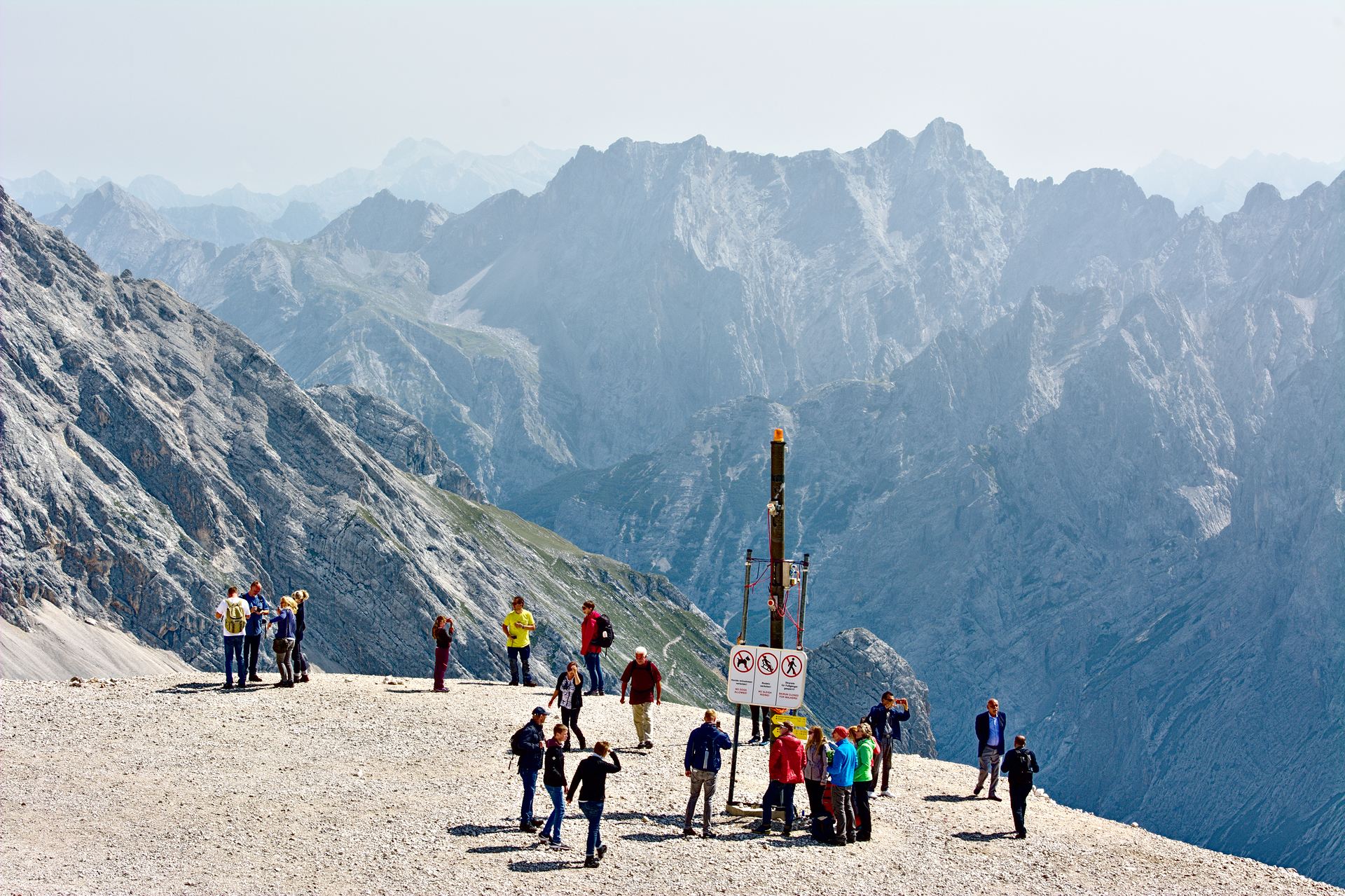
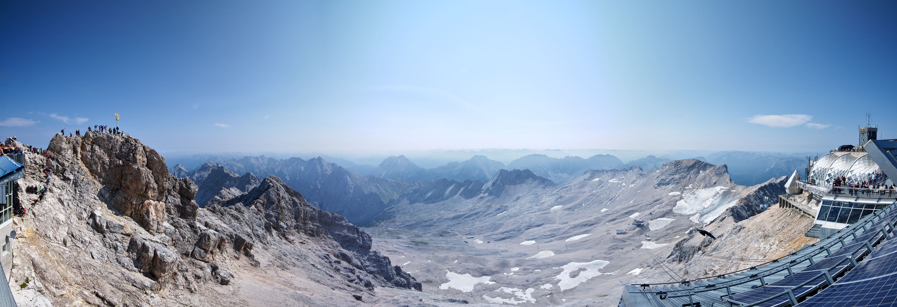
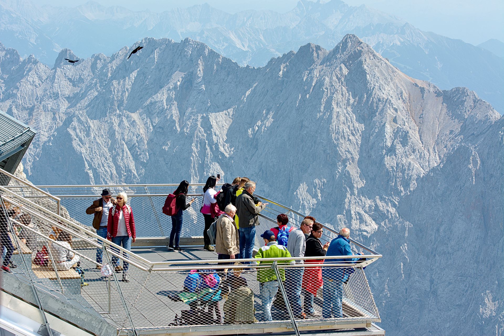
The Zugspitze
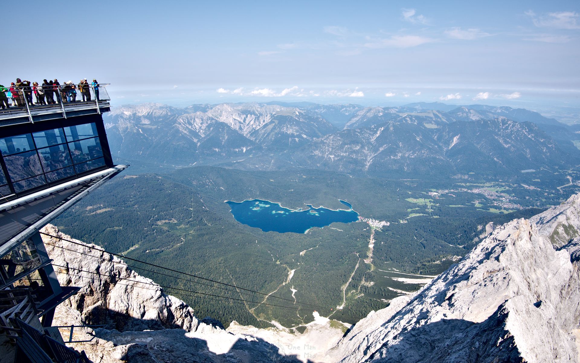
What a view! The glaciers extend to the south, to the north one looks down to the valley with the Eibsee 2,000 metres below. On good days you can see four different countries from here: Germany, Austria, Switzerland and even Italy 🙂
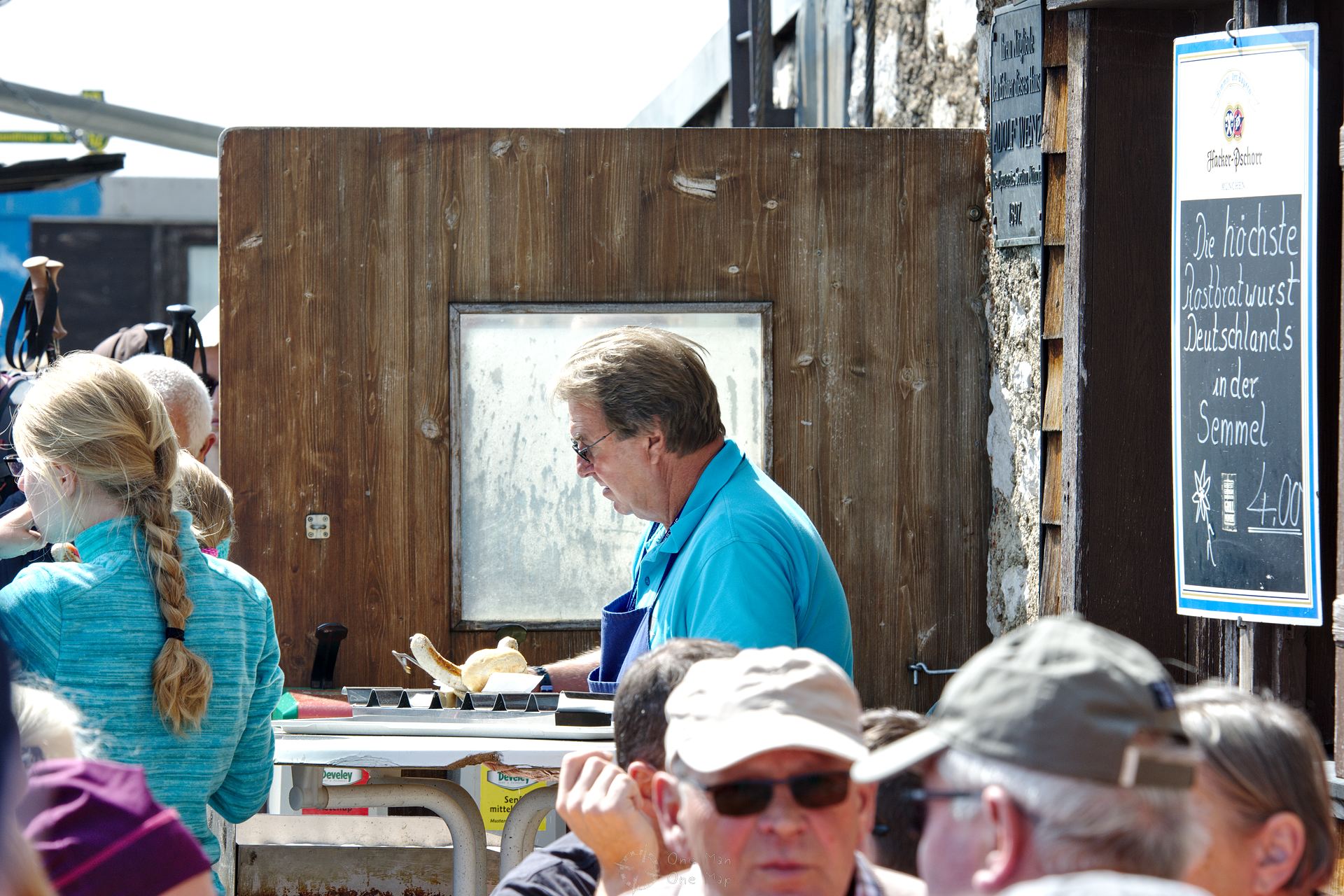
After all our efforts we deserved some food to regain our strength. How about the “Highest Located Bratwurst In A Bread Roll of Germany”? At four euros a piece actually a bargain, considering that every single sausage and bread roll has to be laboriously brought up to the top with the railway and ropeways first 😯
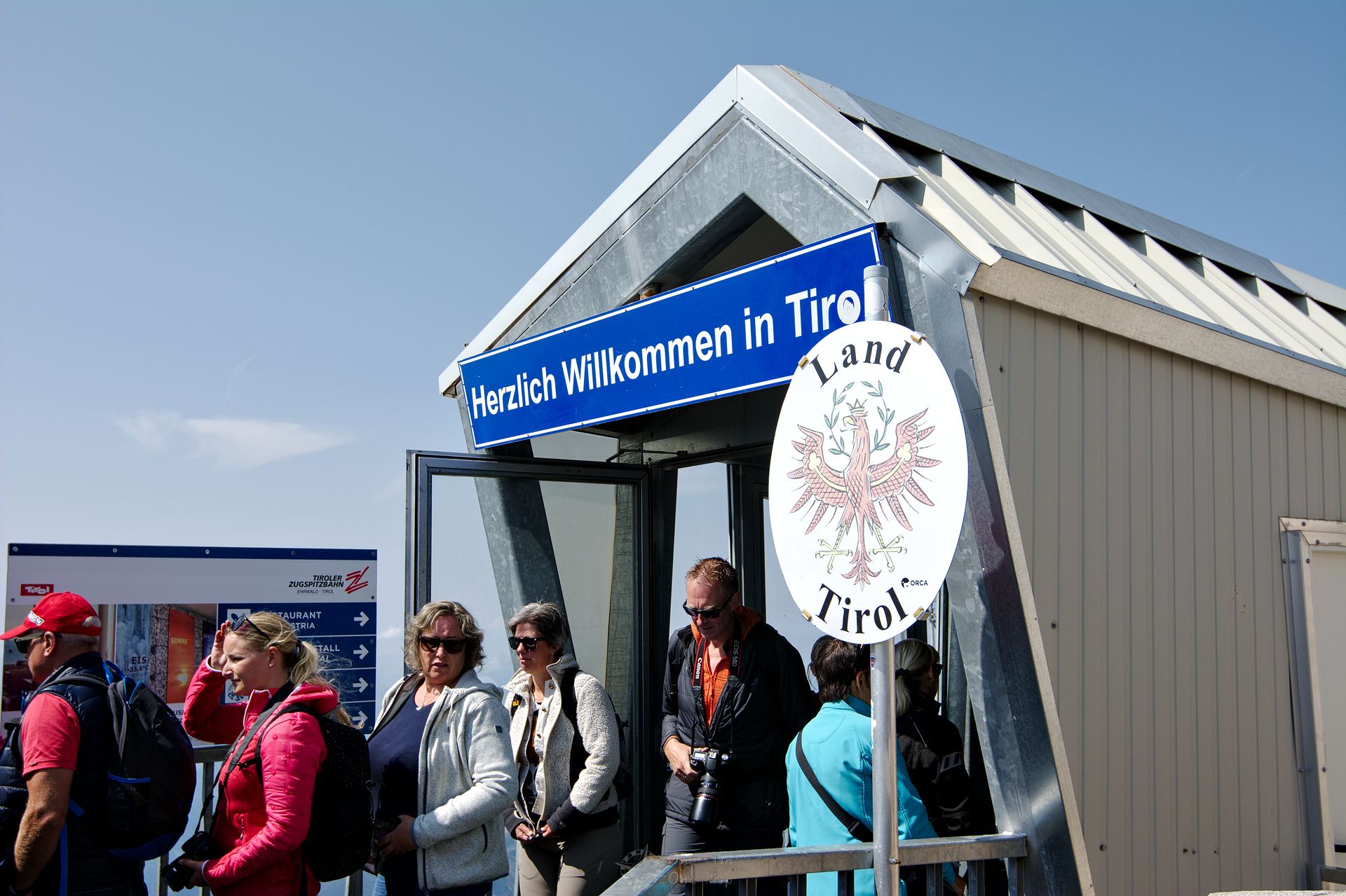
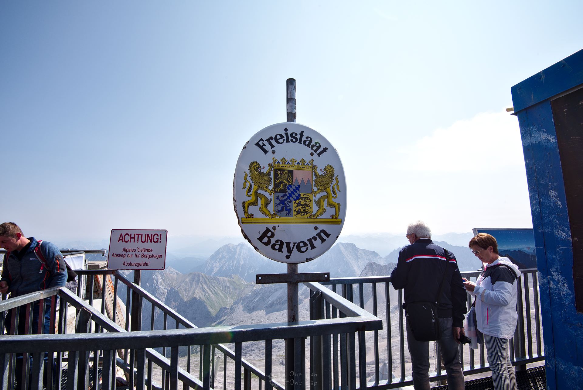
Yes, a few years ago you had to bring your passport! But fun aside 🙂 The official border between Austria and Germany runs through the middle of the Zugspitze, but there are no longer any border controls here.
Theoretically you could take the German train or ropeway to the Zugspitze and then ride the Austrian ropeway on your waay down (or vice versa). But that wouldn’t be exactly cheap: The round trip goes for 58 Euros on the German side and 46,50 Euros on the Austrian side. The single trip tickets on both sides would add up to a total of 65 Euros.
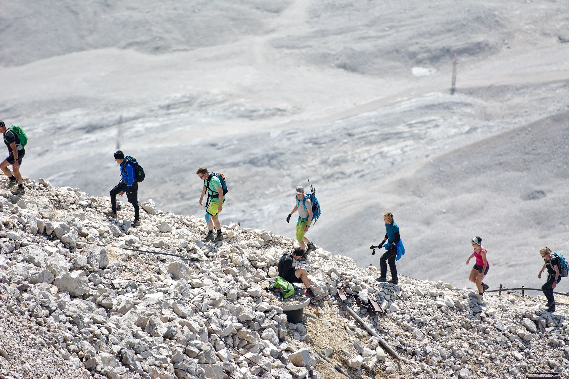
The closer one looks, the more scurrying tourists, hikers and mountaineers one can recognize at some point. Of course, dragging a powerful zoom lens upwards also helps… 😉 The quickest mountaineering route to the Zugspitze takes about nine hours, but most alpinists choose the longer, less dangerous routes which are often split across two days.
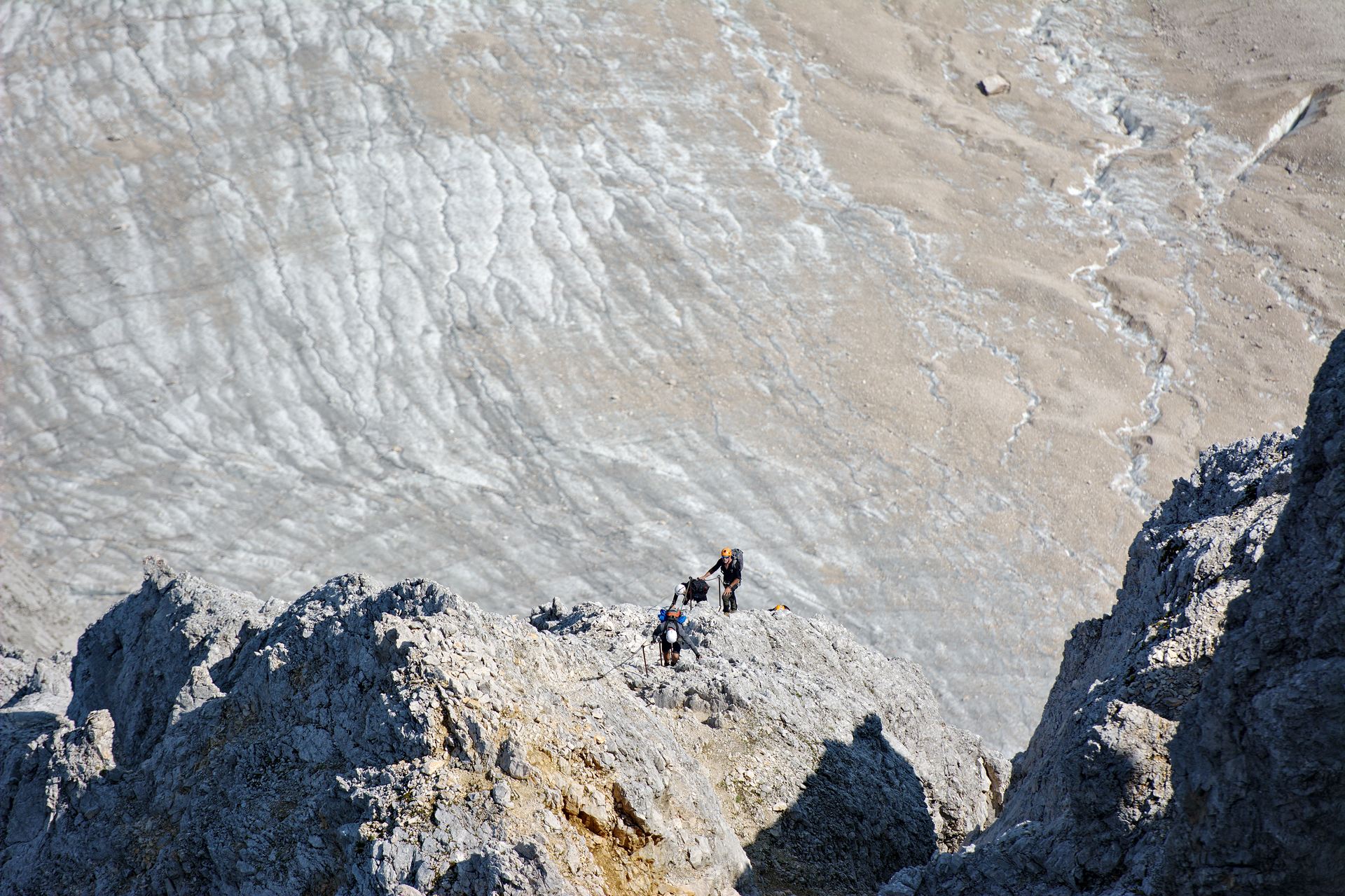
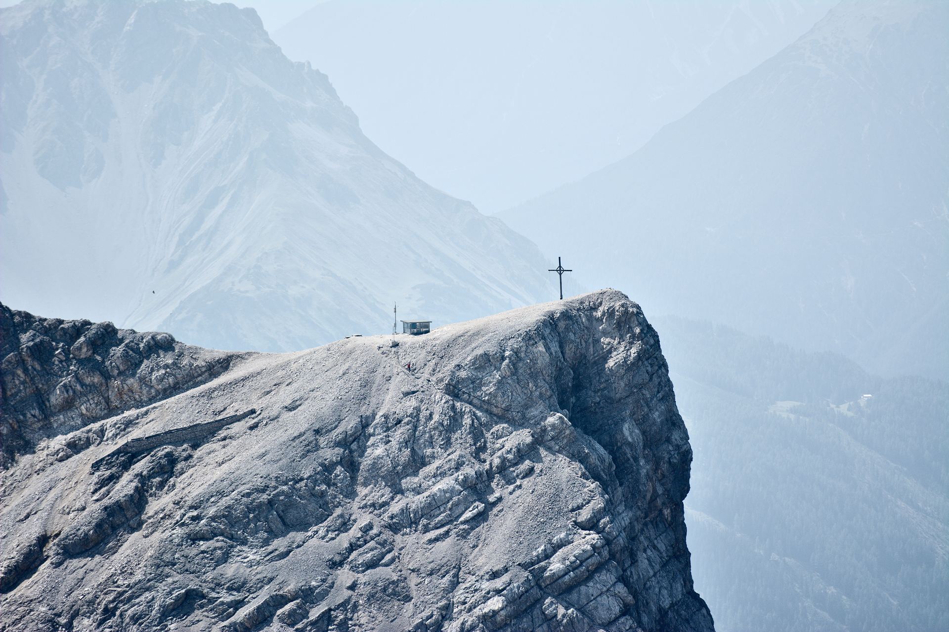
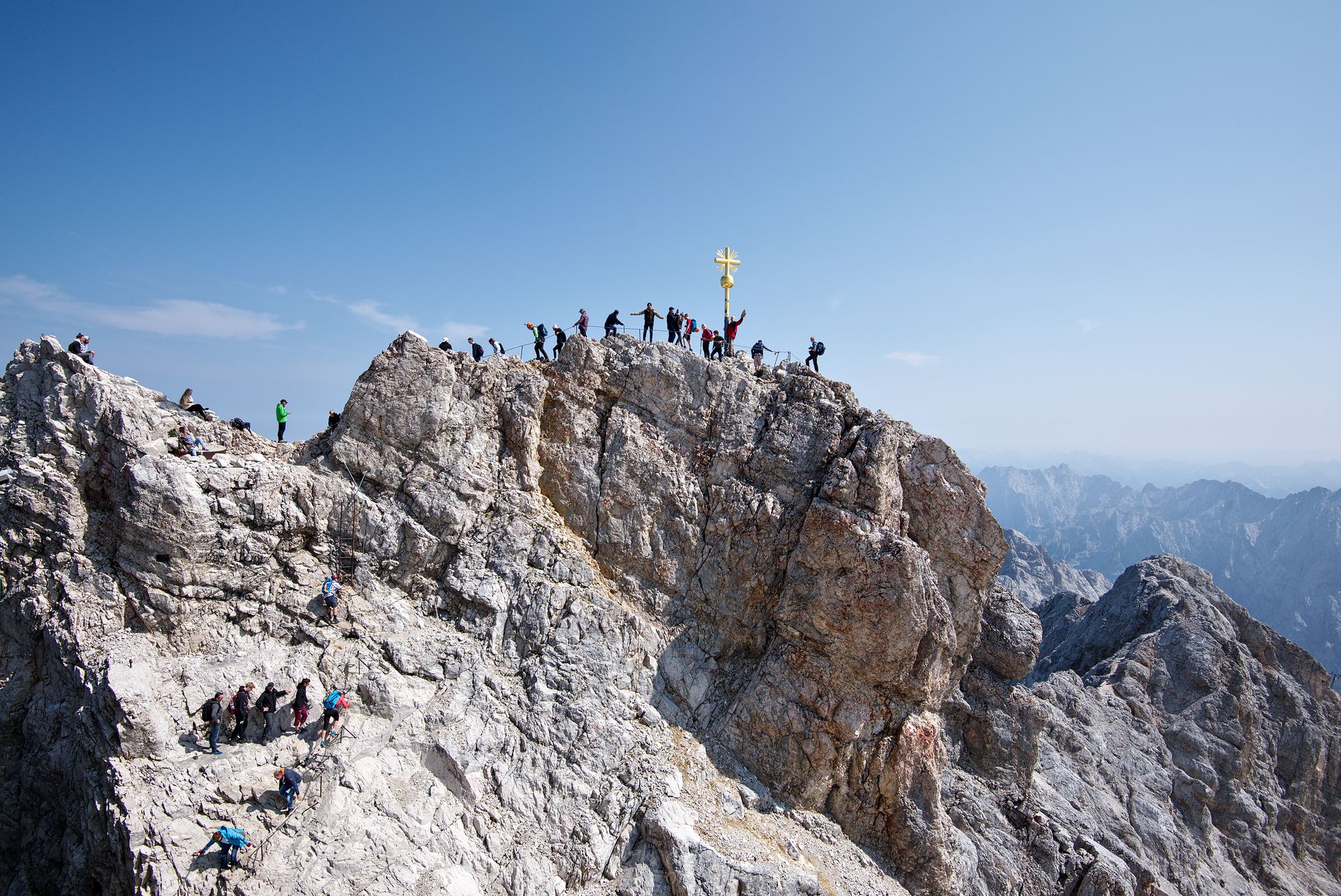
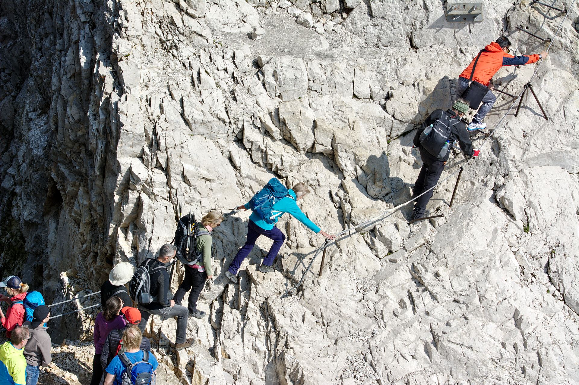
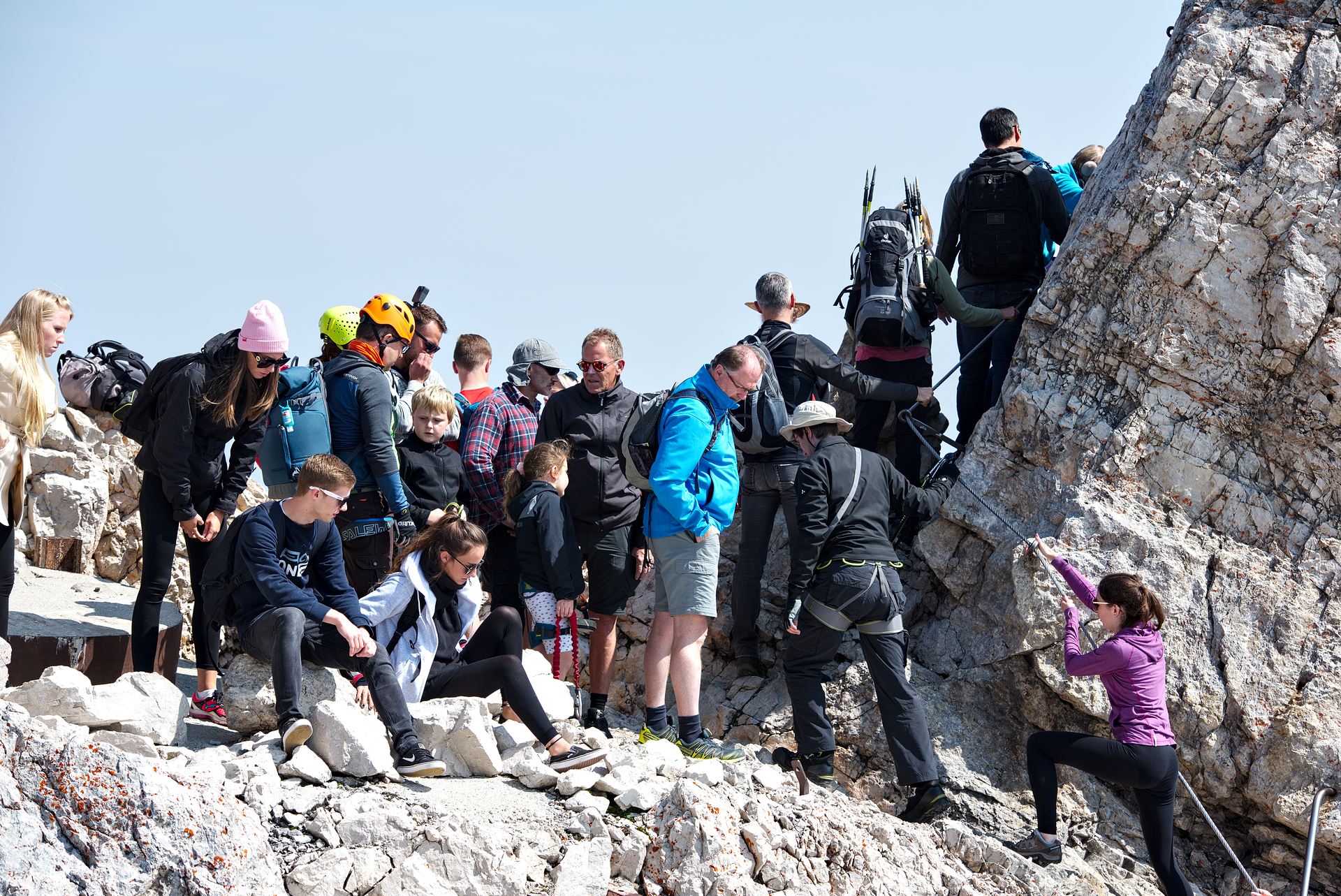
Surprise: Although you’re already looking down on everybody else from lofty heights, you are still not on the actual peak of the Zugspitze. That one is located a little further east and has a golden summit cross. Actually only fully equipped alpinists are allowed to cross the narrow ridge and climb the via ferrata up to the summit cross. In the age of Instagram, however, nobody seemed to care about that any more… 🙁
The word “Overtourism” took on a whole new meaning during our trip. Men, women and children crowded into all niches, without proper mountain gear, many just equipped standard sneakers. The new arrivals blocked the way back to the safe mountain station for the returnees, dangerous traffic jams occurred constantly. It is probably only thanks to lucky coincidences that accidents do not occur more frequently at this point! 🙁
Exhausted by our endevors, the cold wind and the thin air, we made our way back down and back to the apartment. Next time we’ll climb to the Alps a last time before we set off on our way to Eastern Europe and a Lost Place of almost… “radiant” beauty 😉