Dieser Artikel ist auch auf Deutsch verfügbar. Click here to find out more about Germany!
| Osterfelderkopf via Bernadeinsteig | |||
| Area | Wetterstein mountain range, Bayern, Deutschland | ||
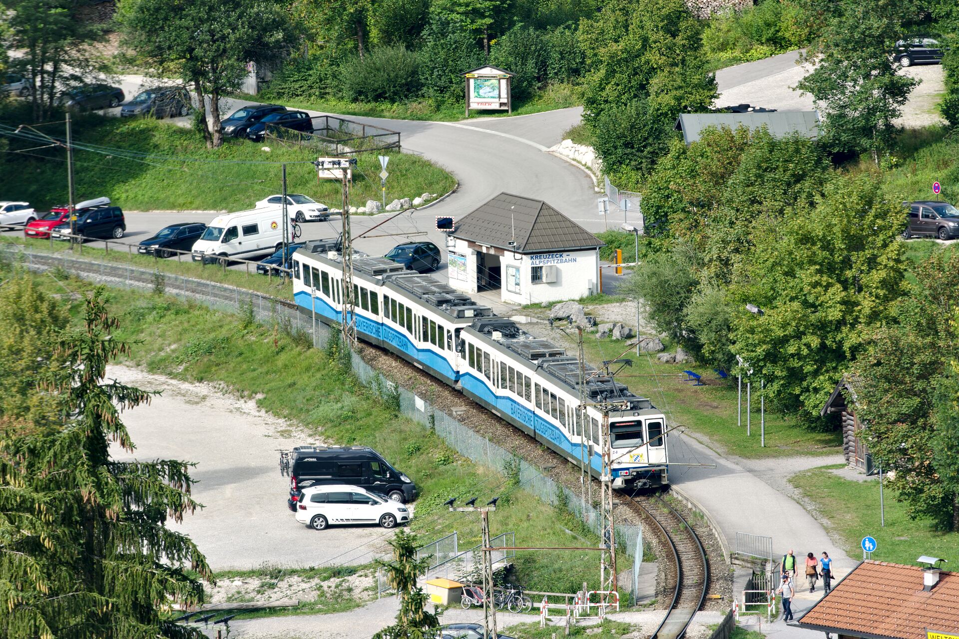
| Start | Mountain station of the Kreuzeckhaus cable car | ||
| End | Mountain station of the Alpspitzbahn cable car | ||
| Distance | 6.5 km | Duration | ~3 h |
| Ascent | 570m | Descent | 170m |
| Average Spring Summer Autumn | |||
Today I’m writing about the third and last hiking suggestion from our vacation in Bavaria. We take the Bernadein path to the mountain station of the Alpspitzbahn and the AlpspiX viewing platform! 🙂
The hike begins at the mountain station of the Kreuzeck cable car in Garmisch-Partenkirchen. The valley station is best reached with the local bus lines 1 or 2 from the main train station. If you already have a ZugspitzCard, you can also travel with the Bayerische Zugspitzbahn, for everyone else the high price for the rack railway ticket is hardly worth it. The main train station of Garmisch-Partenkirchen is well connected to the rest of the Deutsche Bahn rail network and can be reached from Munich in less than an hour and a half, so the hike also makes a good day trip.
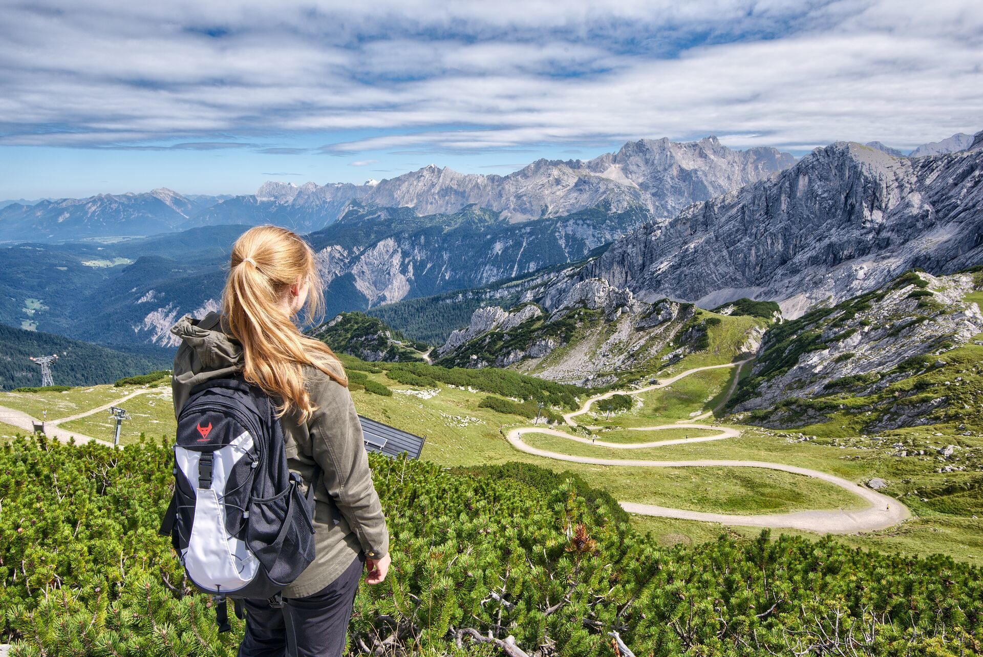
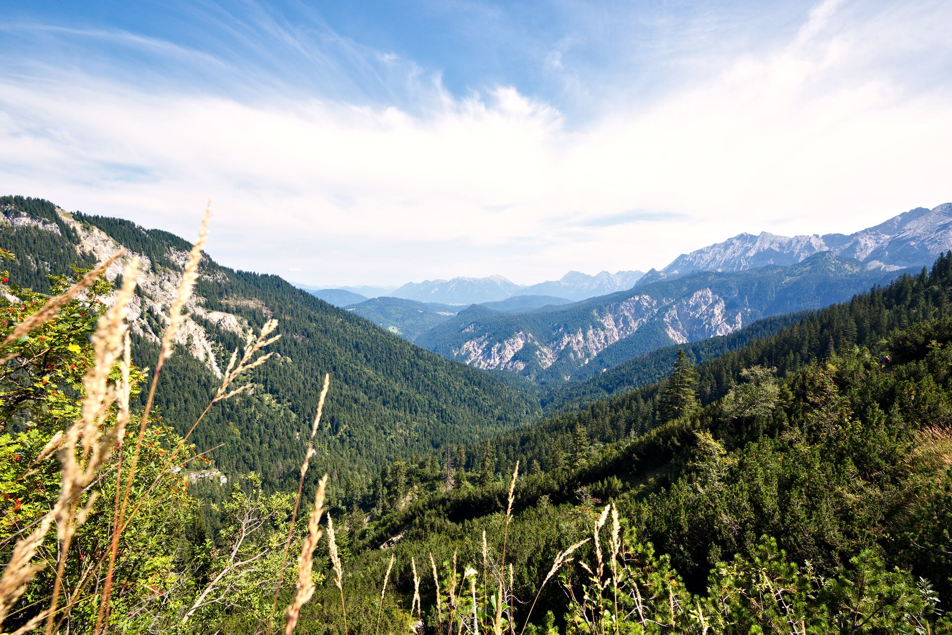
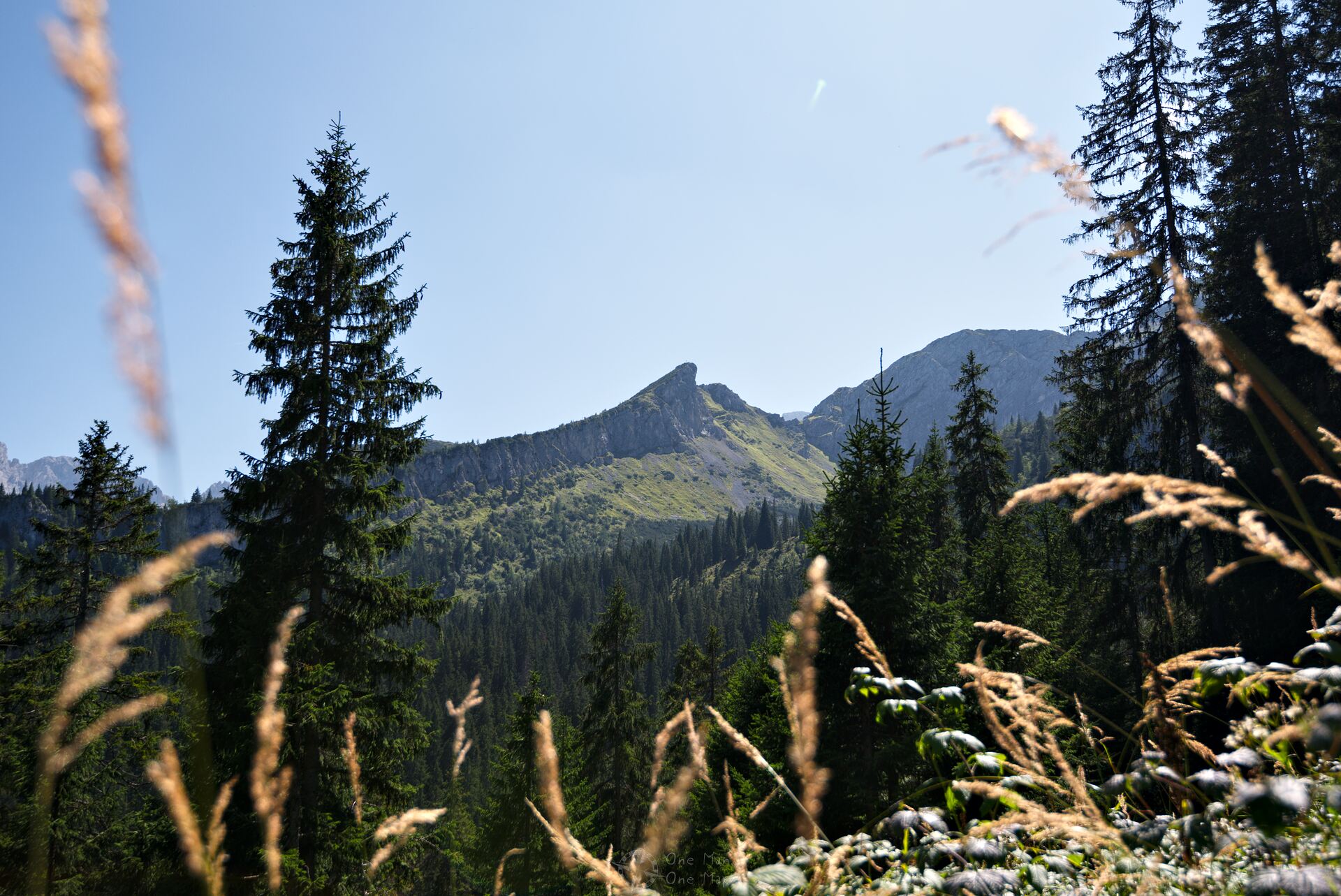
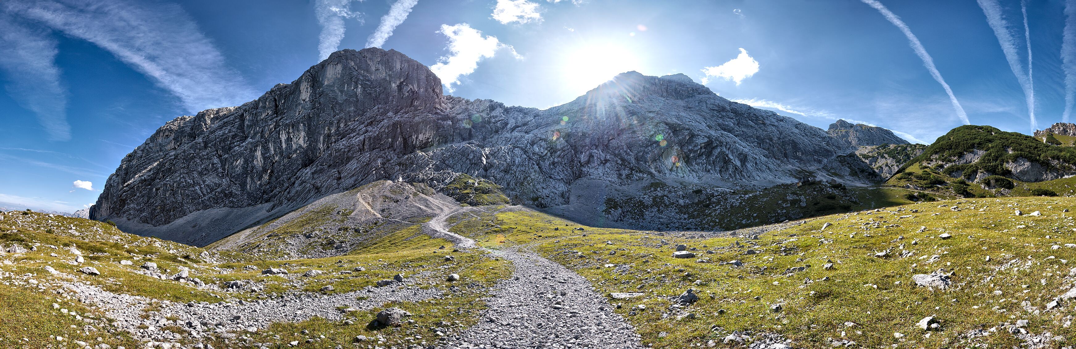
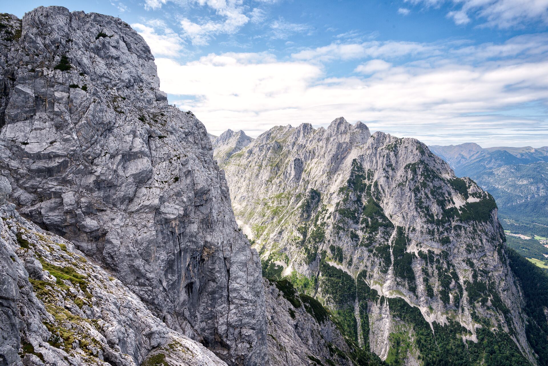
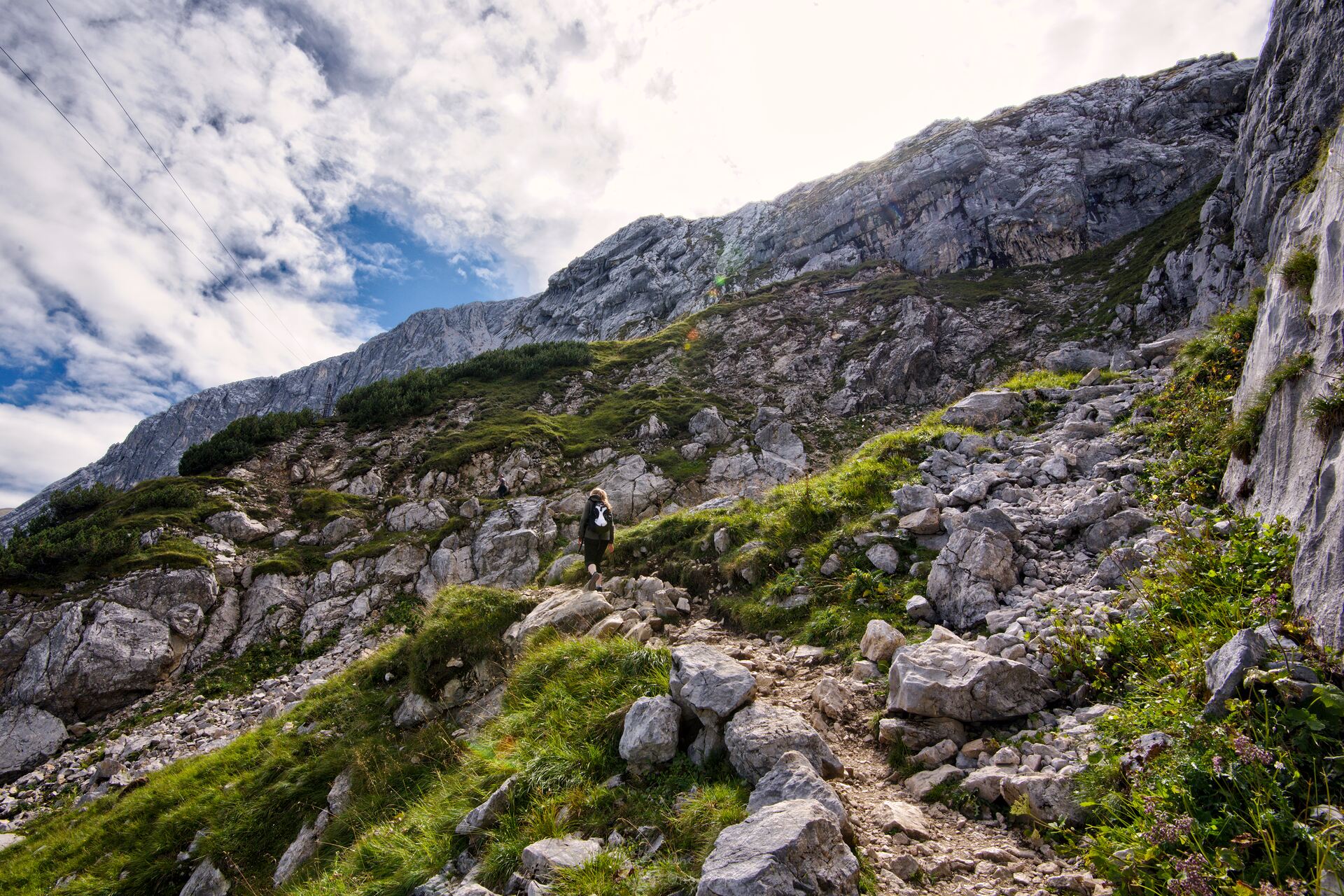
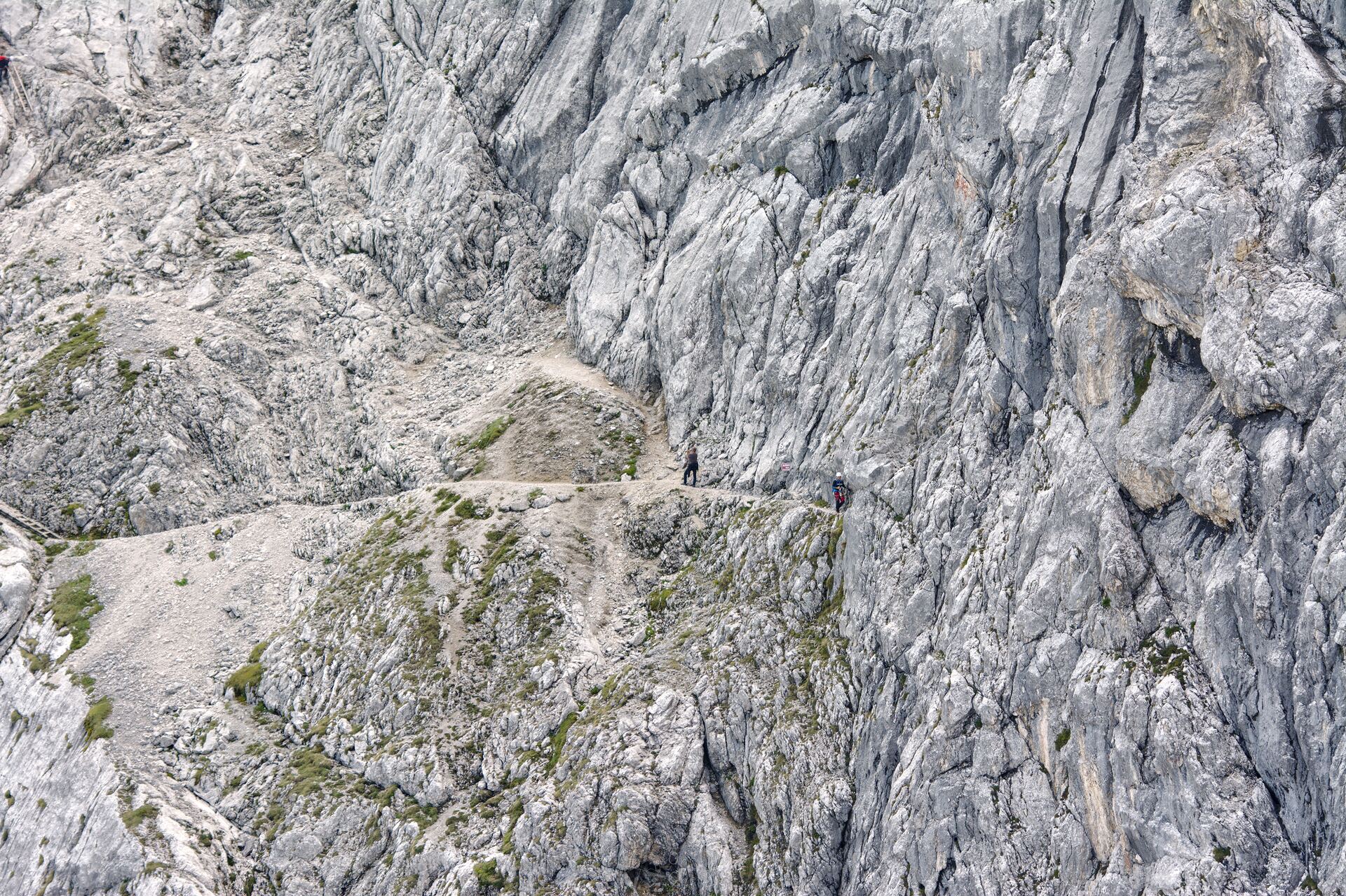
There are only six and a half kilometres ahead of us, but between the Bernadein hut and the Osterfelderkopf we have to climb more than 500 metres of altitude on just three kilometres. The fantastic views of the valleys in the surrounding area, the Bernadein walls, the Bernadeinkopf, the Rinderscharte, the Osterfelderkopf, the Höllentorkopf and the basin around Garmisch-Partenkirchen will be a matching reward, however. On parts of the route there is danger of falling rocks and the paths are quite narrow at times. In case of bad weather or in winter I can recommend the hike only for experienced hikers.
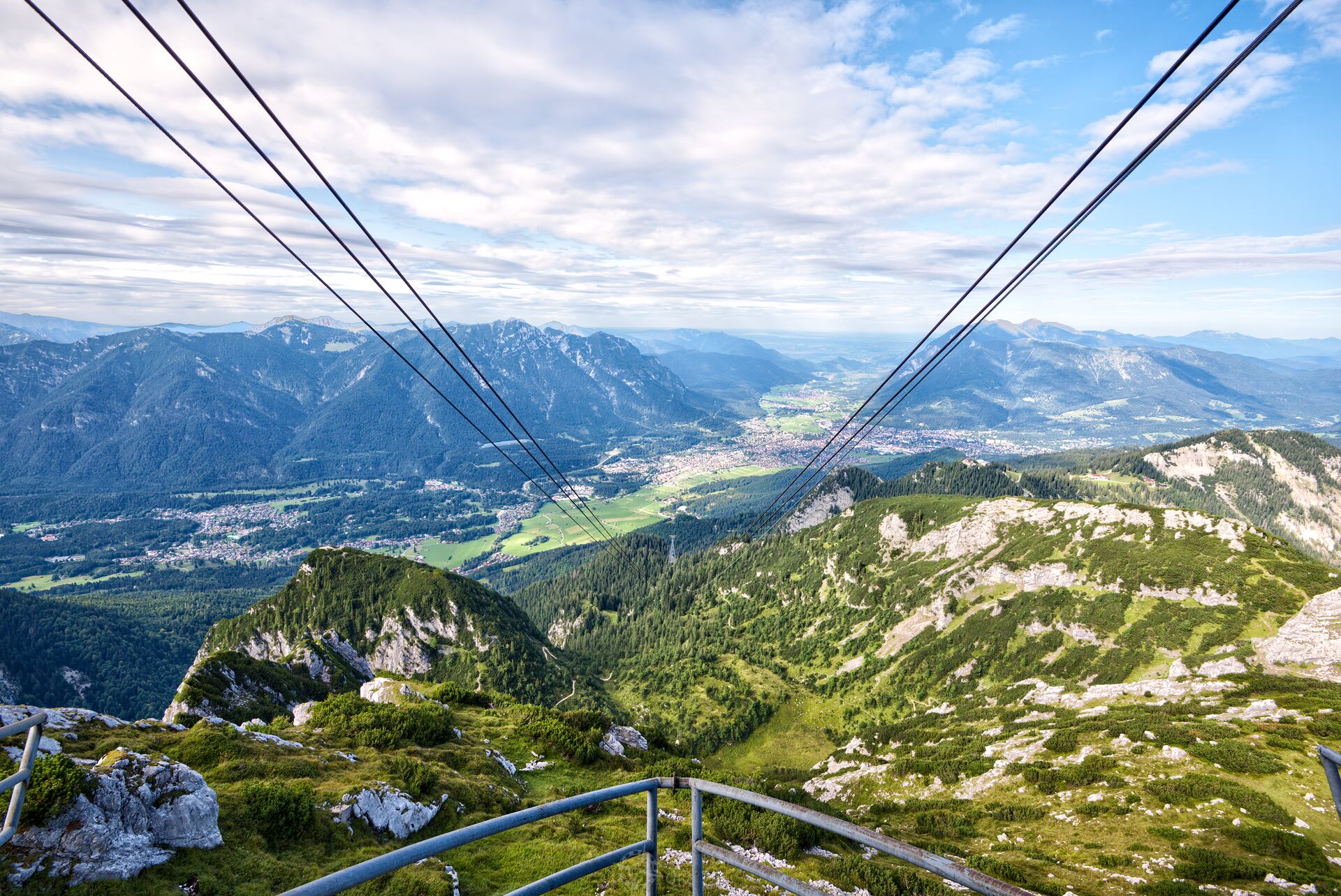
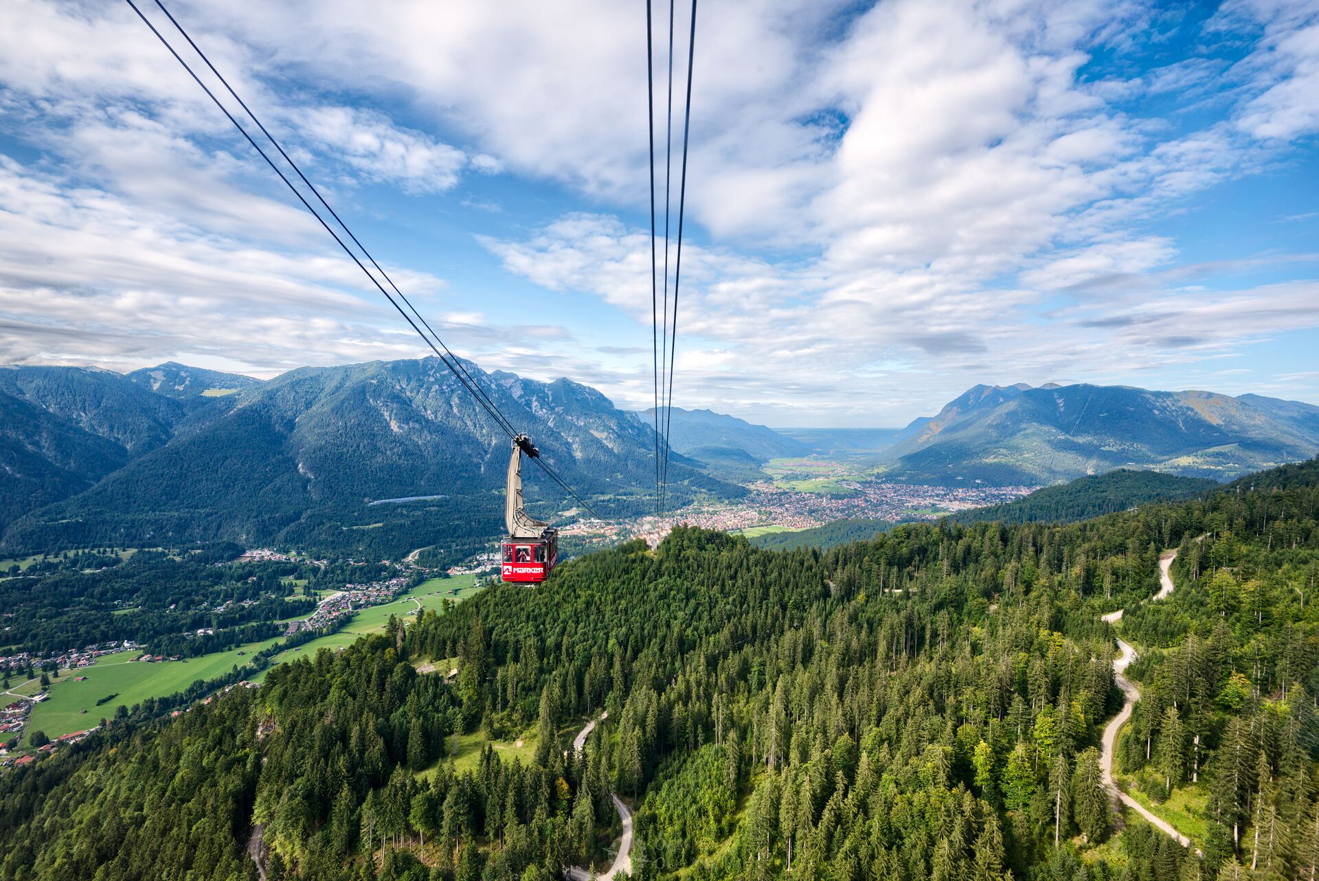
At the end of the hike, the Alpspitzbahn cable car takes us back down to the valley and back to the same bus stop we started at, as the valley stations of the two cable cars are only about two hundred metres apart. The ticket for the round trip with the cable cars, the so-called “Garmisch-Classic”, currently costs 28 euros.
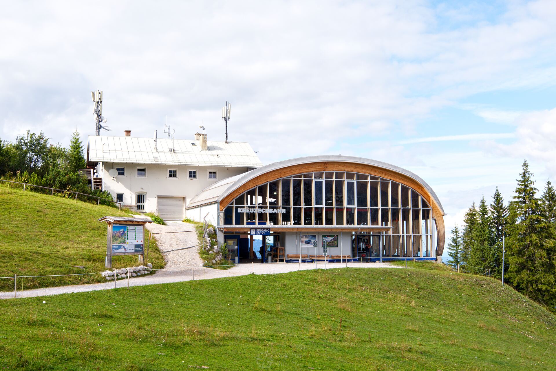
From the mountain station you have to walk about 700 meters on a well-built gravel road before the Bernadeinsteig (signs labelled “KE5”) branches off rather covertly at a tree. From here it is a pleasant downhill walk. But later we have to climb every single on of those meters back up again…
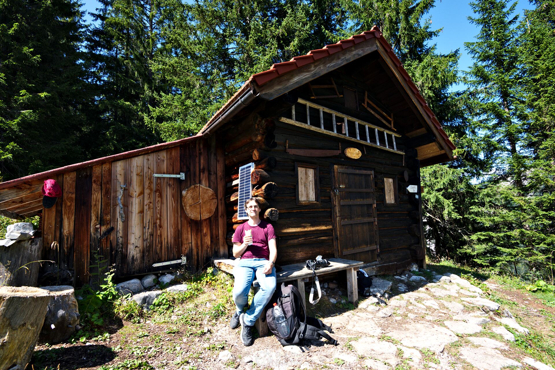
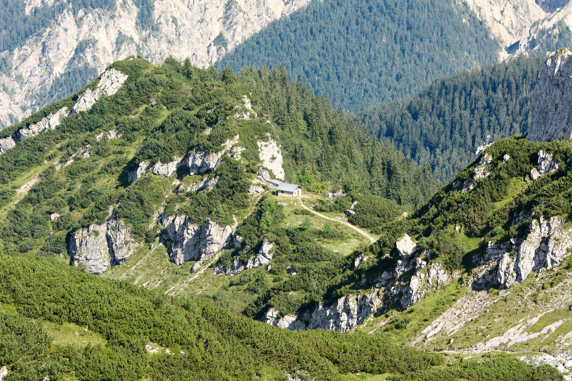
After about 1.8 kilometres you reach the Bernadein hut. Admission is only open to members of the Munich Academic Section of the German Alpine Club. But the bench in front of the hut is big enough for a small snack in between, and from here one also has a nice view on the Mauerscharte peak.
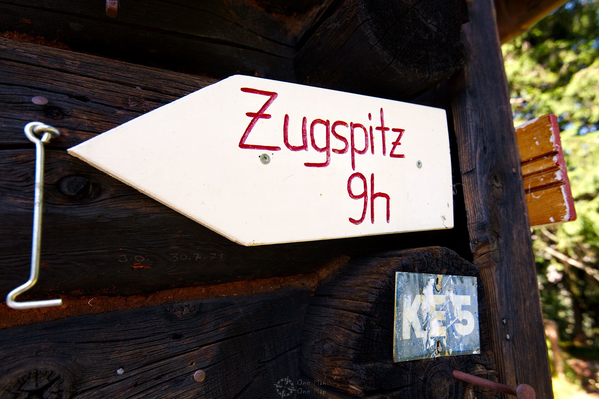
From here it would take about nine hours, 7.5 kilometers and 1450 meters of altitude difference to get to the Zugspitze. So you shouldn’t leave too late in the morning, or you might not make it up there before the sun goes down.
Most hikers and mountaineers probably decide to spend the night at the Kreuzeckhaus. They have 58 hotel beds and a mattress dormitory for 43 people available.
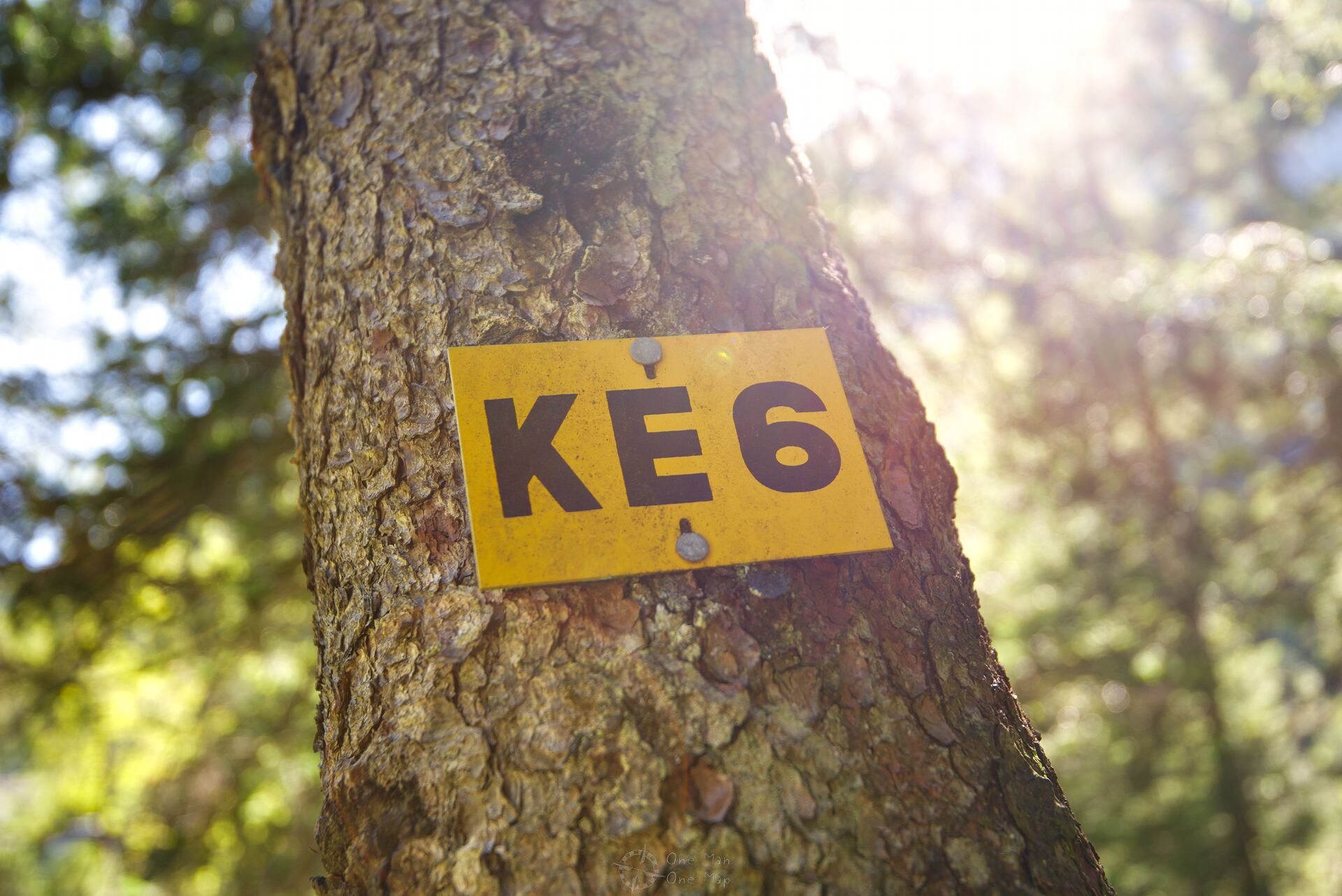
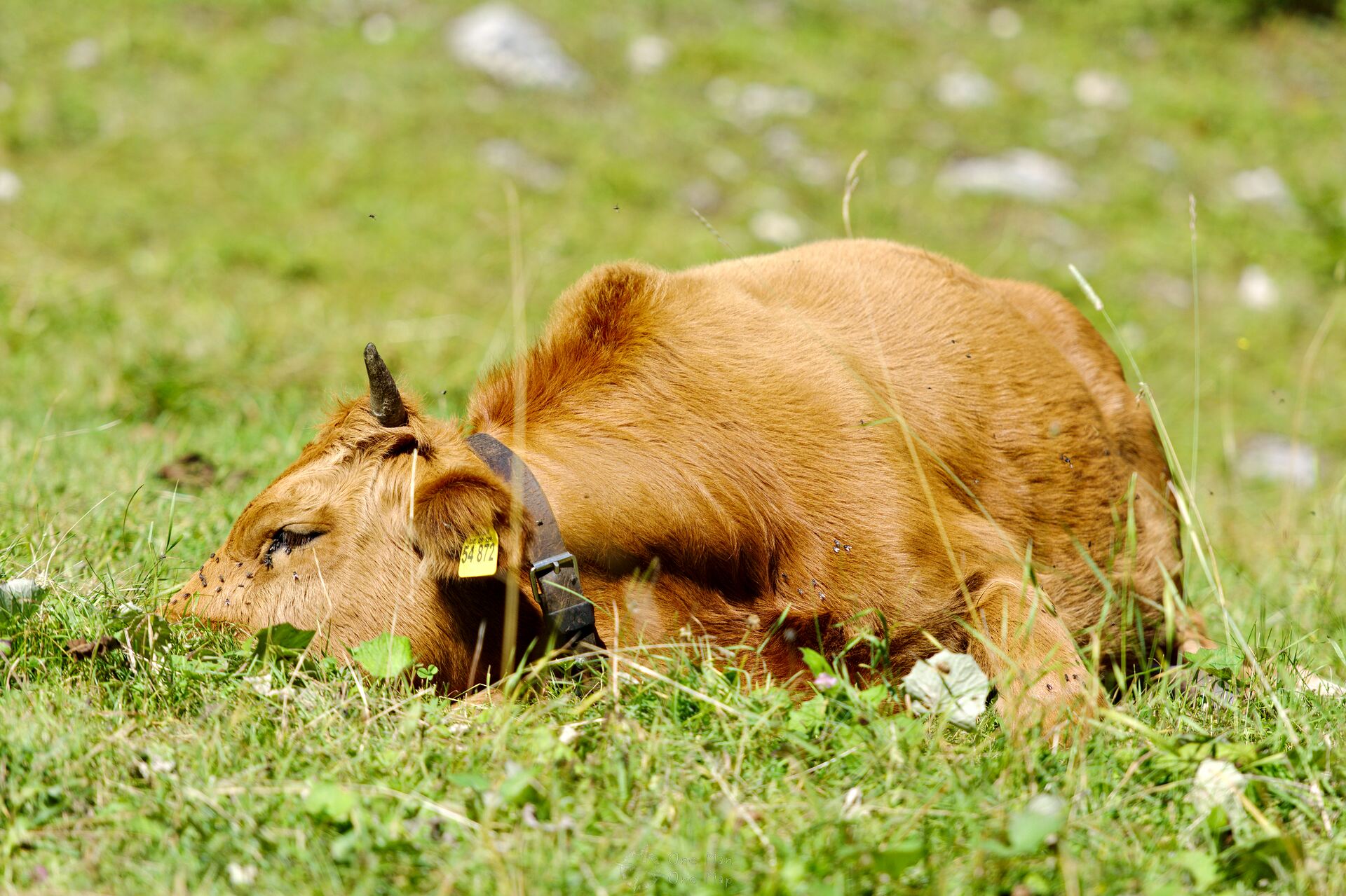
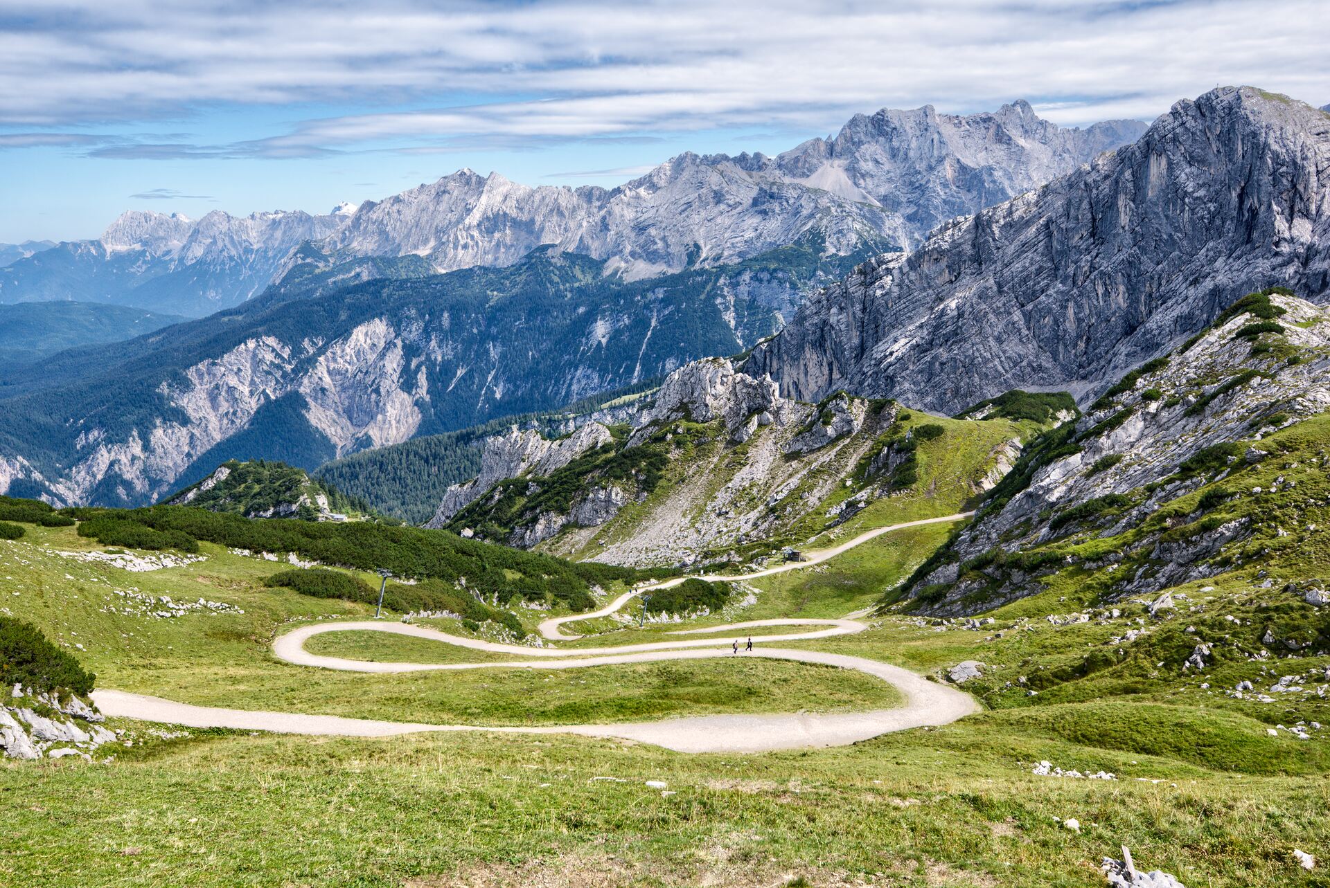
We continue through the dense forest, past grazing cows. After a short time we cross the Bernade lift. It not only serves as a ski lift in winter, but is also a valuable landmark. Many hikers miss the turn-off towards the Osterfelderkopf (signs labelled “KE6”) about 150 metres behind the lift and continue on the Bernadeinsteig!
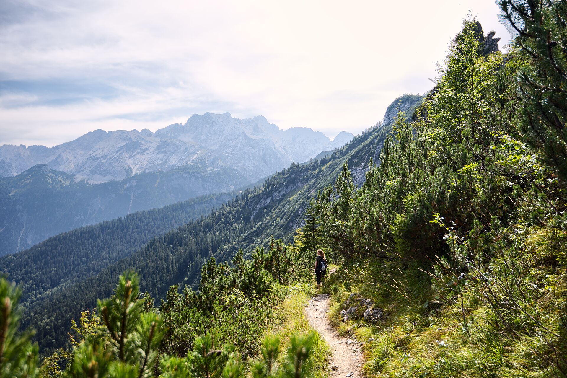
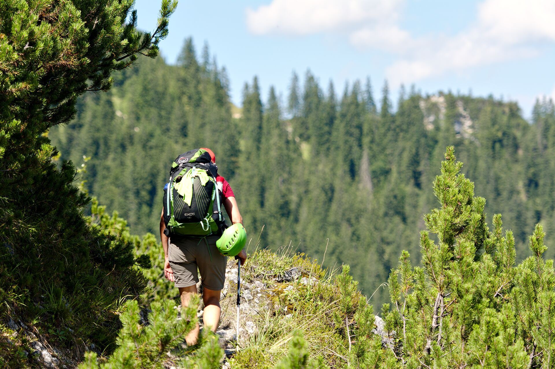
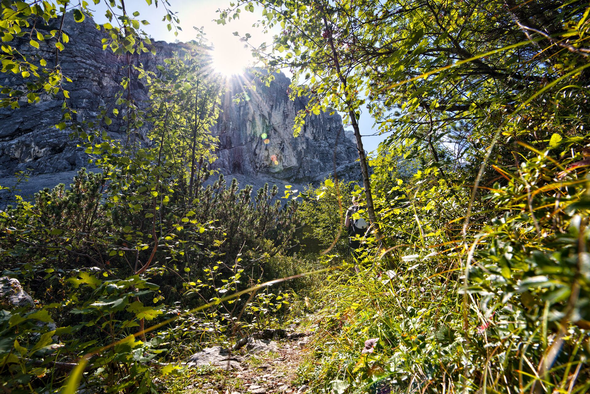
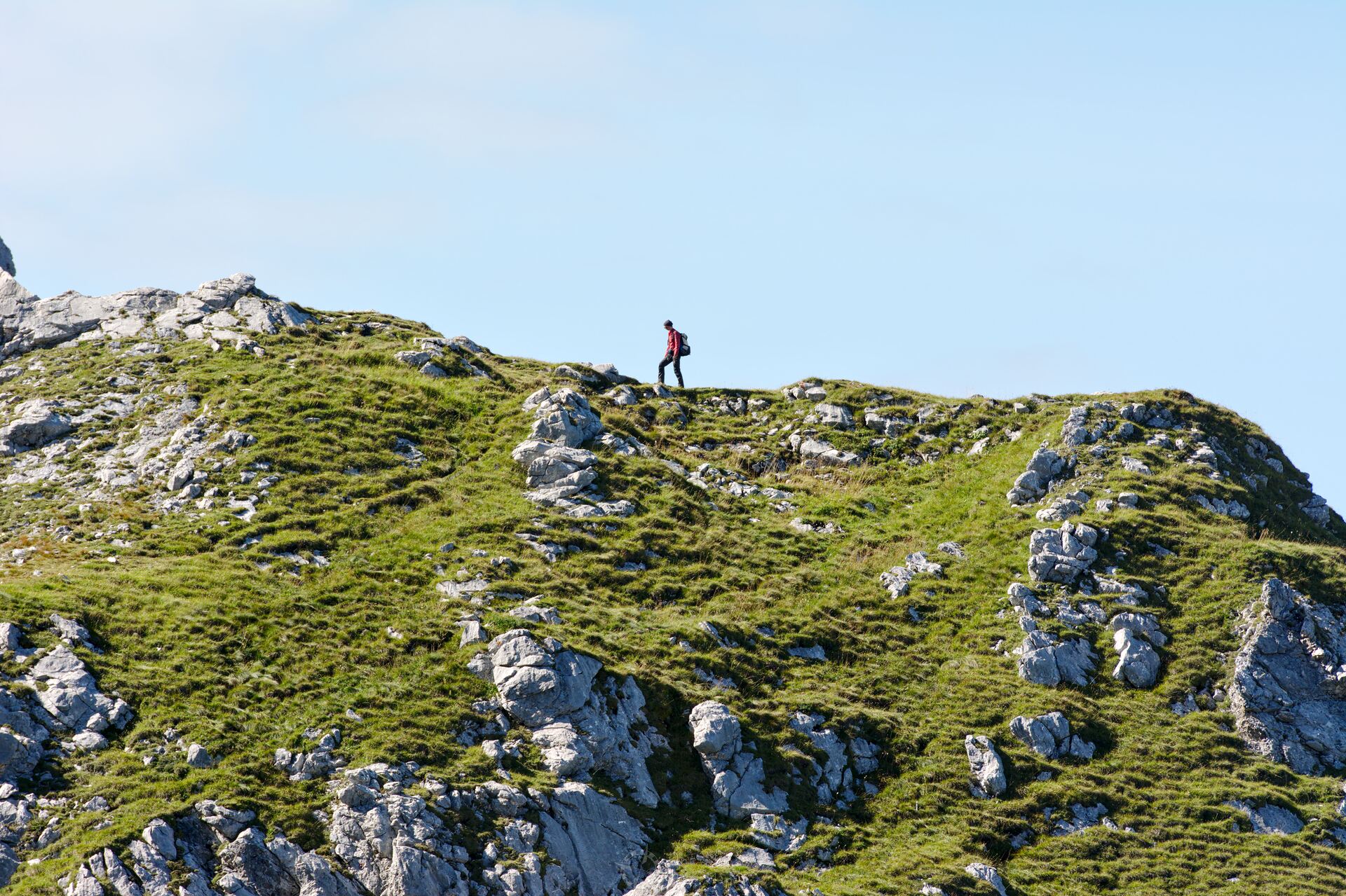
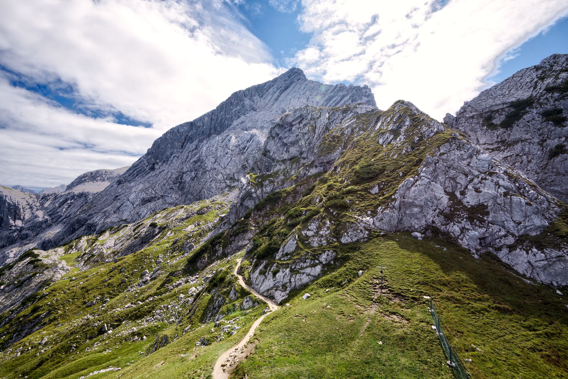
From here it’s a steep climb up. Serpentine after serpentine we work our way up. On the left side, the Bernade walls rise high above us and are already casting their shadows. In summer a welcome way to cool down a bit, but in autumn it can already get quite cold in the shade 😯
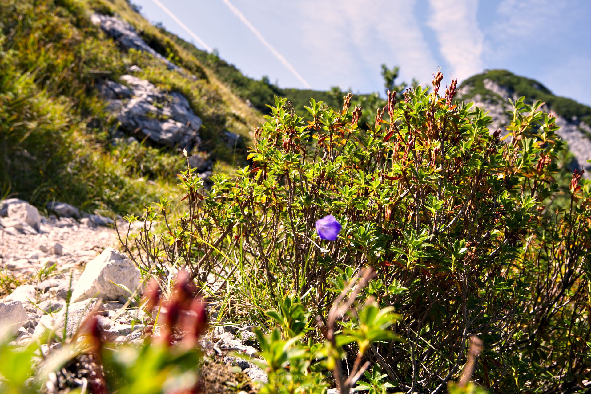
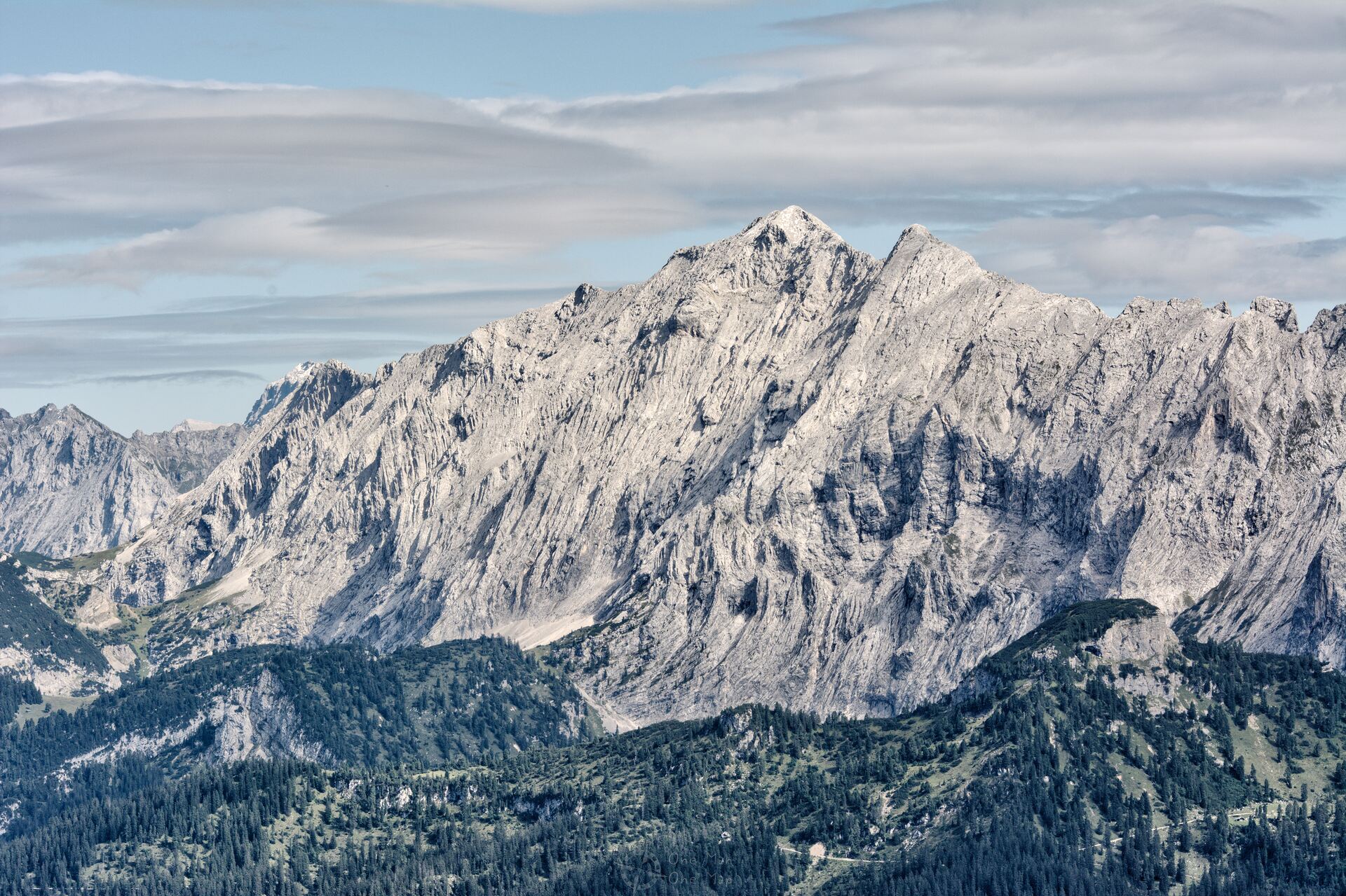
After two kilometres the most strenuous part of the hike is over, and as you can see it is worth it. The view is simply breathtaking. The whole width of the Bernadein walls with the 2144 meter high Bernadeinkopf is visible in front of us. If you branch off here, you can climb the Bernadein walls via the Schöngänge path.
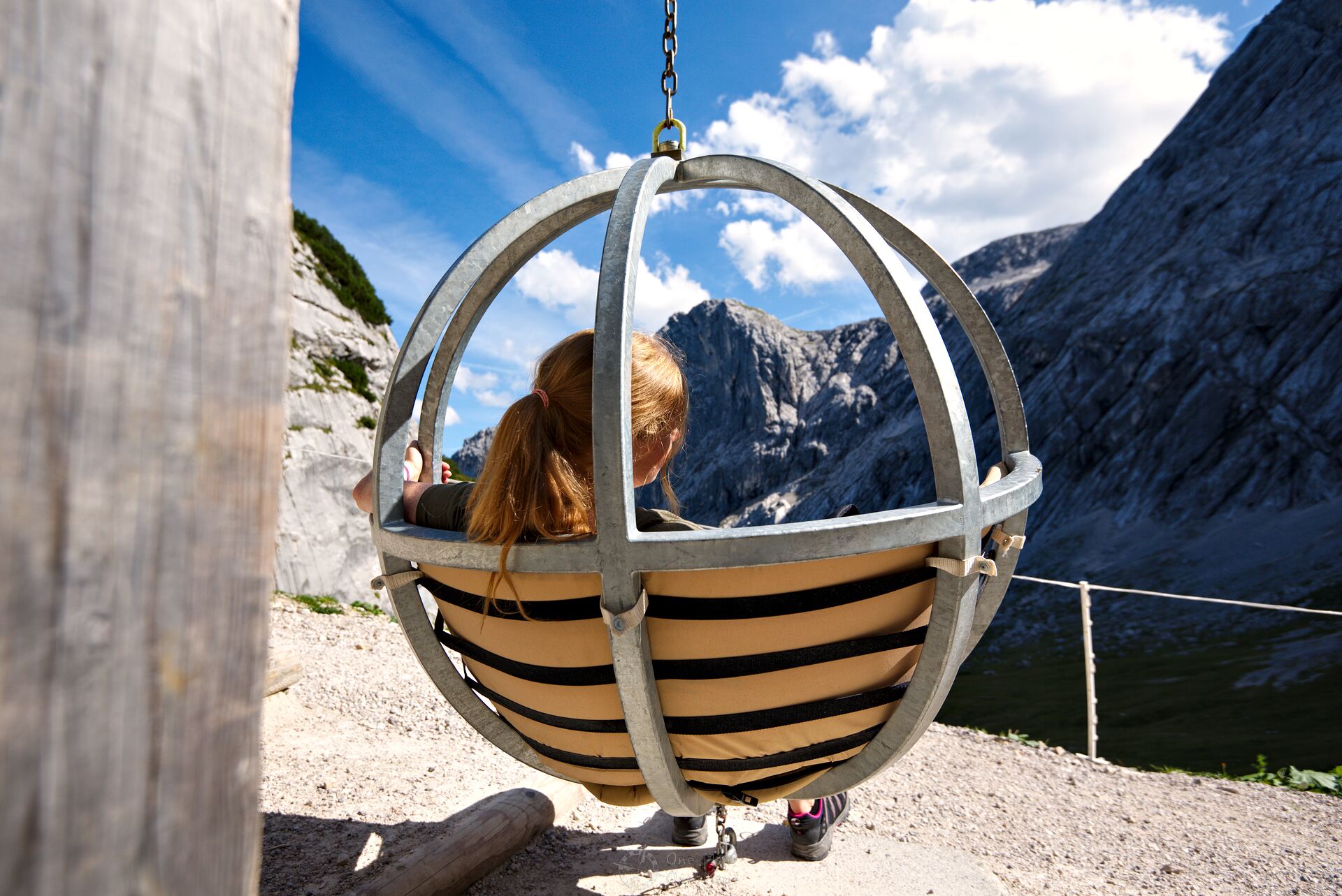
We continue on the KE6 hiking trail, however. The last stretch up to the AlpspiX is part of the “Experience Trail”. In addition to stations with fairy tales for the little ones, there are also hanging chairs with poles, a stone labyrinth, deck chairs, “sight pipes” and much more.
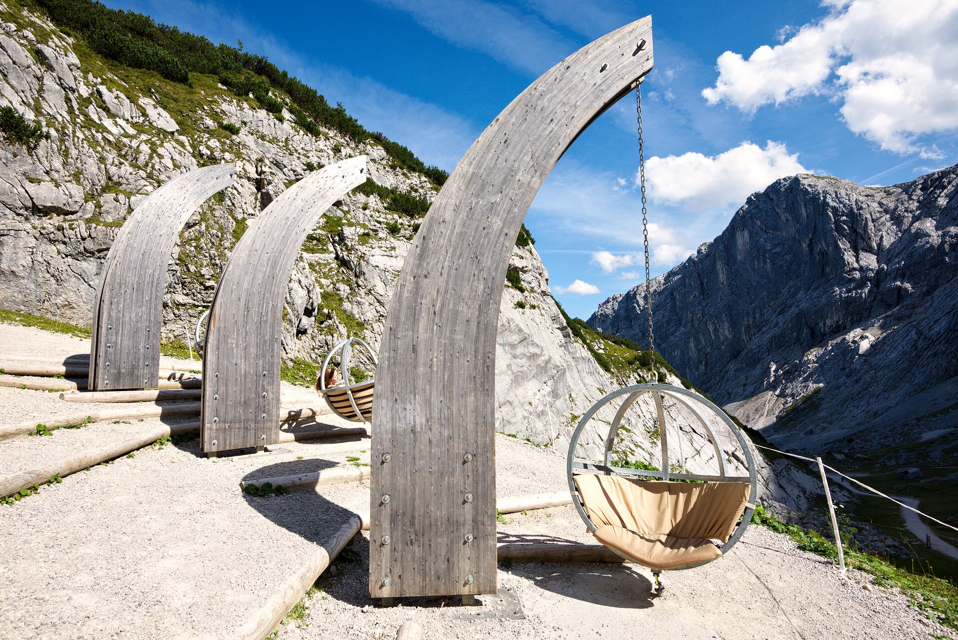
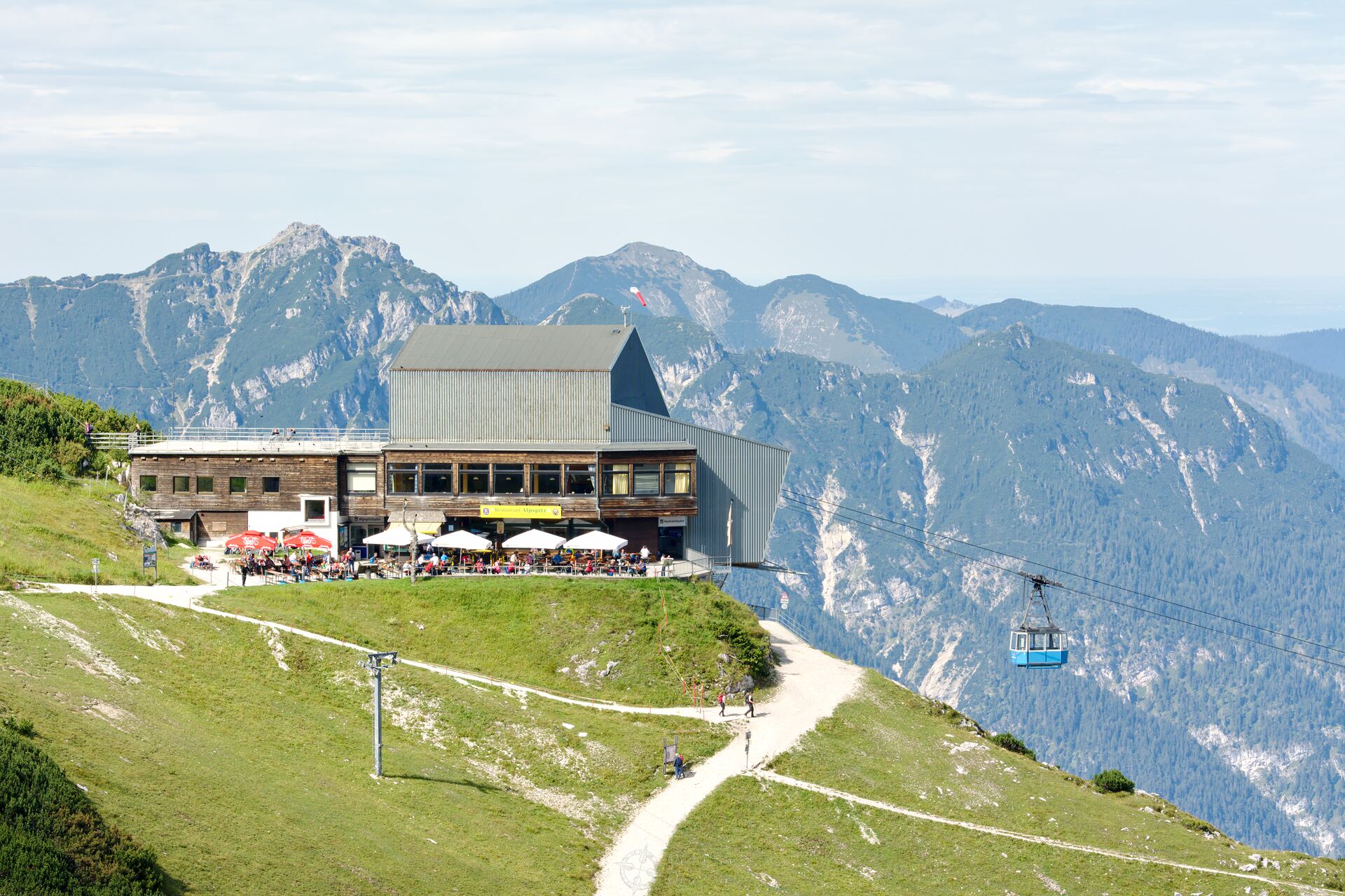
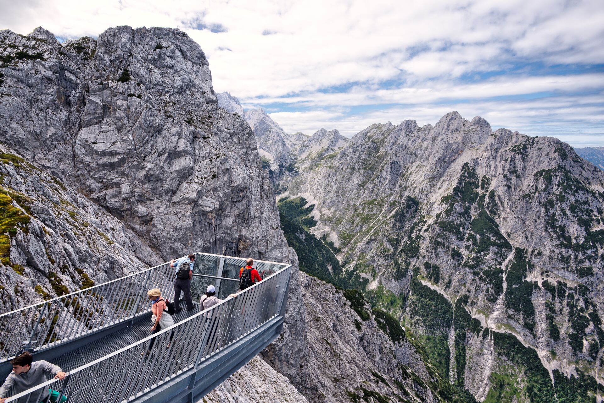
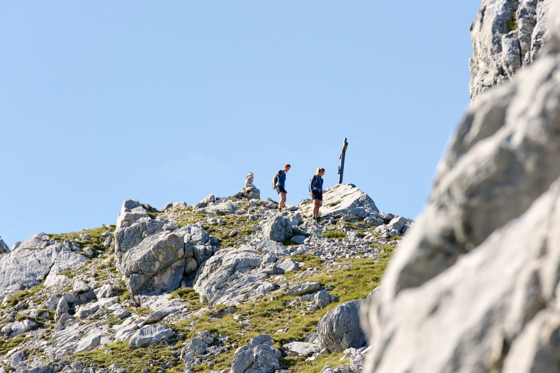
Finally we reach the mountain station of the Alpspitzbahn cable car and the AlpspiX viewing platform. Both are not, as suspected, located on the Alpspitze, but lie 600 metres below at the Osterfelderkopf. If you want to climb the actual Alpspitze from here, you have to bring proper climbing equipment for the Alpspitz-Ferrata.
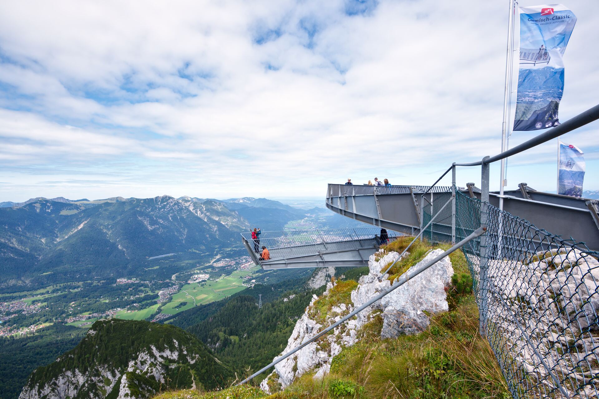
The AlpspiX viewing platform was attached to the Osterfelderkopf in 2010 and consists of two free-floating “arms” which project over the edge of the rock and thus provide a direct view of the Höllental valley up to 1,000 metres further down. Access is free, but not for the faint hearted – the floor is only laid out with simple metal lattice tiles 😉
But also without having to overcome one’s fear of heights there is much to see.
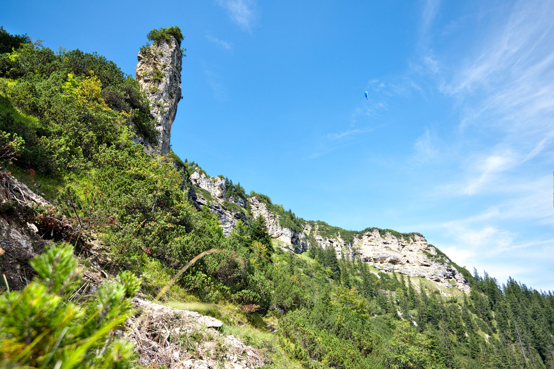
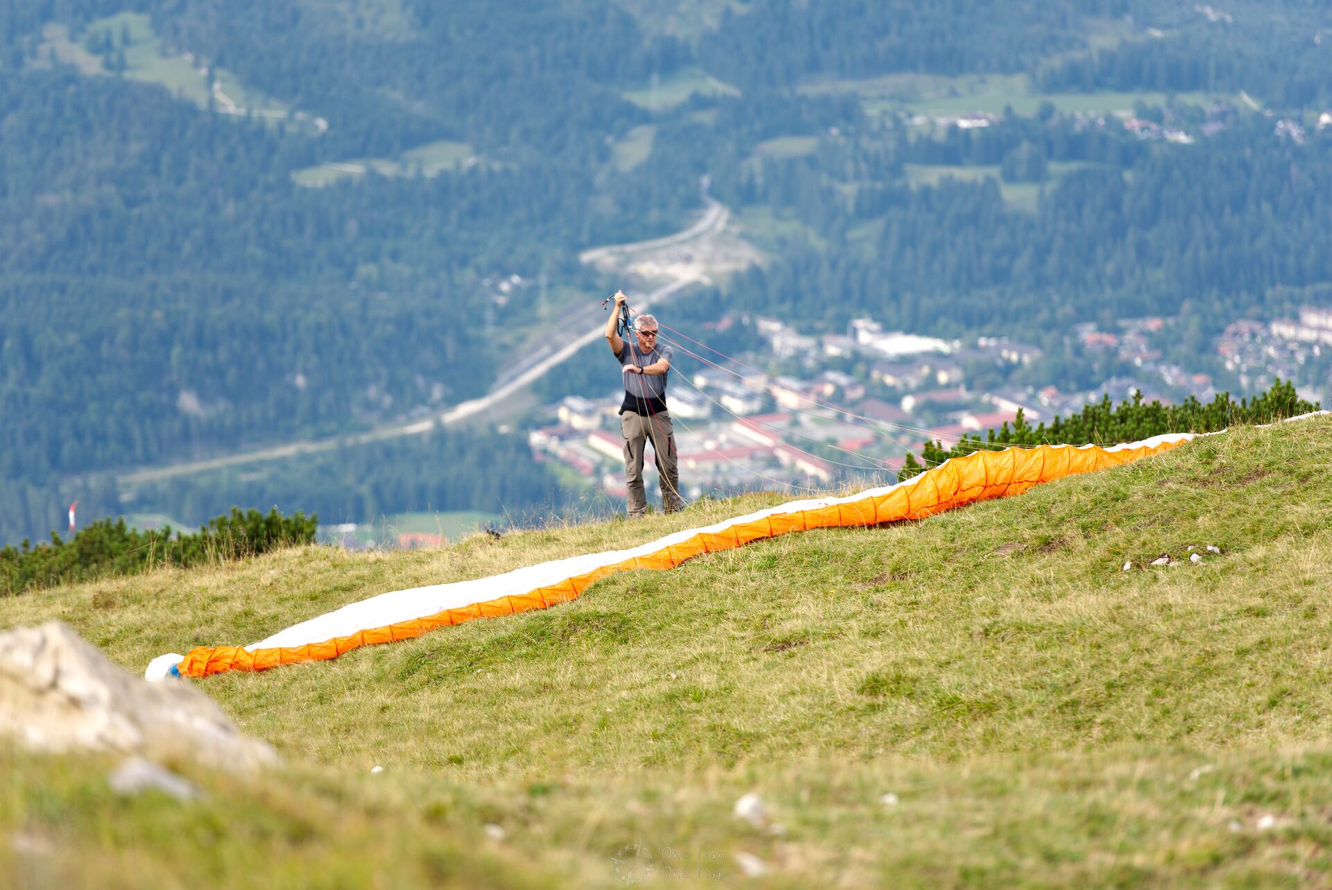
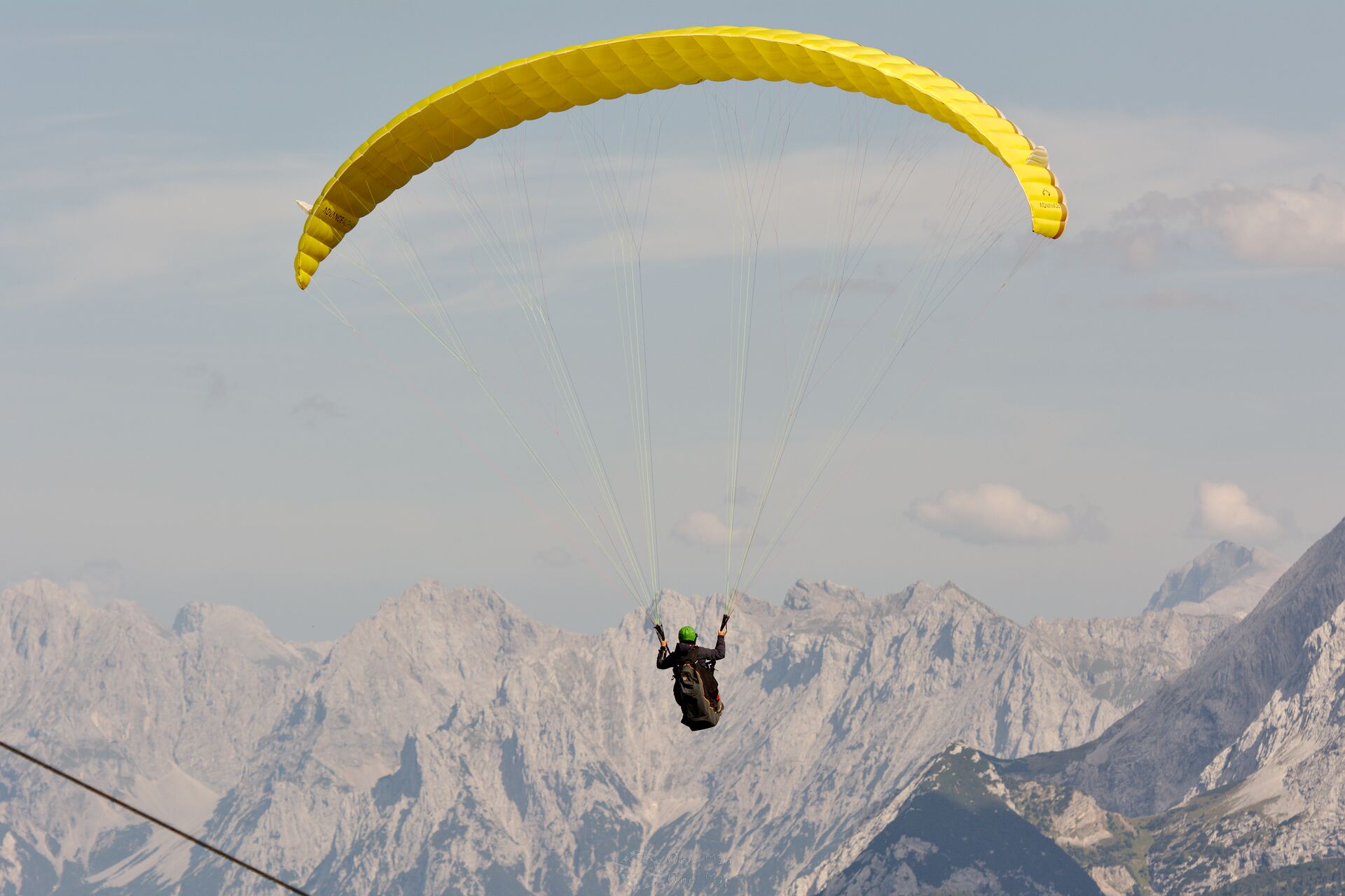
On the Osterfelderkopf there are several runways for paragliders. From the terrace of the restaurant you can watch the athletes assembe their delicate paragliders and take off.
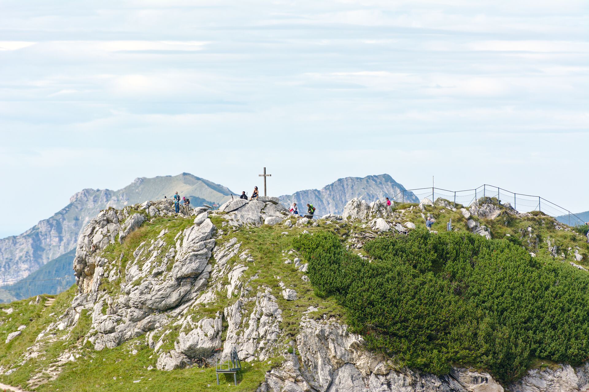
If you want to hike a bit further, there are several possibilities. The Rinderscharte is located only 100 meters of altitude higher, the Höllentorkopf about 160 meters. Both are to the left and right of a small pass, which can be reached via the Rindersteig path.
On the other side the Rindersteig leads all the way down to the Hammersbach. From there you can hike through the Höllentalklamm gorge or over the Stangensteig path to the village of Hammersbach.
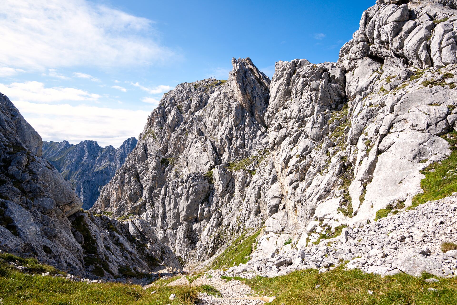
A second option is the Nordwandsteig. It starts at the Rindersteig path and leads over narrow paths and through tunnels across the Bernadein walls, all the way to the Bernadeinkopf. The Alpspitz-Ferrata also begins here.
We end the beautiful day at this point, though, and take the Alpspitzbahn cable car back to the valley 😉
This post was written by Simon for One Man, One Map. The original can be found here. All rights reserved.