| Passerschlucht | |||
| Area | Passeier Valley, South Tyrol, Italy | ||
| Start | St. Leonhard in Passeier | ||
| End | Moos in Passeier (Return by public bus) | ||
| Length | 7 km | Duration | 3 hours |
| Ascent | 420 meters | Descent | 70 meters |
| Easy Spring Summer Fall | |||
Dieser Artikel ist auch auf Deutsch verfügbar. Click here to find out more about Italy!
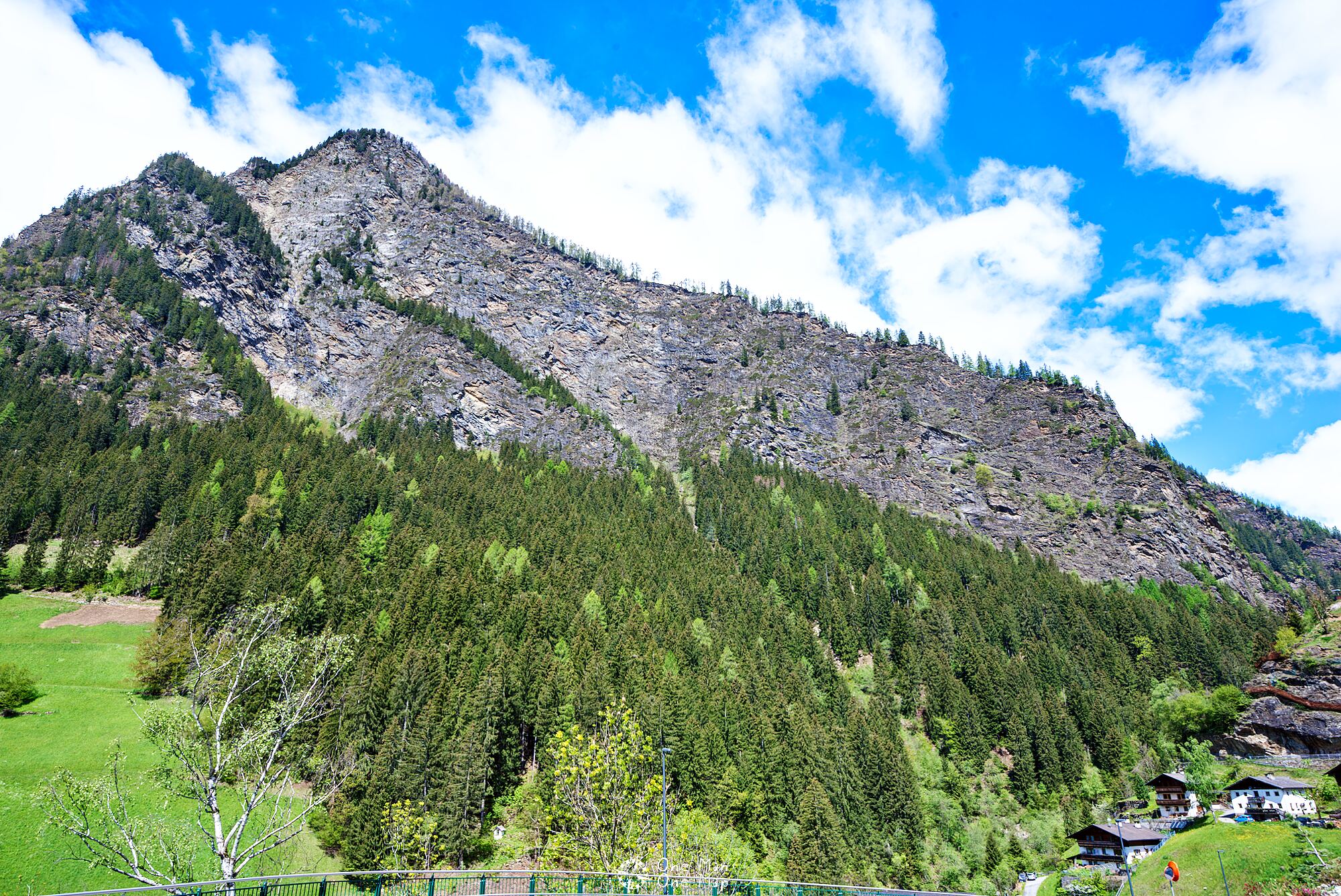
In 2015, a new hiking trail was opened up in the Passerschlucht gorge between St. Leonhard and Moos in Passeier. Spectacular metal walkways lead over river rapids and deep abysses and past waterfalls and steep slopes.
The hiking trail begins at the parking lot at the sports center in St. Leonhard in Passeier. Those arriving by public transport go to the bus station in the town center of St. Leonhard, or to the stop “Passeirerhof”, and then continue to the sports arena on foot.
From the sports arena, you first go along the street on the right side of the Passer river up to a small bridge. There you cross to the other side of the river, and this is where the actual hiking trail begins.
The first half of the route is mainly on forest paths and over meadows. There are only two short sections with metal walkways.
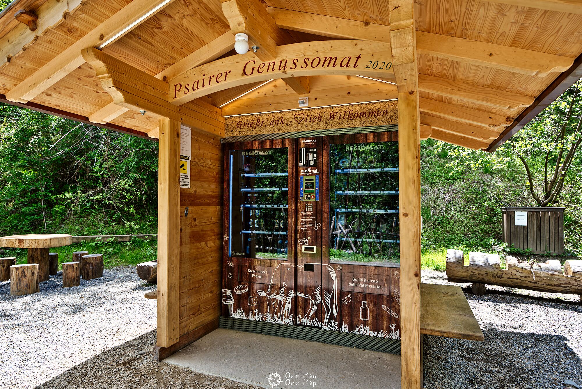
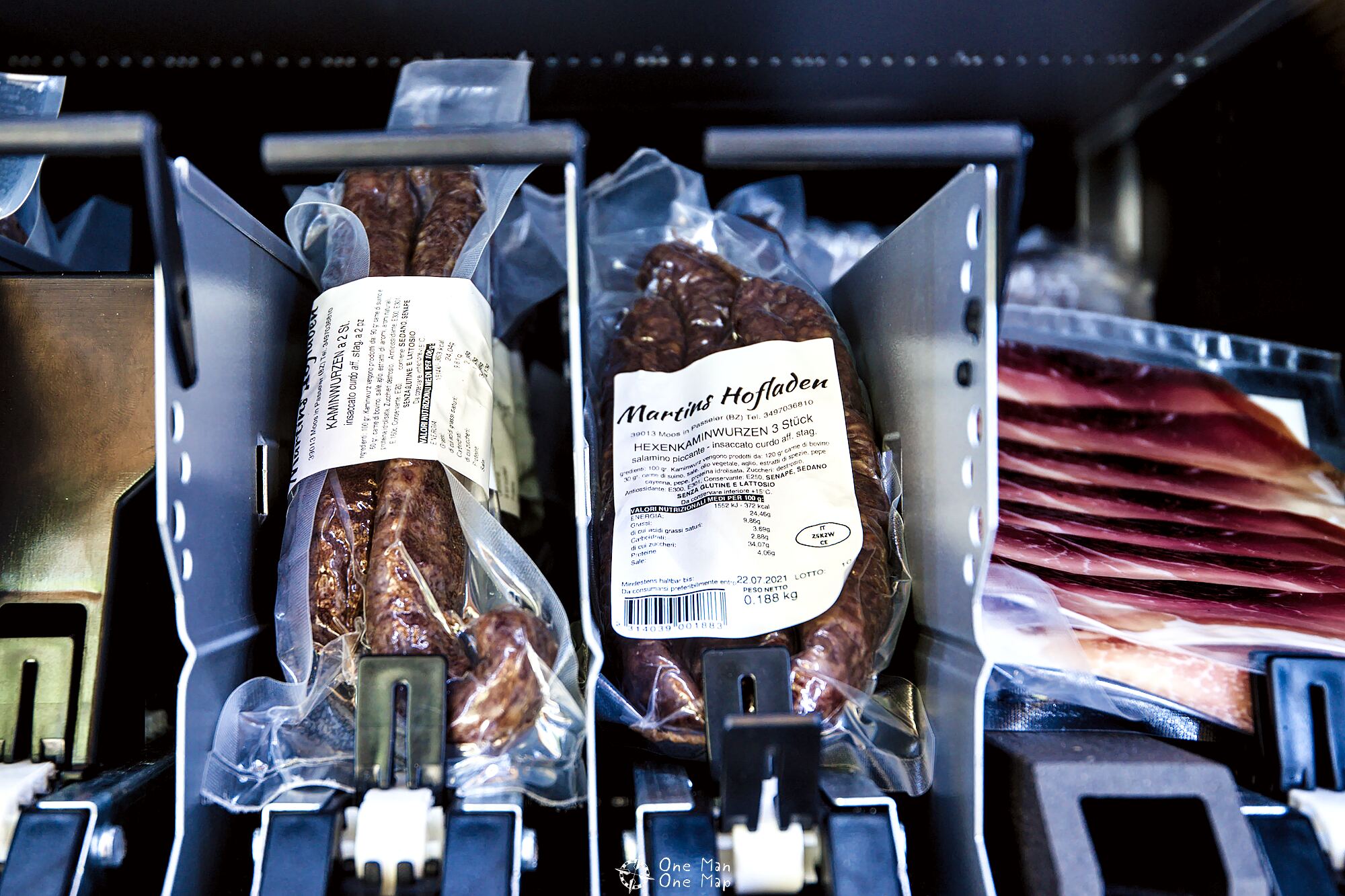
On the way we pass the new “Psairer Genussomat” (basically “Passeier Enjoy-O-Mat” in English). A farmer from the region regularly refills it with products from his own farm shop and bottled drinks. Not a bad business idea;)
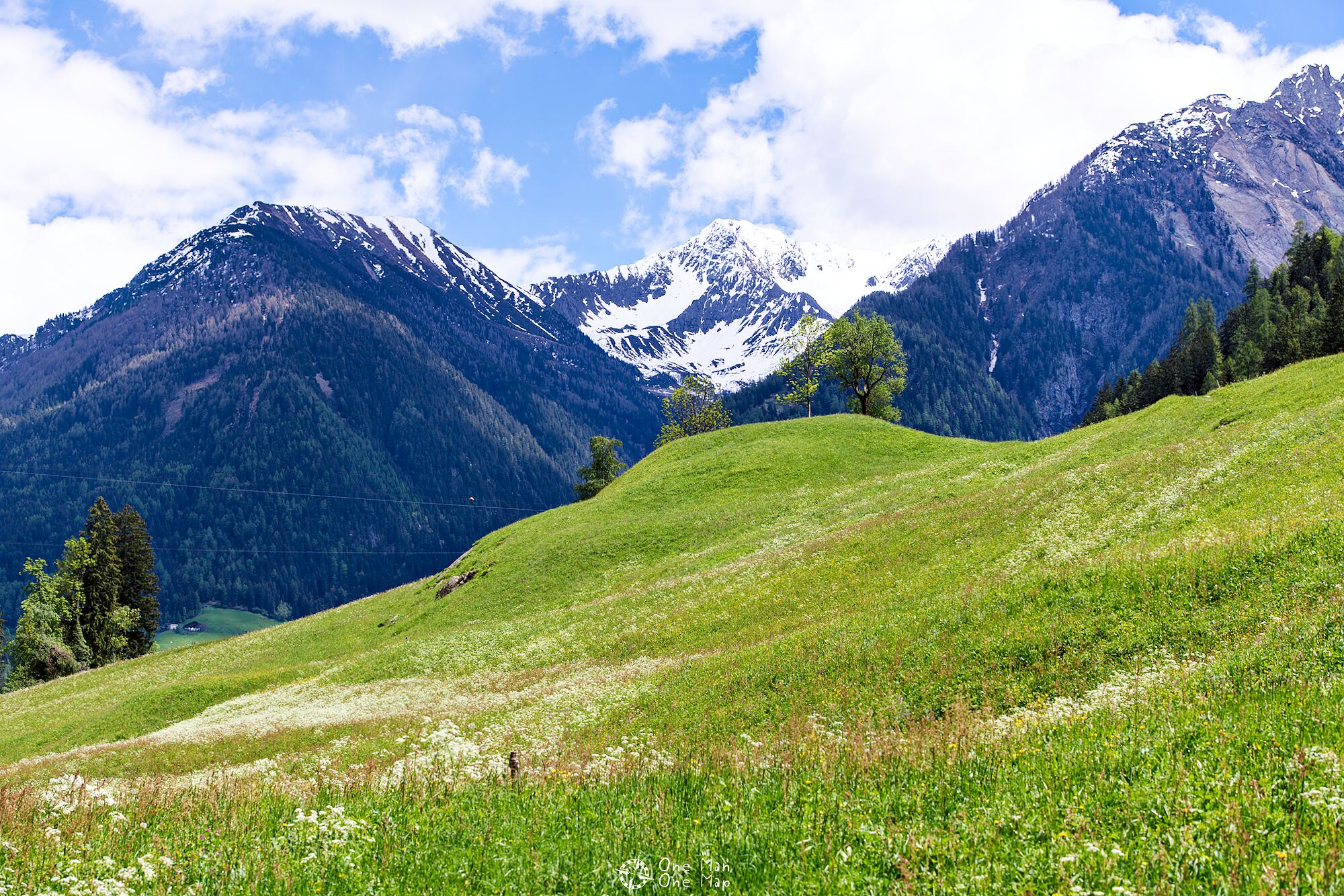
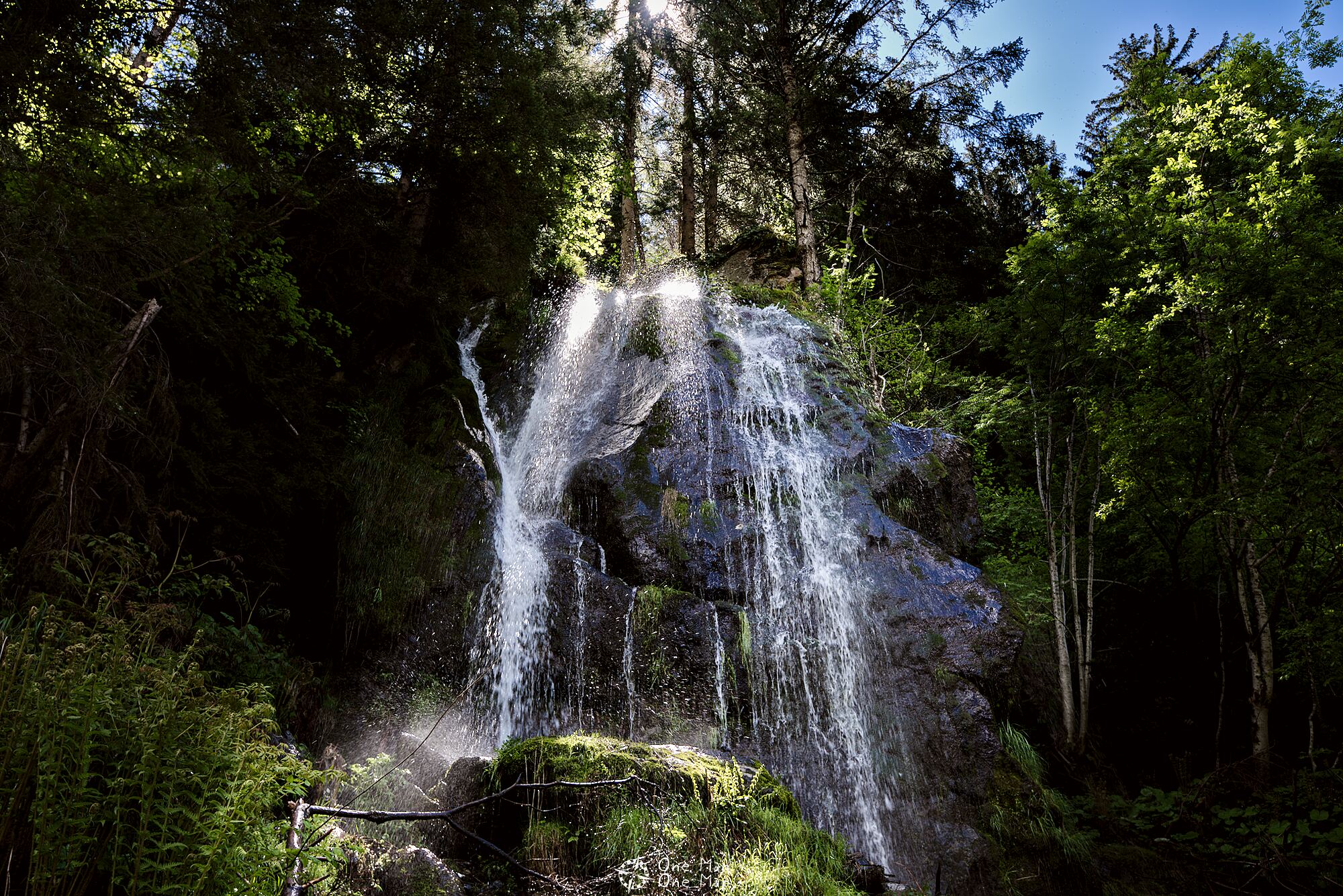
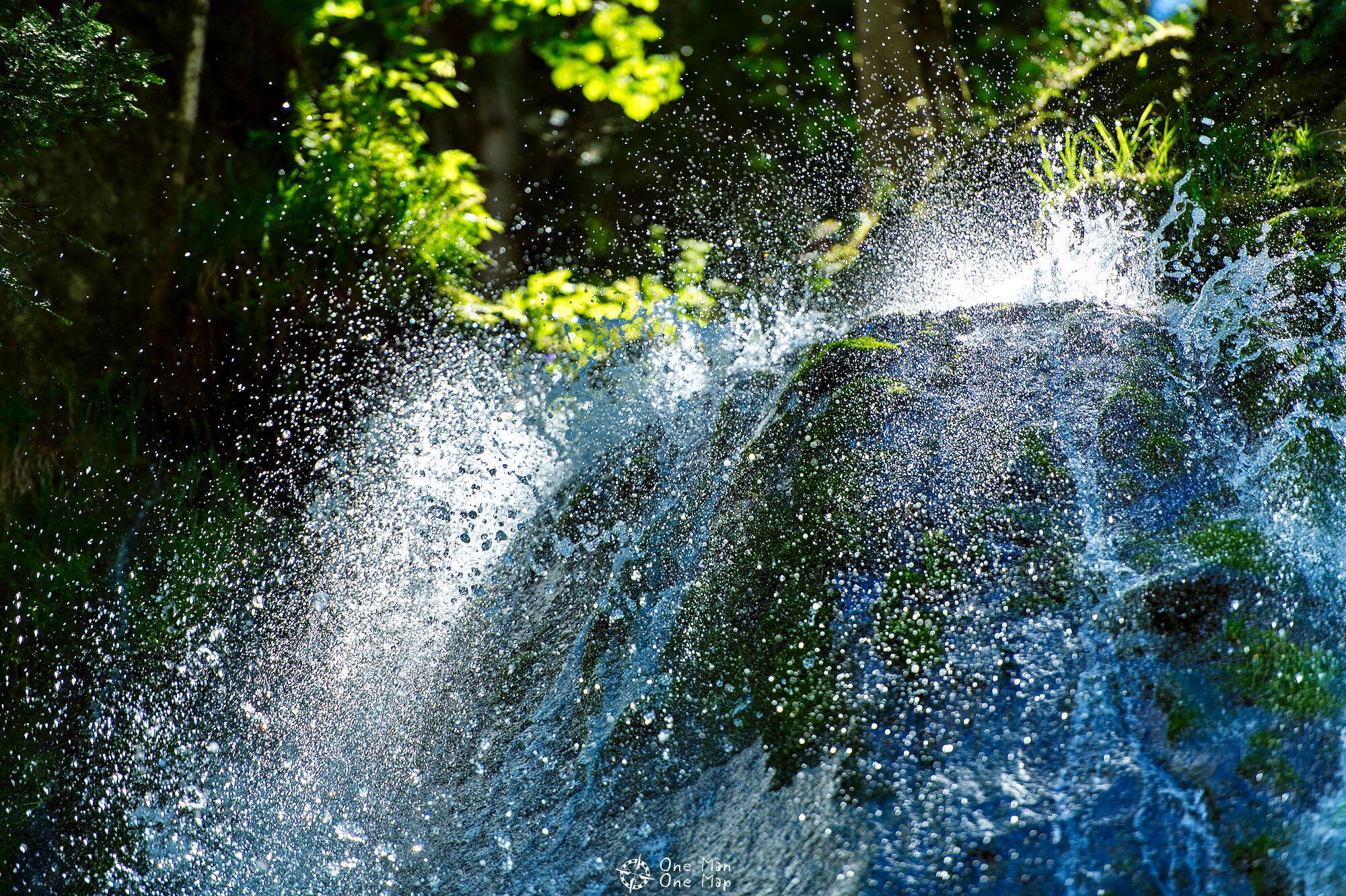
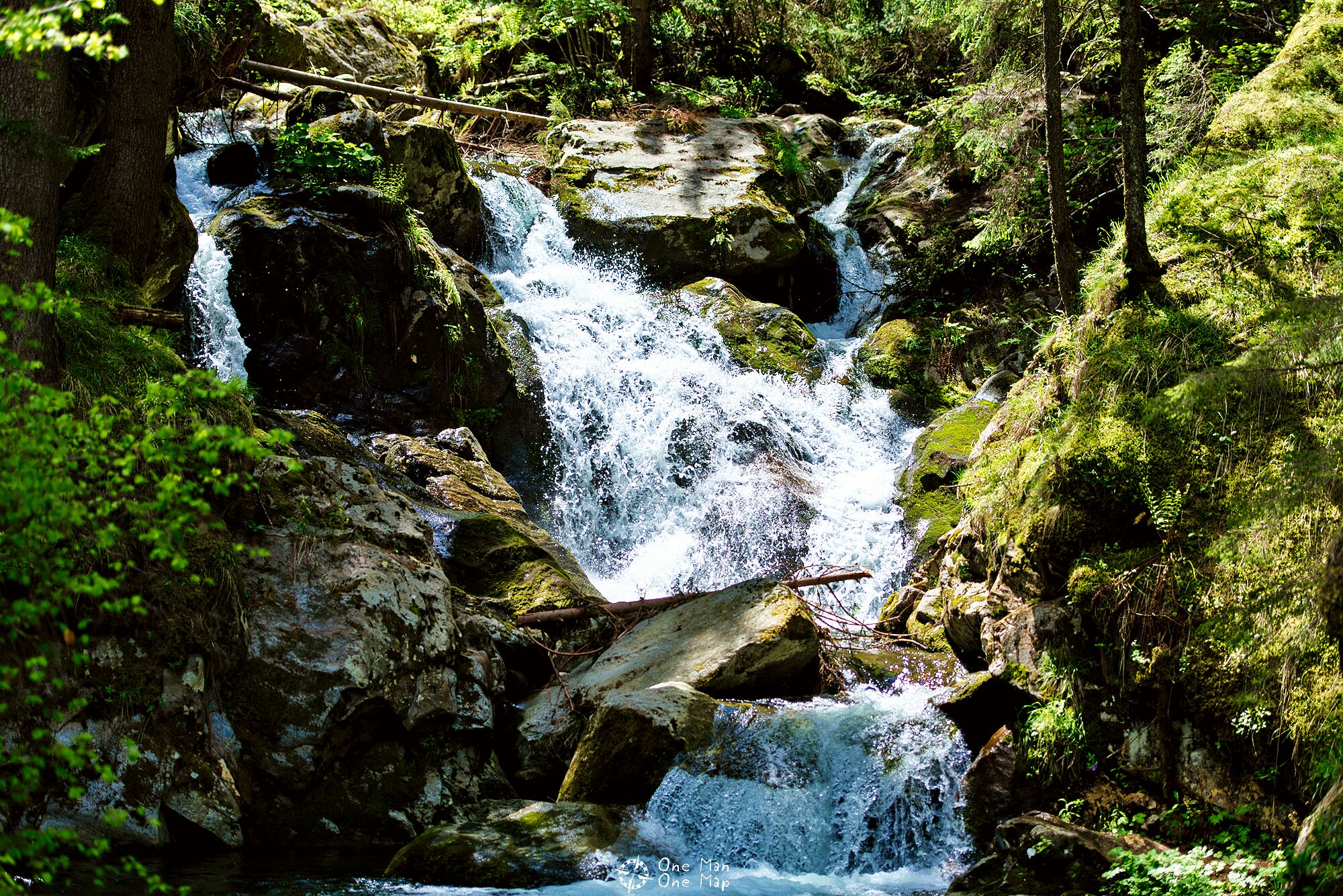
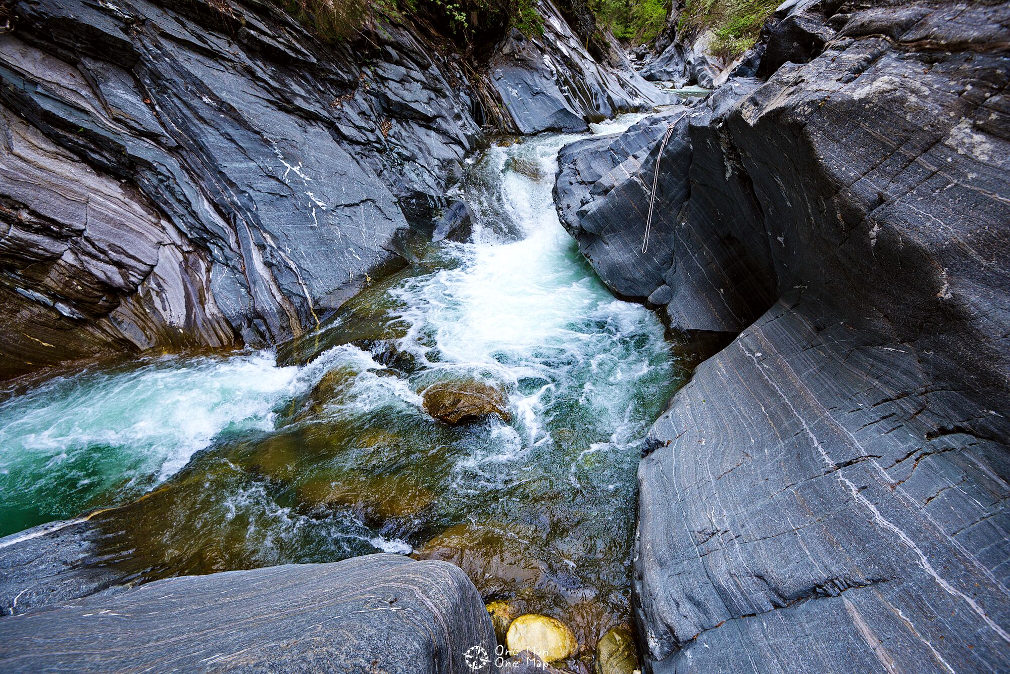
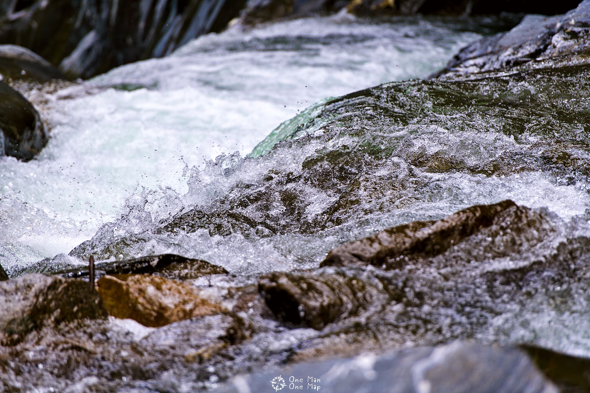
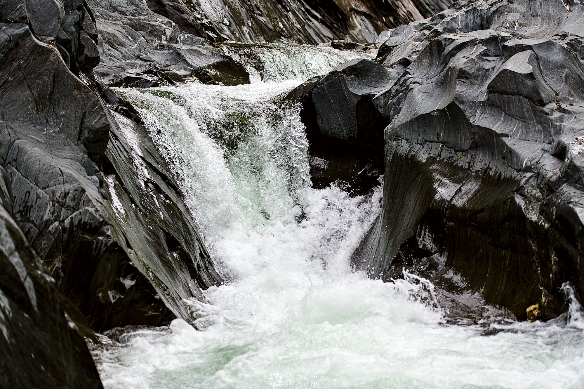
Especially in spring and after prolonged rain, water gushes out of every crack in the Passeier Valley. Usually it’s only small rivulets, but in some places full-blown waterfalls rush down the slope.
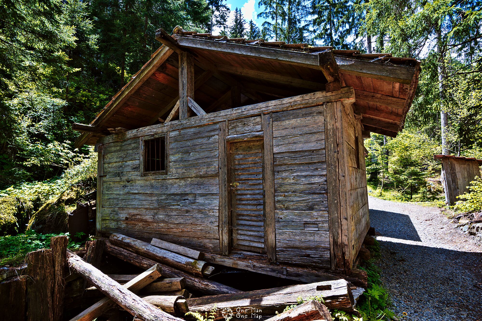
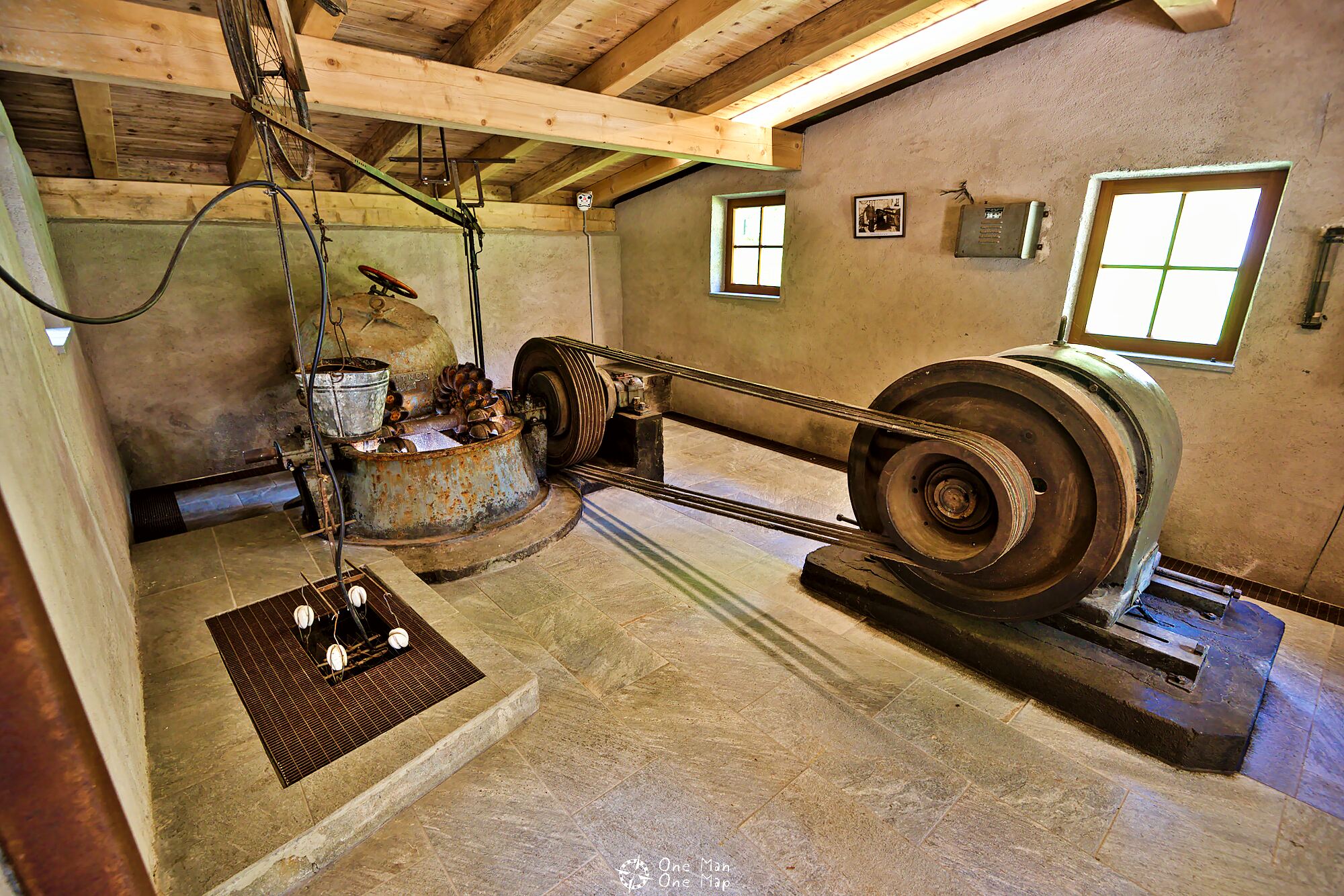
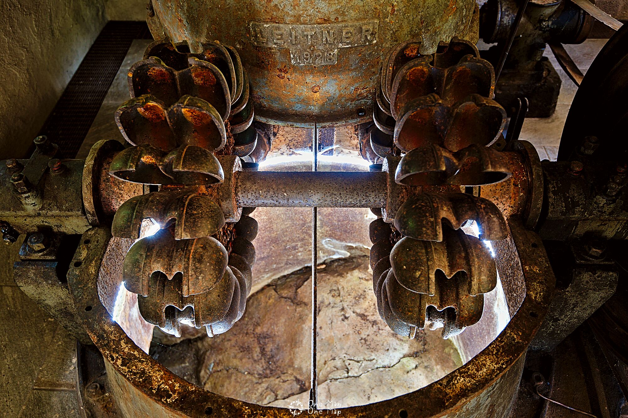
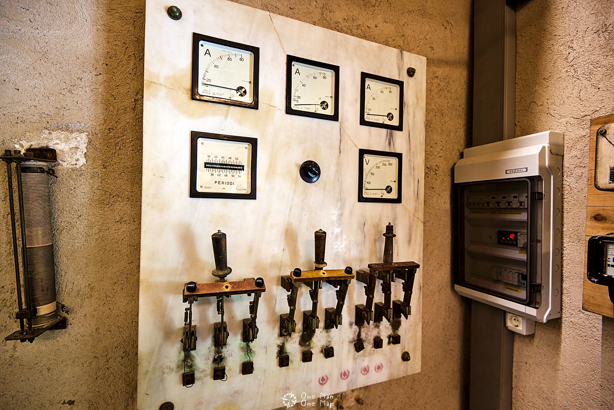
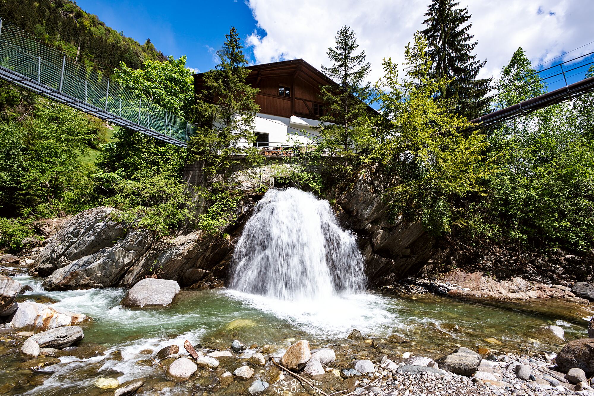
The Gomion-Langwies power plant
It’s no wonder that hydropower has been used here for quite some time. The old Gomion-Langwies power plant was built in 1955 in a simple wooden shack using a second-hand turbine built in 1928. 60 meters of descent produced an impressive 30 kilowatts of electrical power, which were used to operate both a mill and a sawmill.
Today the power plant is a protected historical building and can be visited for free. Public toilets and picnic tables are also available.
The new power plant was built in 1983 on the opposite side of the Passer. It draws its water from the Salderenbach, a tributary river of the Passer, and can produce up to 770 kilowatts from a descent of 330 meters – more than 20 times as much as its predecessor.
Water and steel
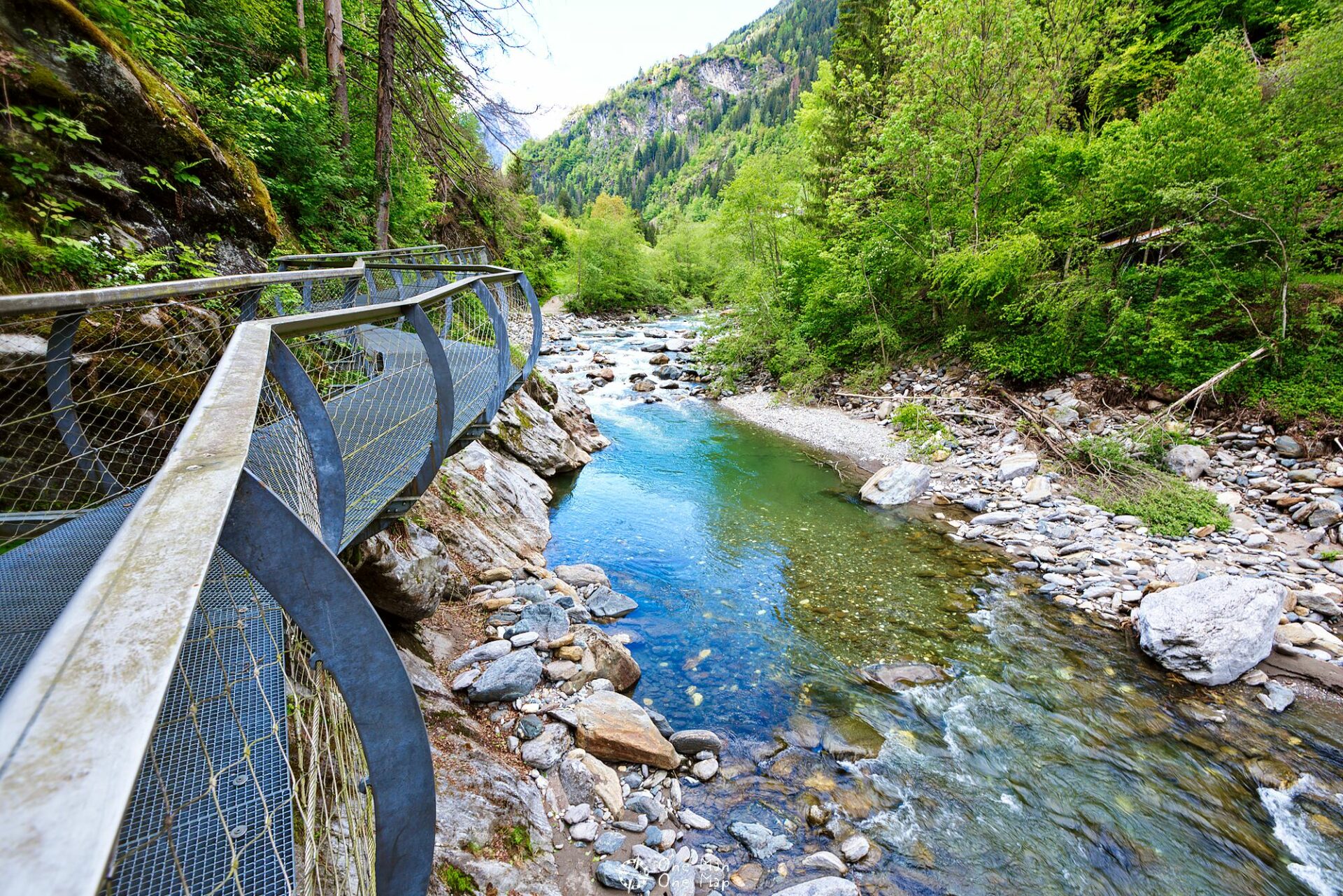
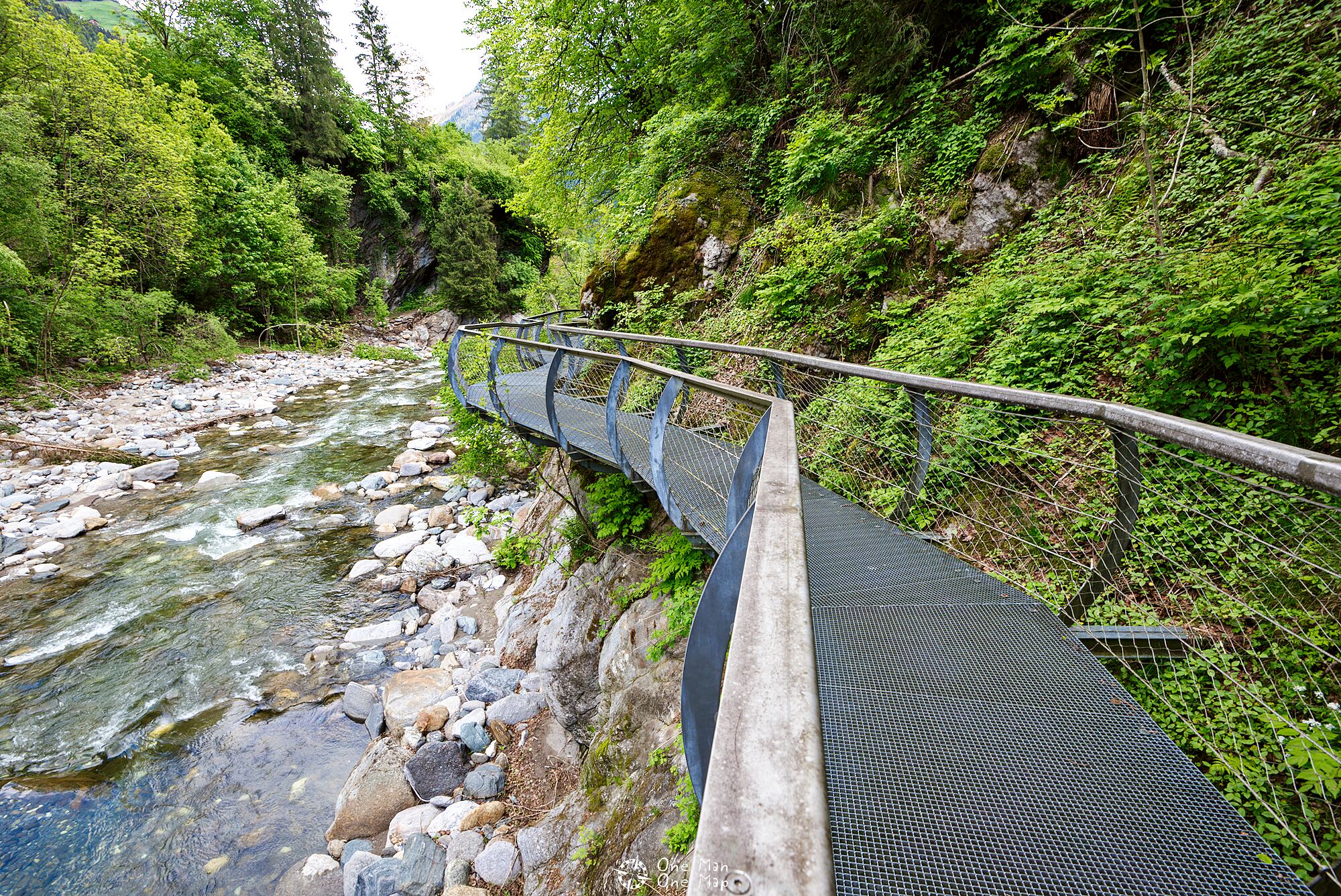
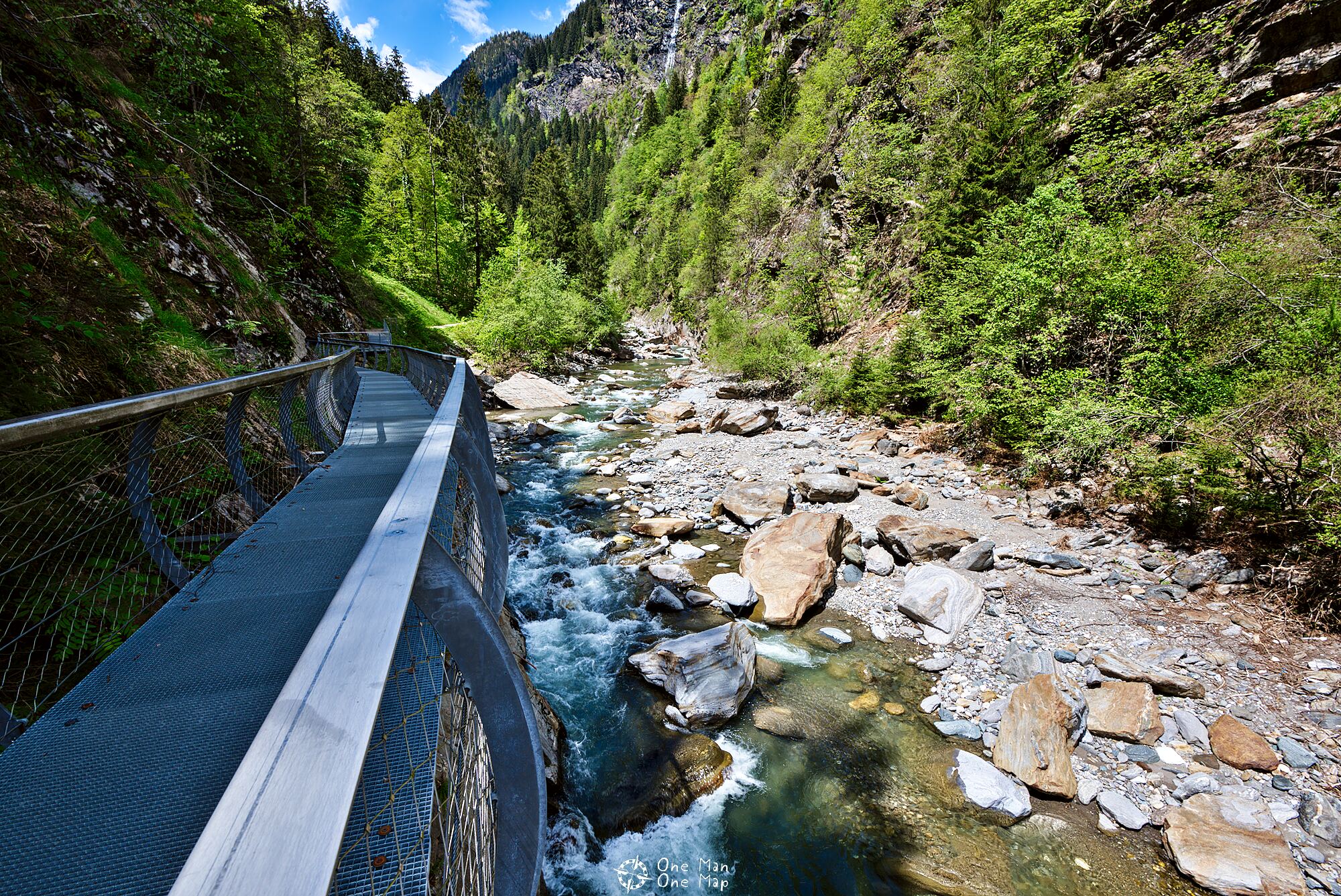
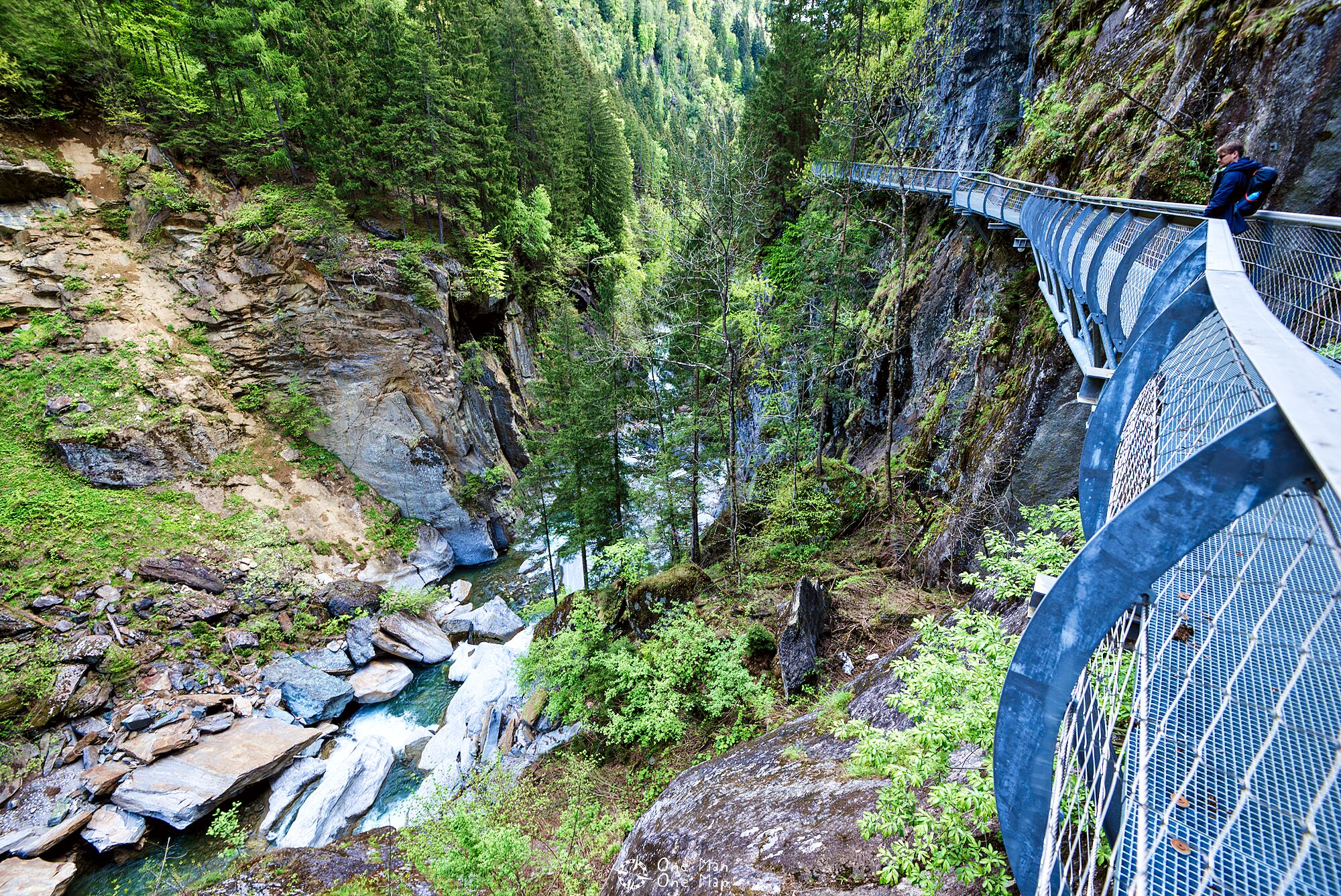
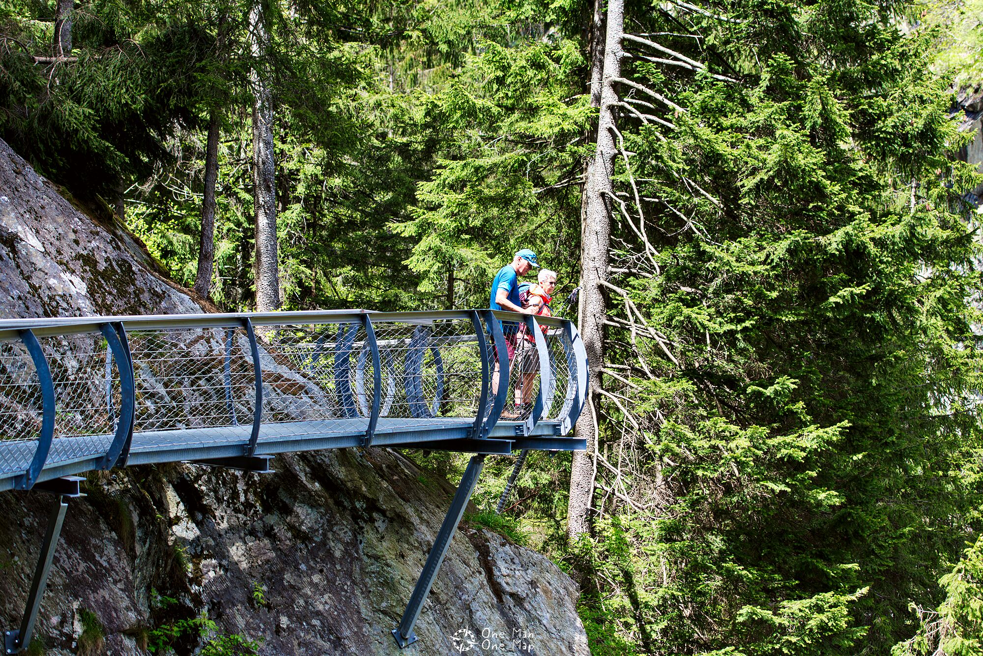
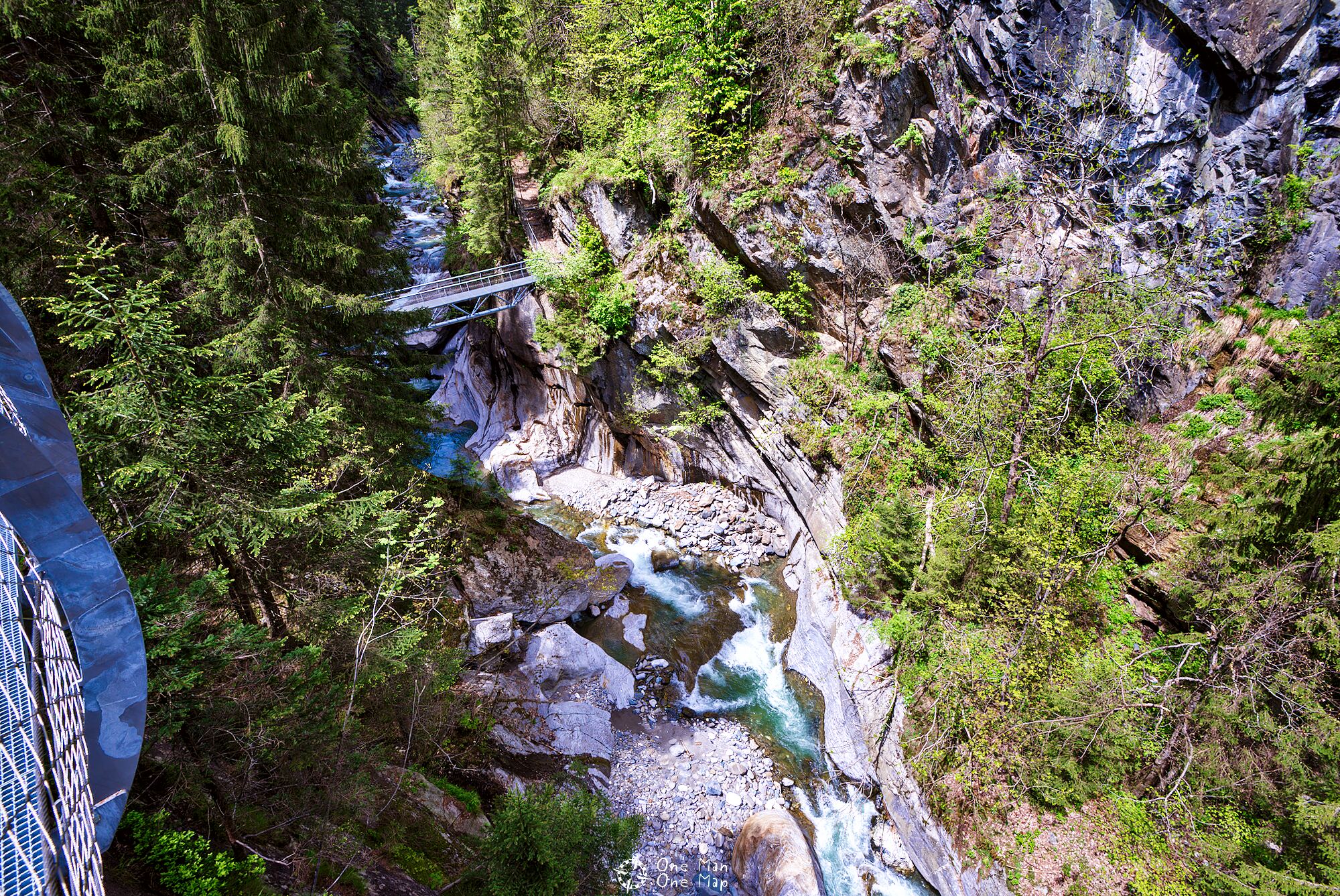
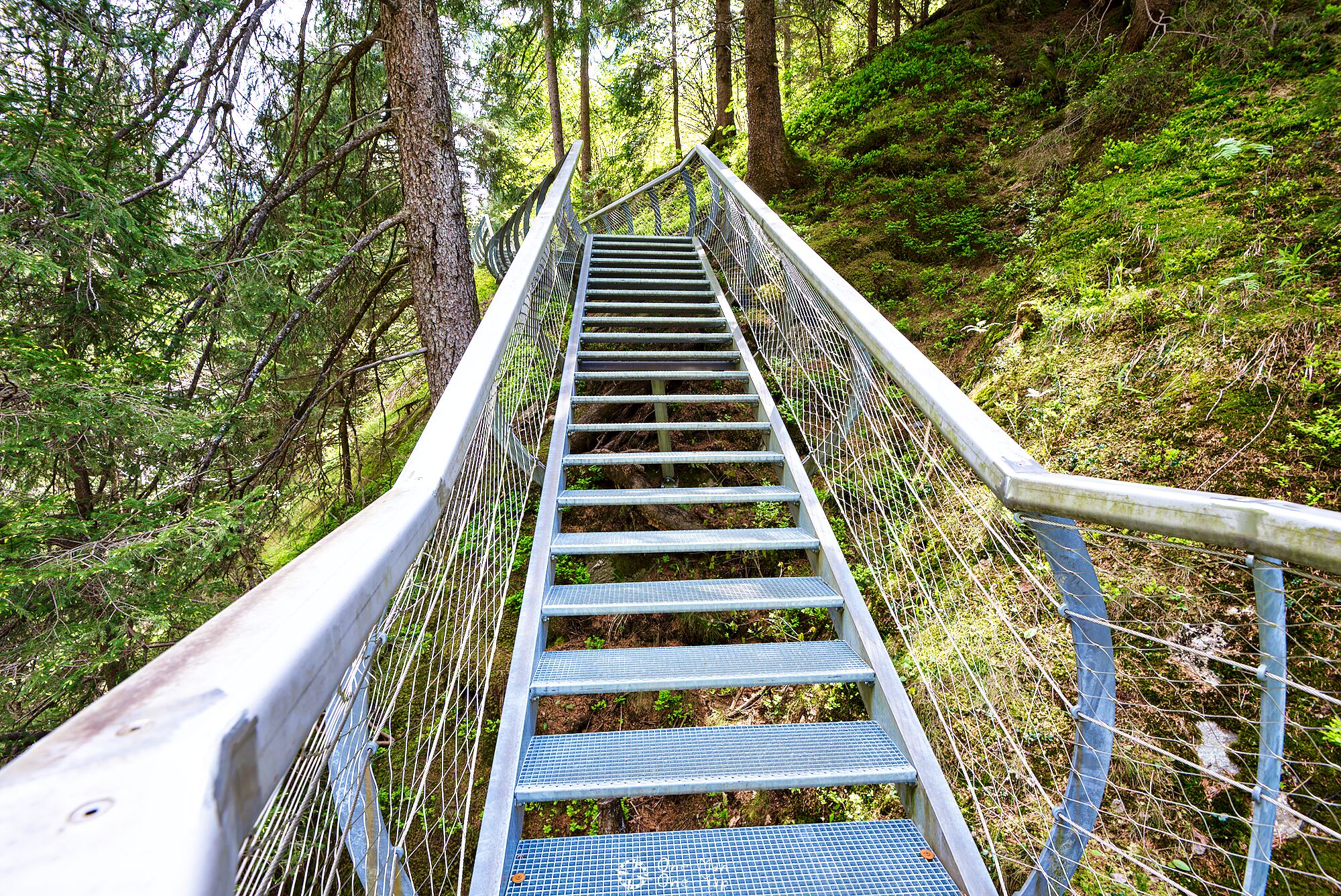
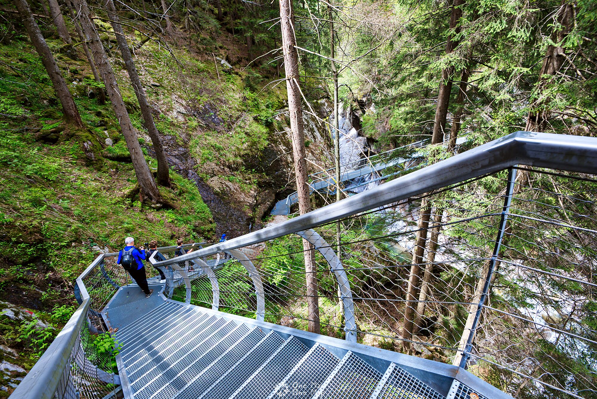
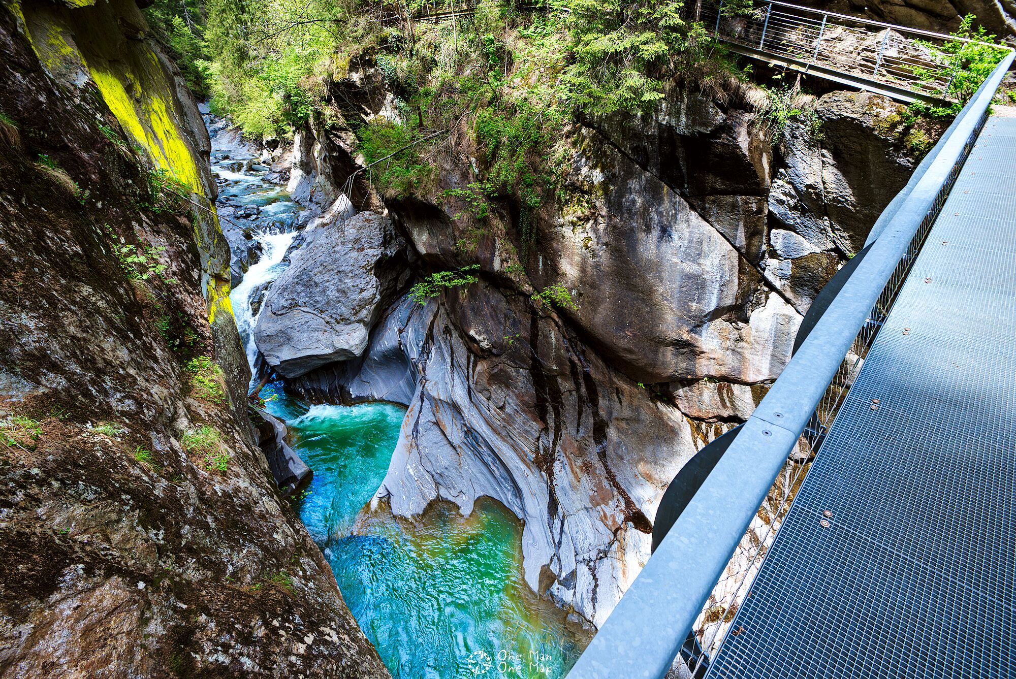
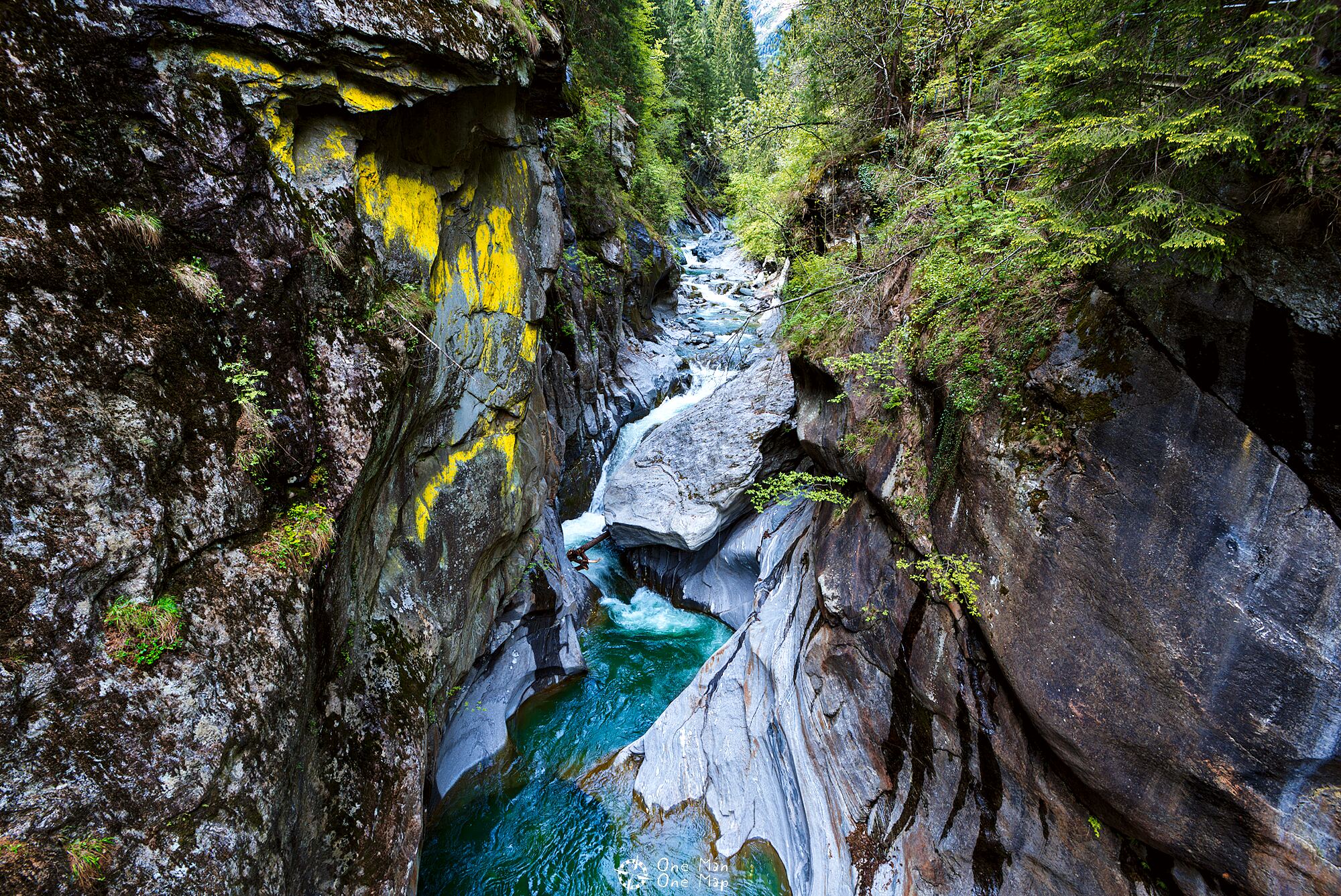
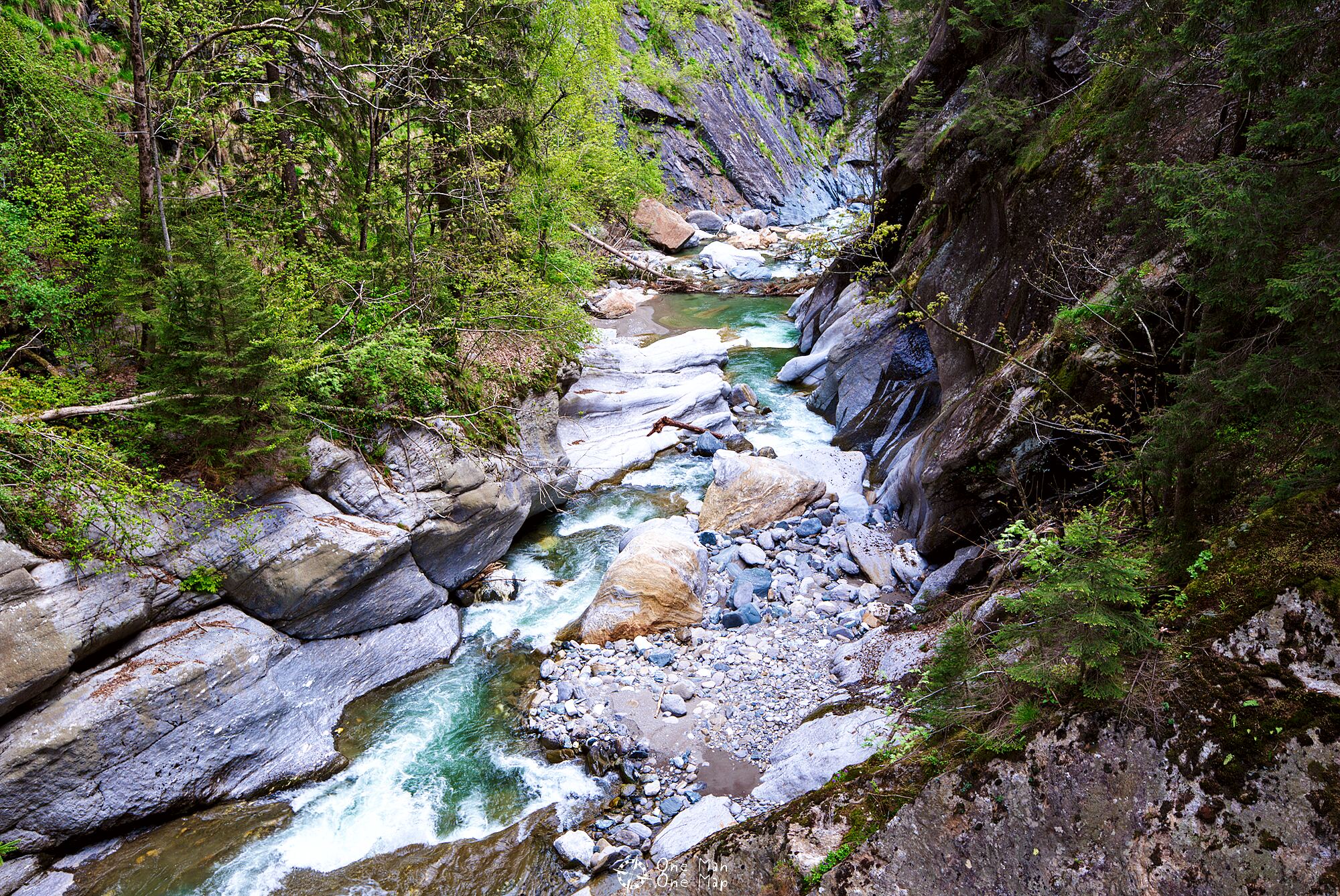
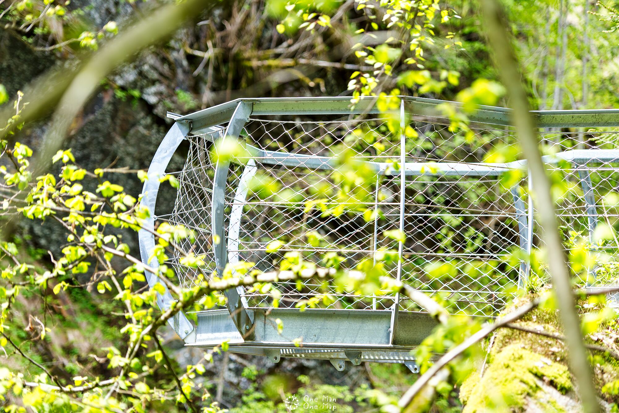
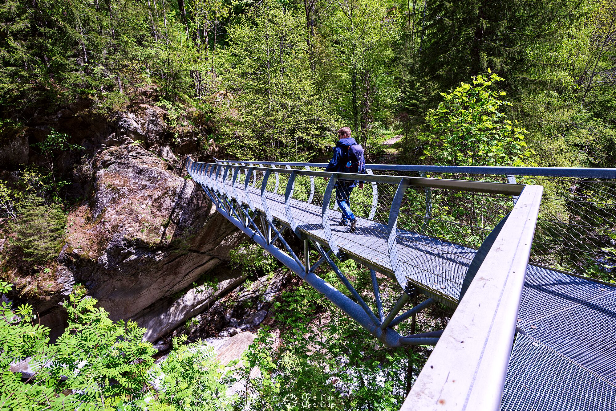
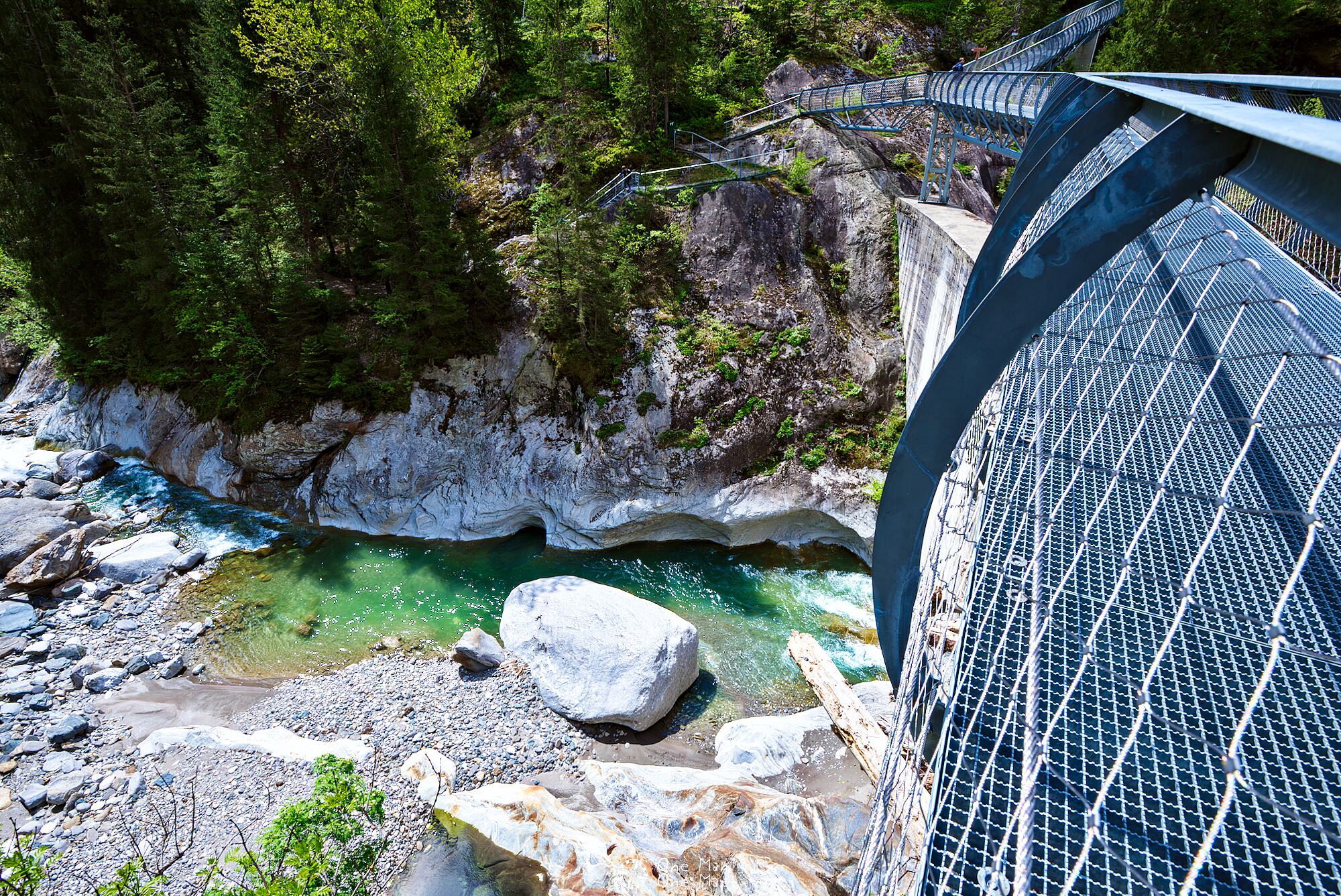
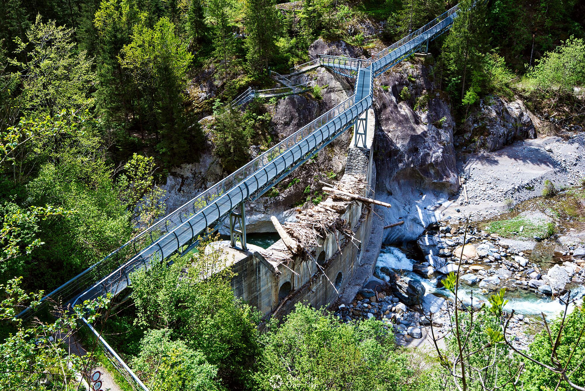
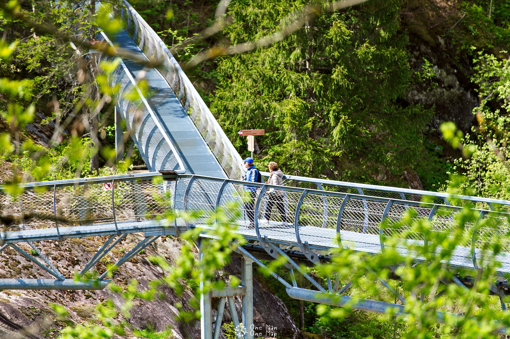
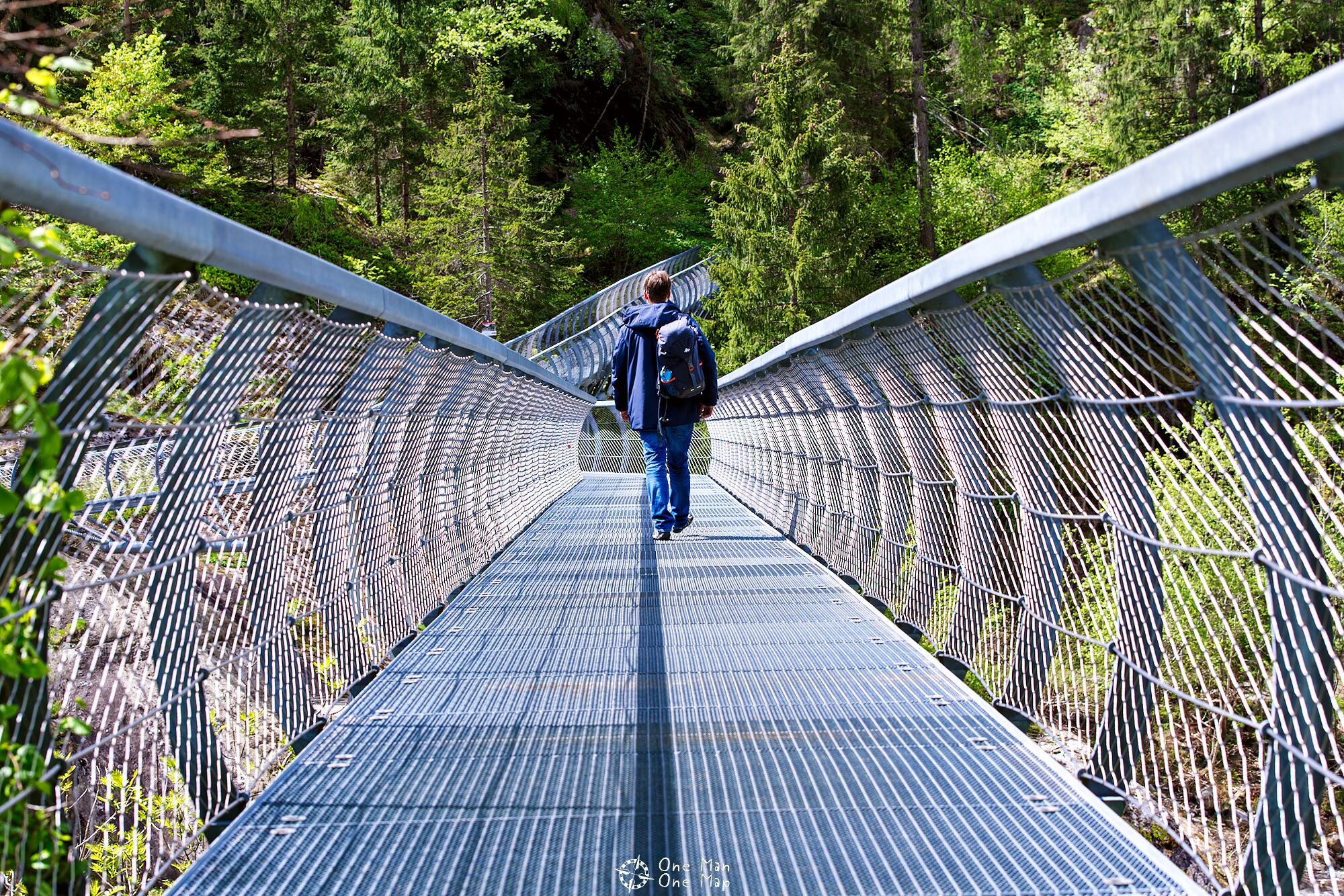
From here the valley becomes significantly narrower and from now on the path goes much more often over the new steel walkways installed in 2015. These walkways do not just simplify the ascent in many places, but also enable completely new perspectives on the river.
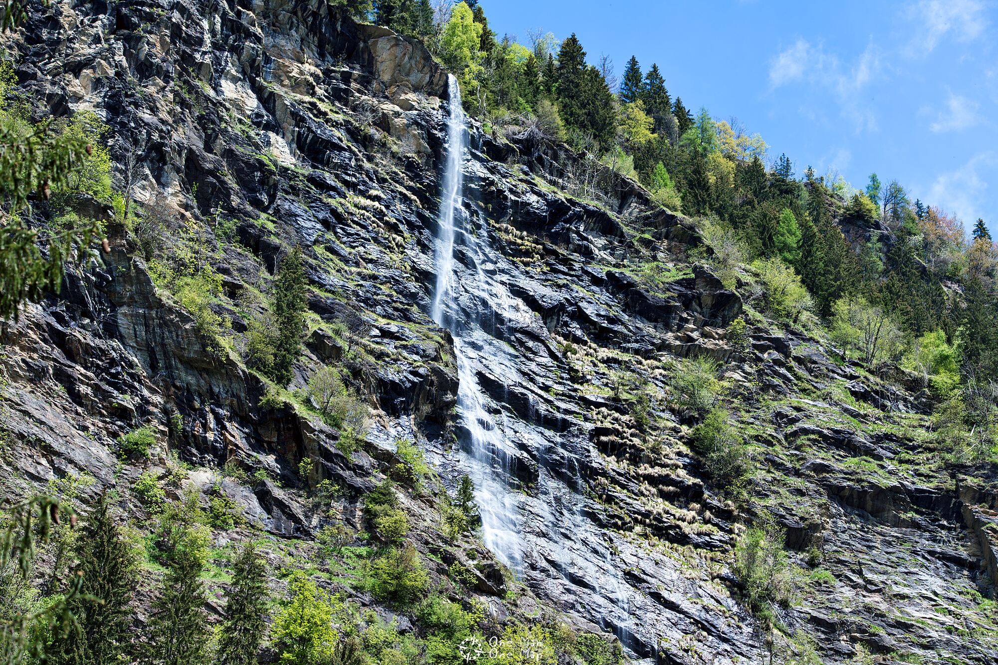
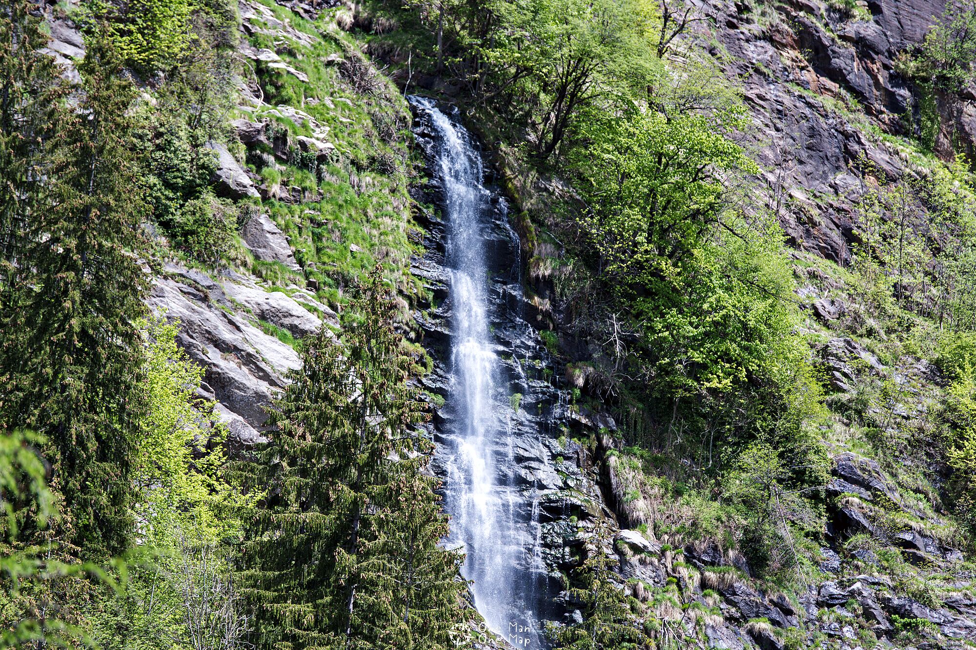
The Stulser waterfalls
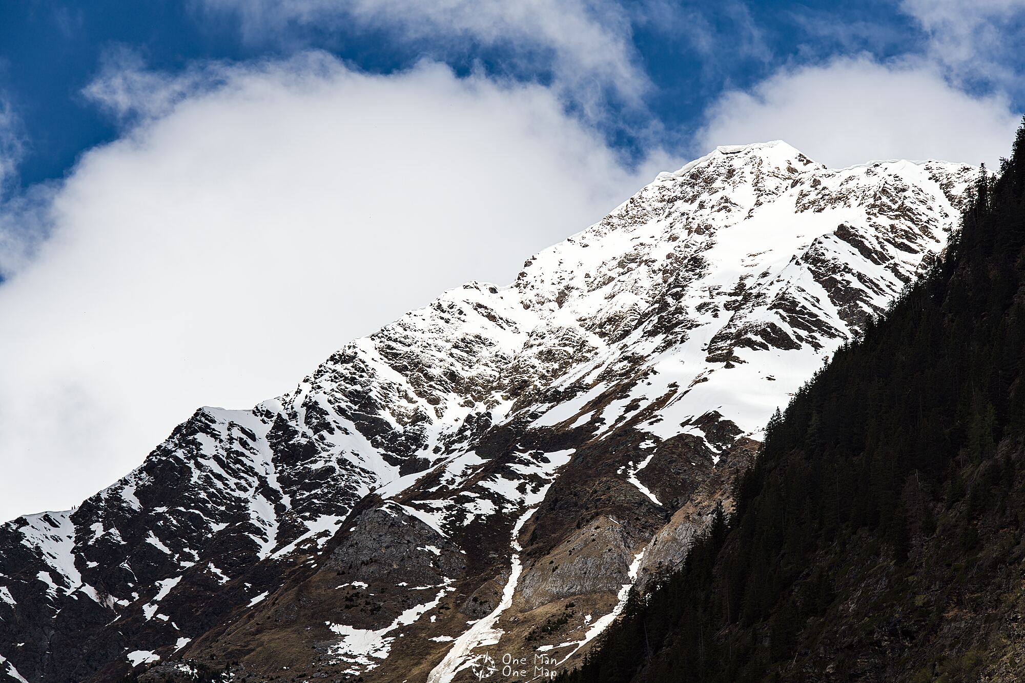
It’s worth keeping an eye on the other side of the valley and lifting your head every now and then. Especially at the point where the Stuller waterfalls plunge down the slope a whopping 342 meters in three stages. Taken together, the three stages form the third highest waterfall in Europe. There even is a via ferrata next to the waterfall!
High above
Higher and higher the steel walkways continue along the spectacular slope, while the Passer river loudly rushes downstream deep down in the valley.
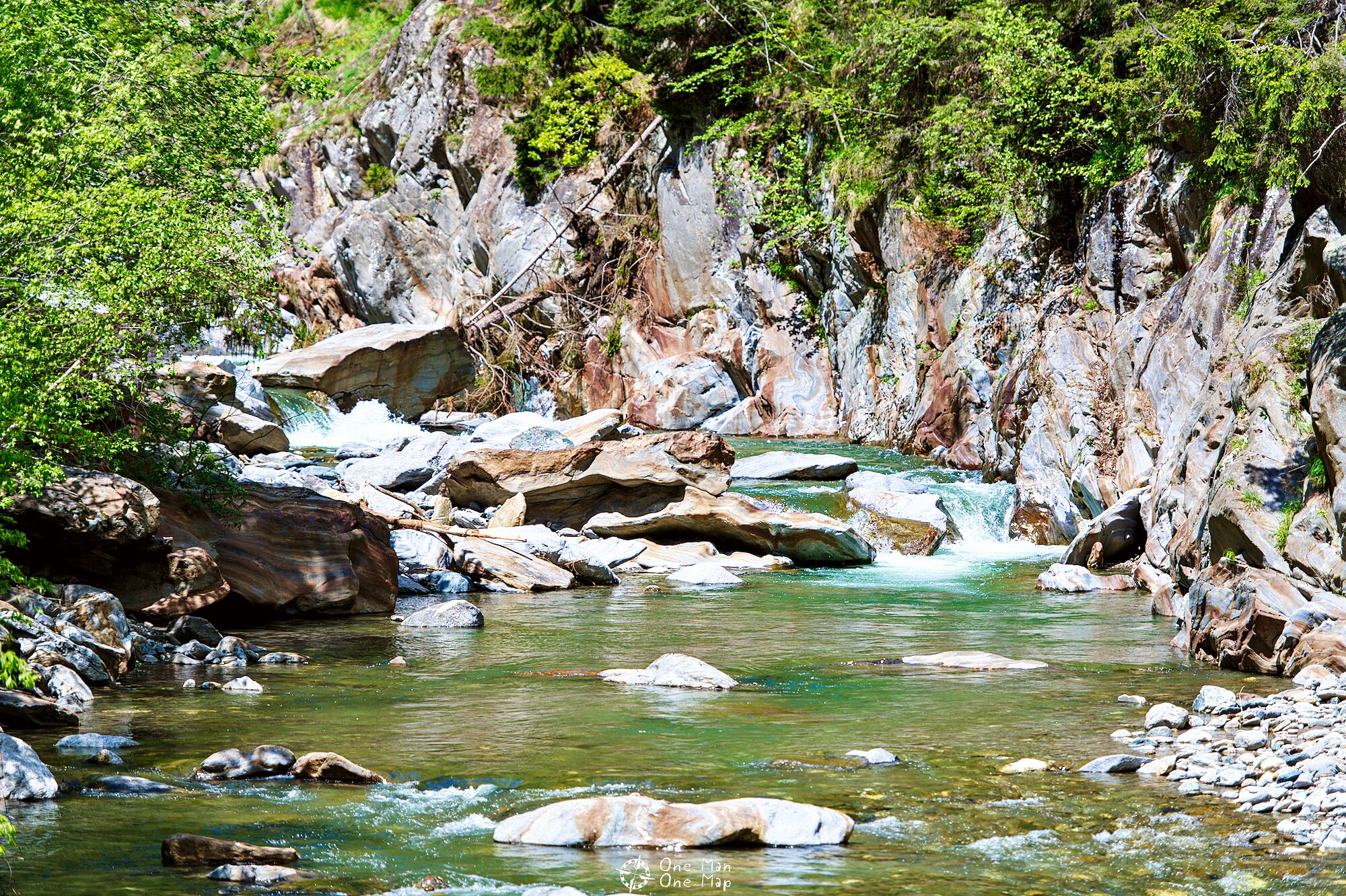
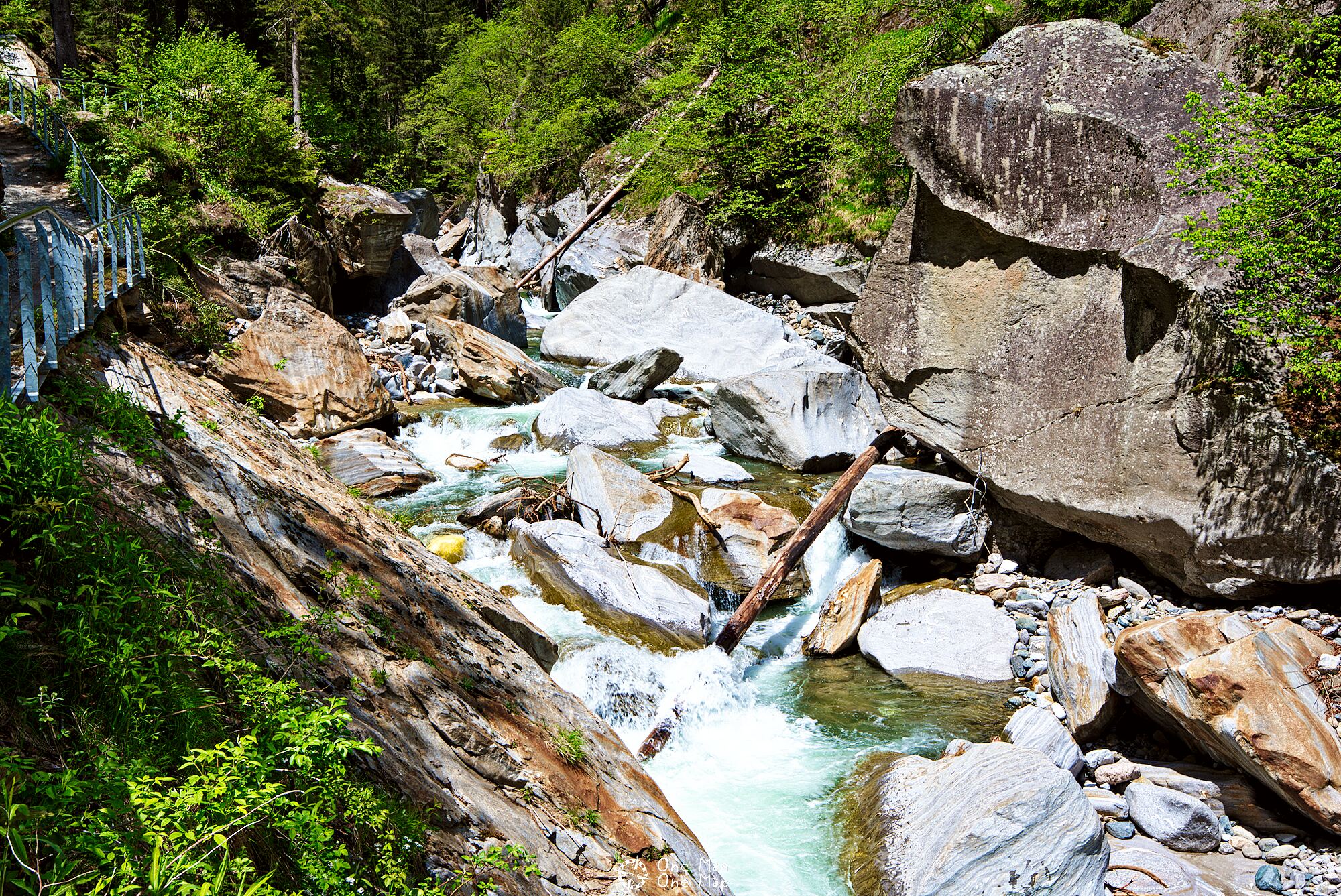
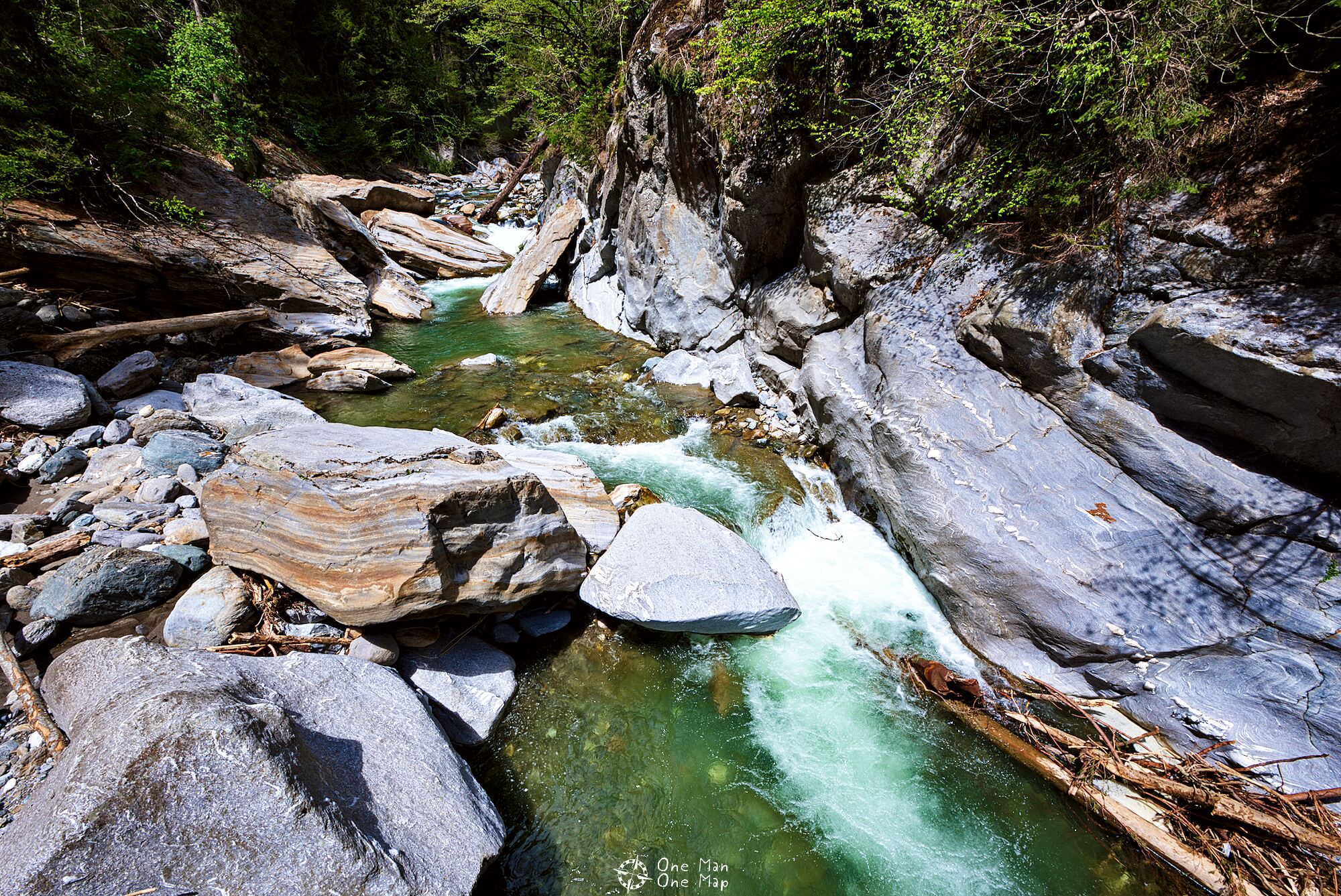
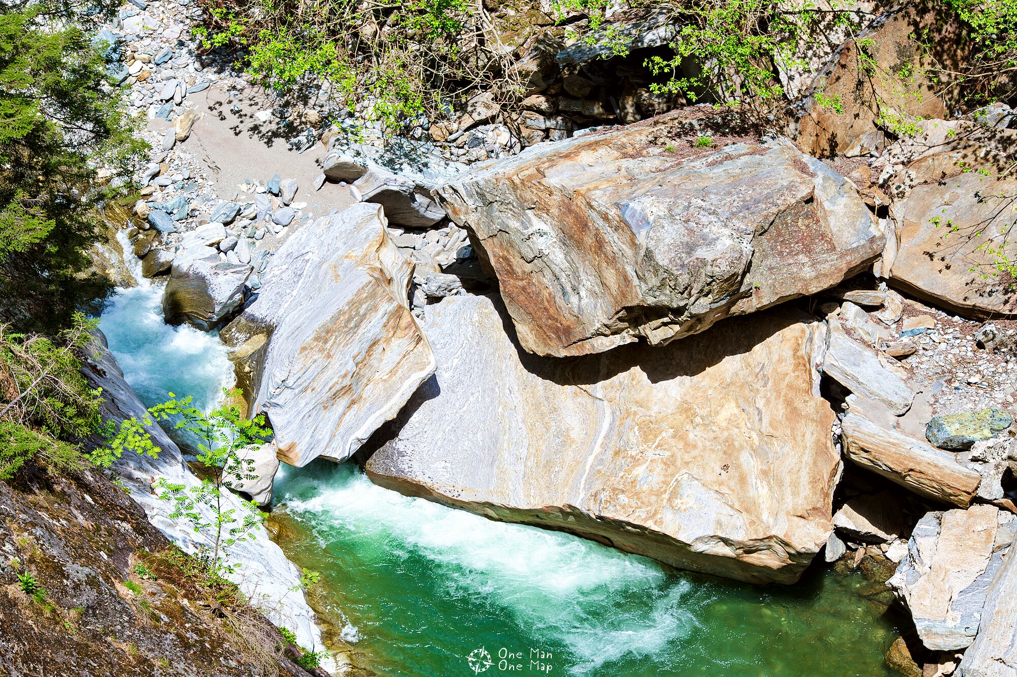
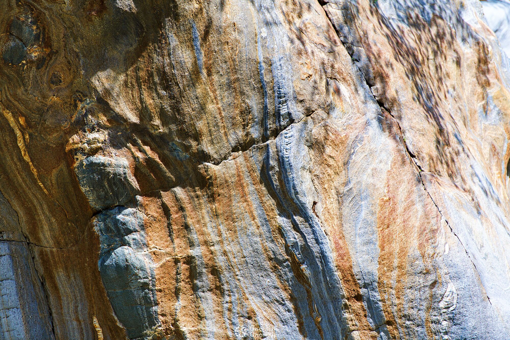
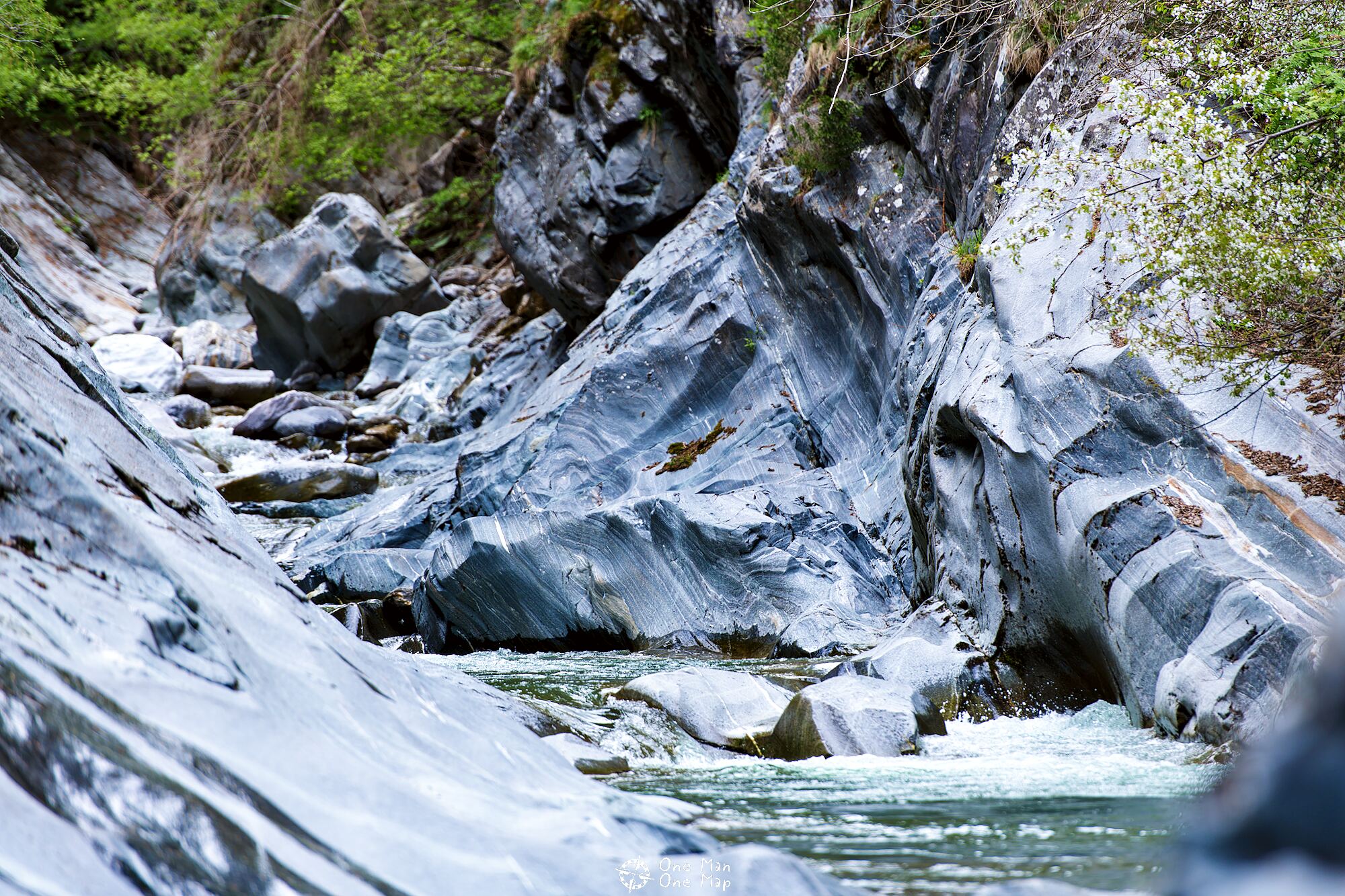
Colors deep down
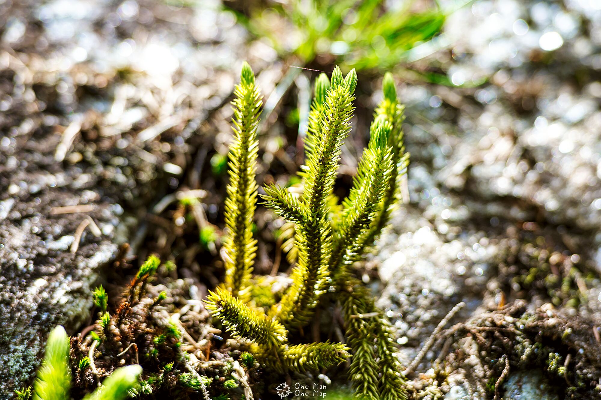
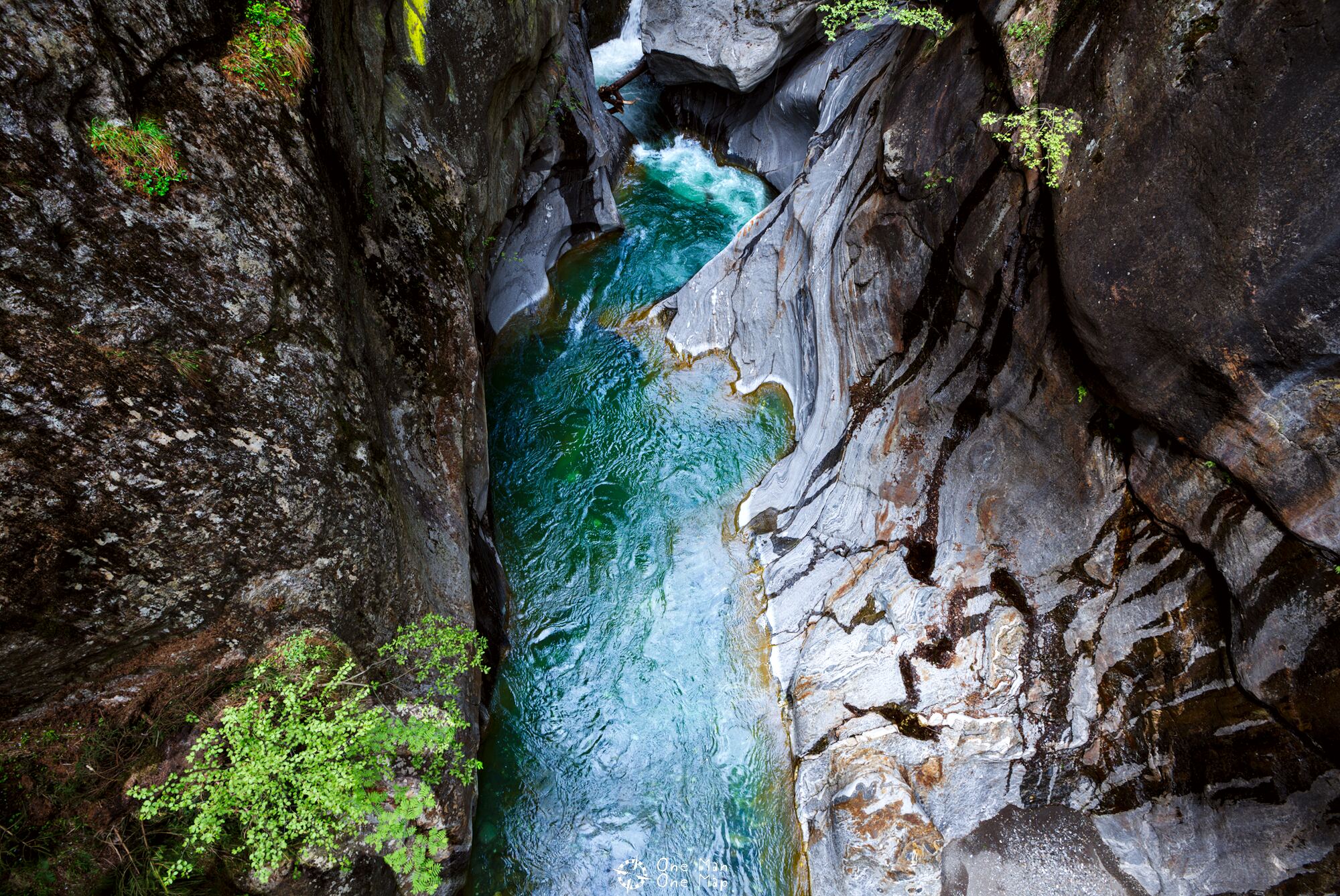
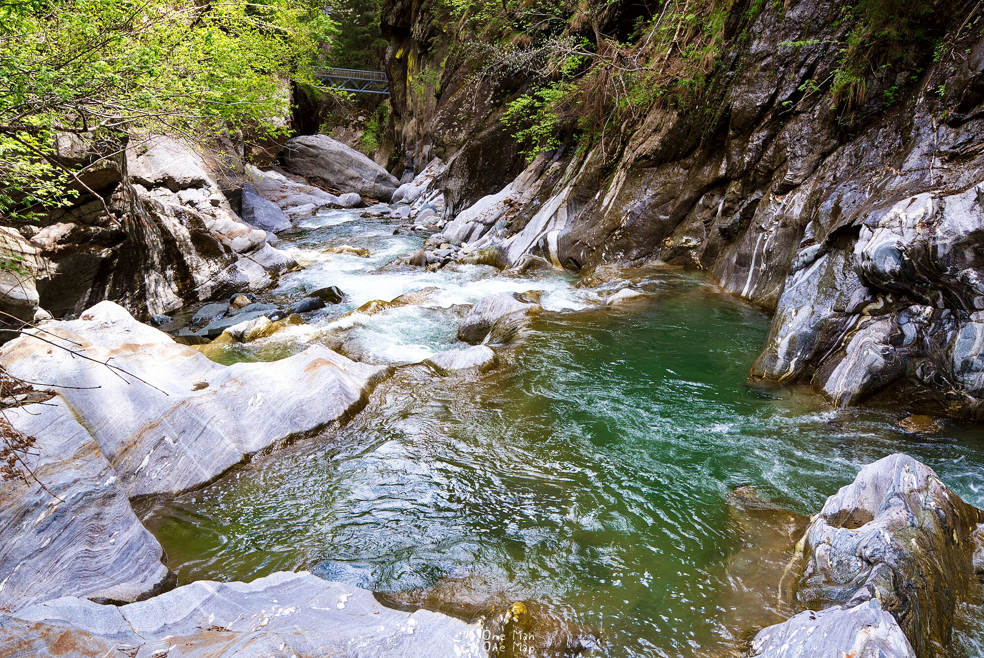
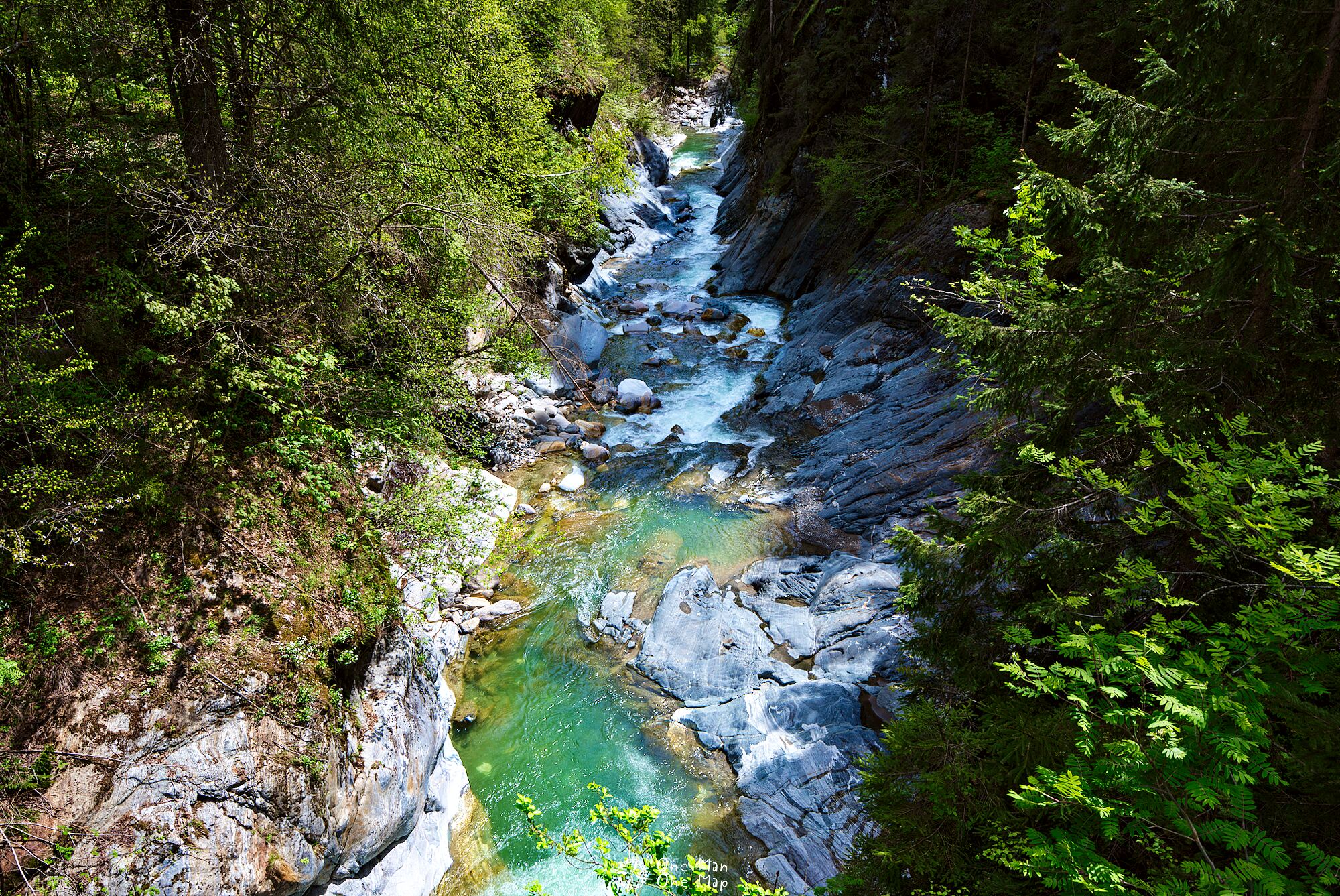
Finally we are getting closer to the river again. The clear water shines in shades of blue and turquoise, and on the red and blue colored rocks the mosses, lichens and plants grow in bright green and yellow. What a blaze of colors!
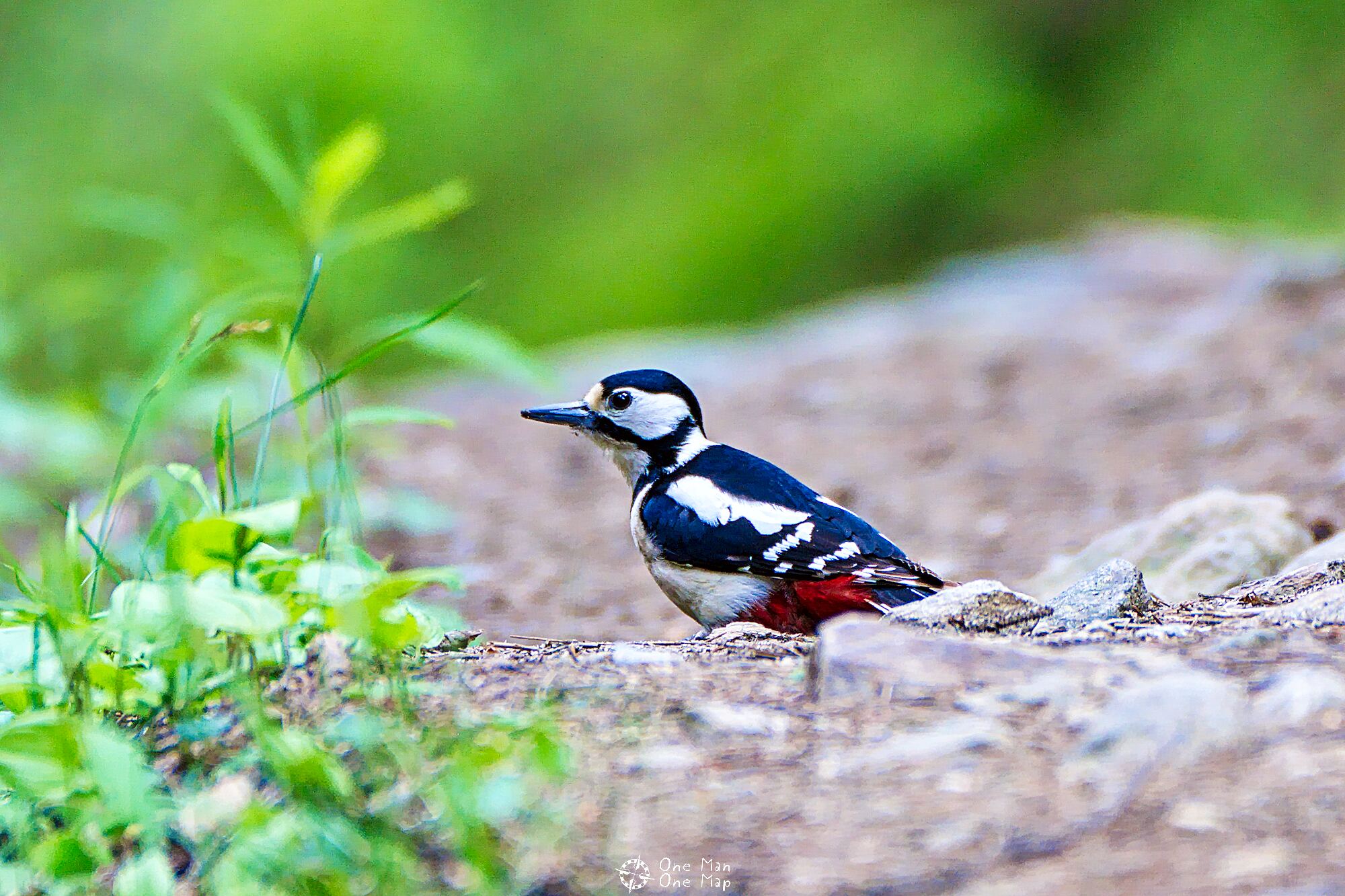
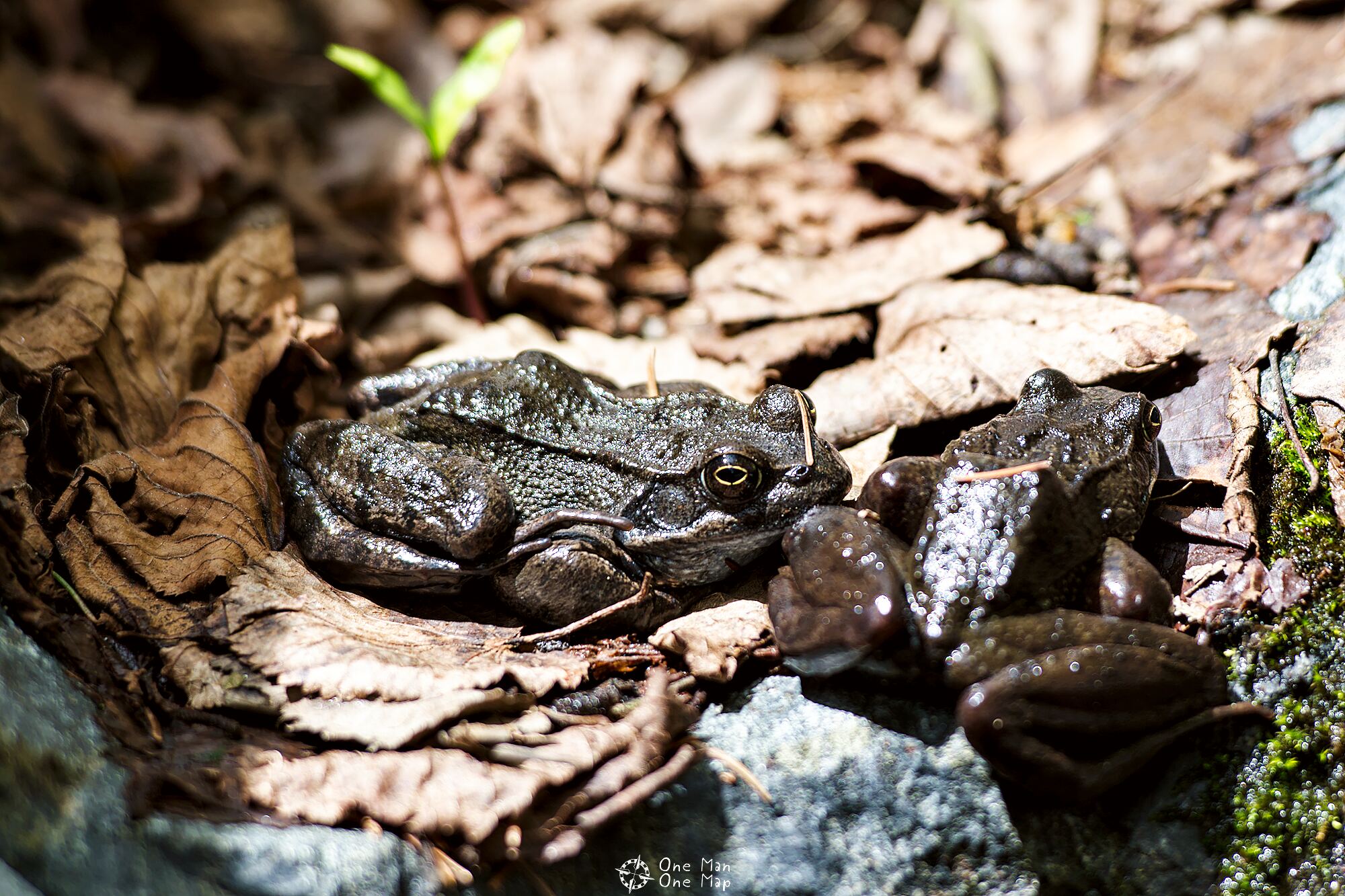
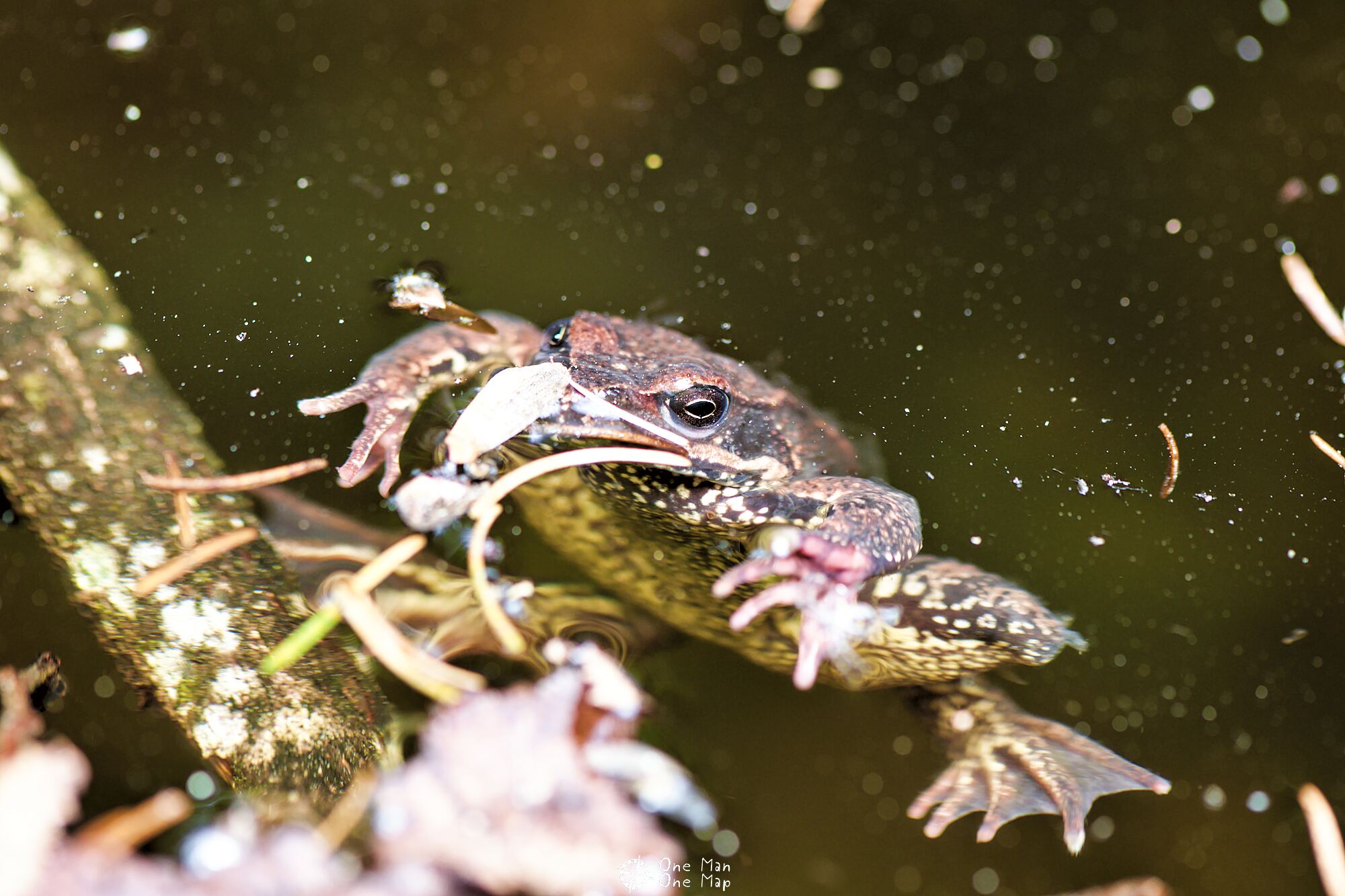
With so much water, of course, toads and frogs in all of their variations are never far away. These friends here were just thawing in the sunlight and staid still long enough for a show 🙂
The viewing platform
Shortly before the end of the path there is a small viewing platform from which one has a particularly good view of the gorge.
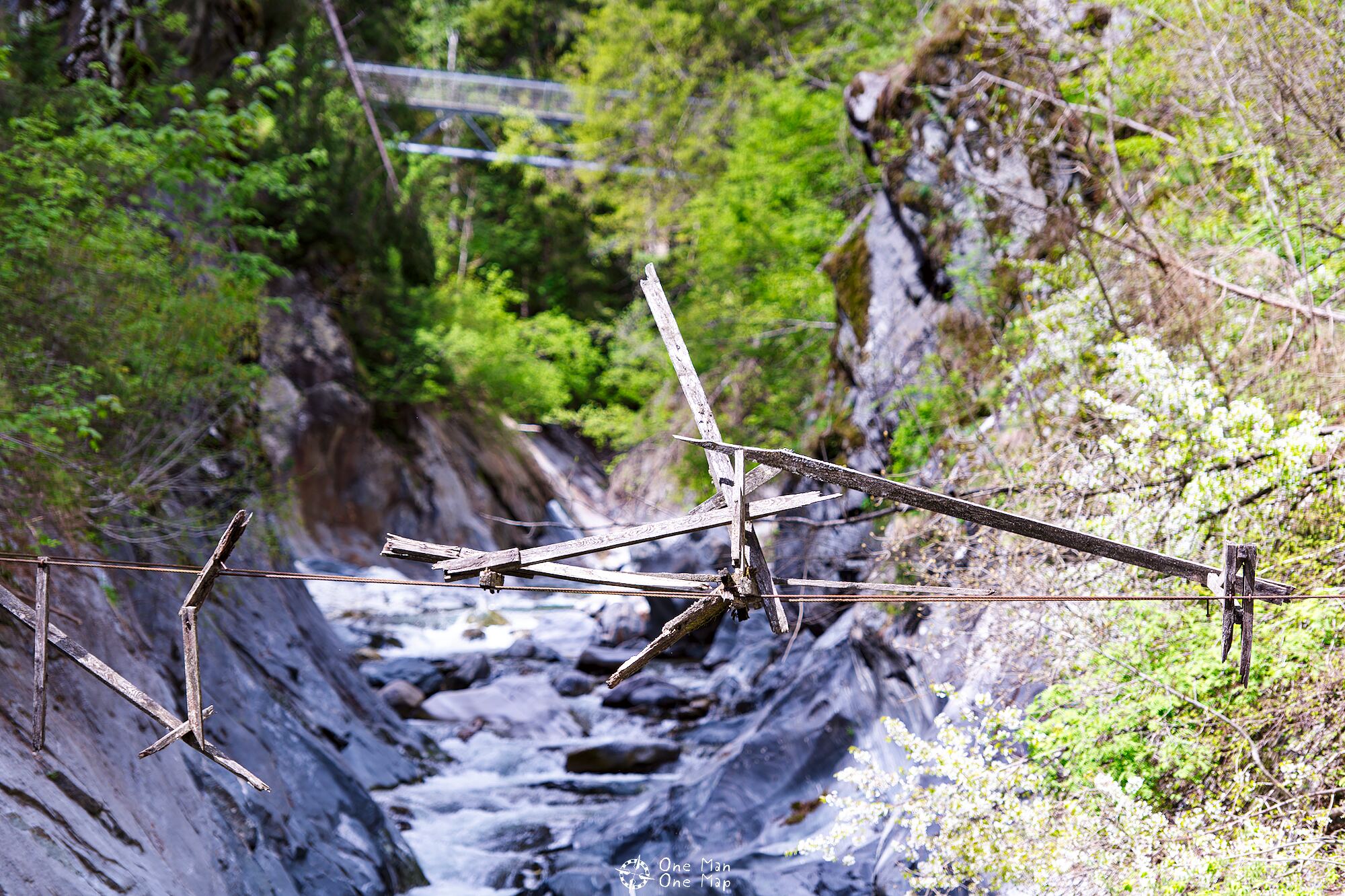
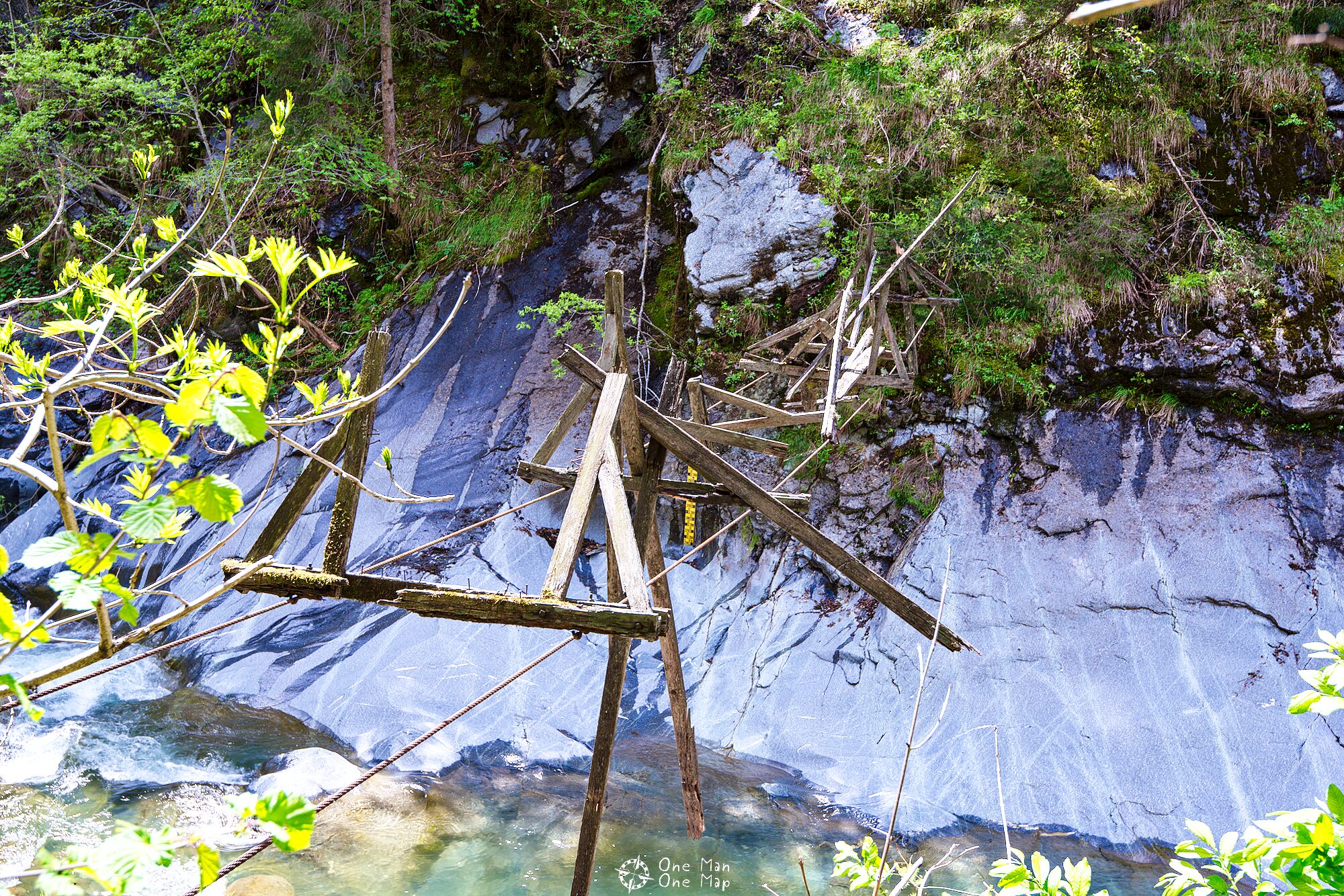
At this point you can also, after some climbing, take a look at the only relic from the times before the ultra-modern steel walkways. How long might this old wooden bridge have been rotting away? The last bits of wood will probably not be able to hold up much longer …
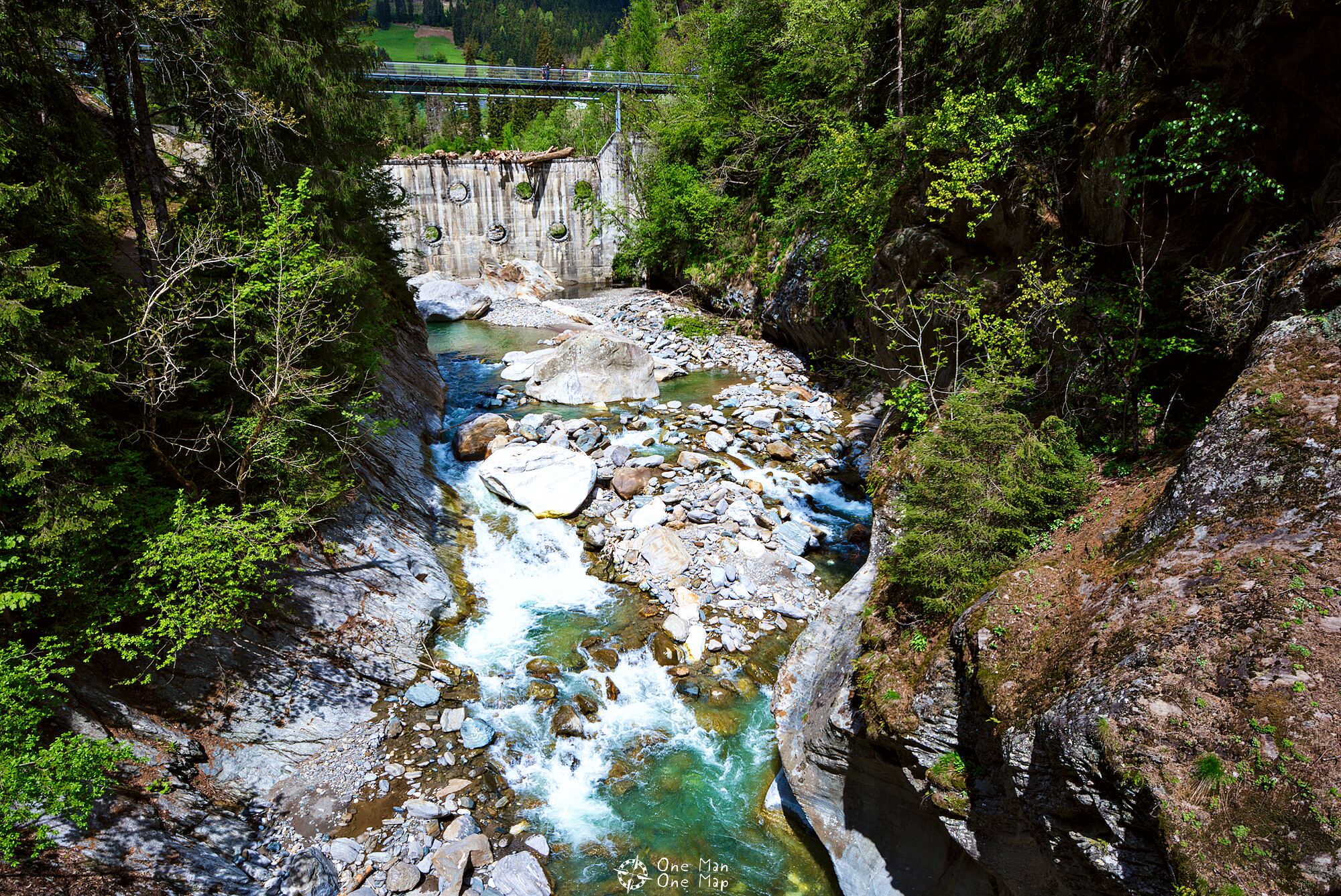
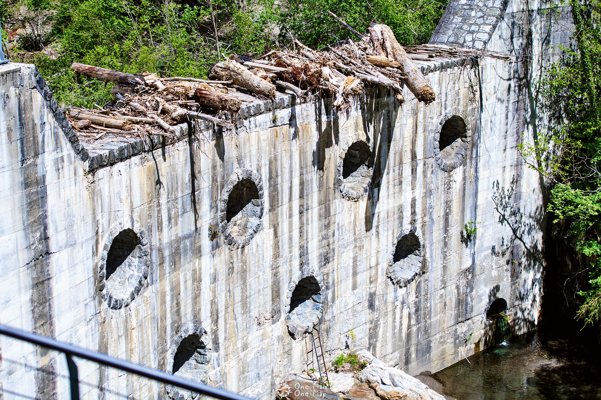
The imposing barrier at the end of the gorge also marks the end of the hiking trail. It holds back large material such as boulders and tree trunks, which would otherwise be washed into the gorge after the snowmelt and prolonged rainfall.
As you can see, this is sorely needed …
The last steel walkway crosses over the barrier. Here you can change sides one last time and reach Moos in Passeier, the final destination of our hike.
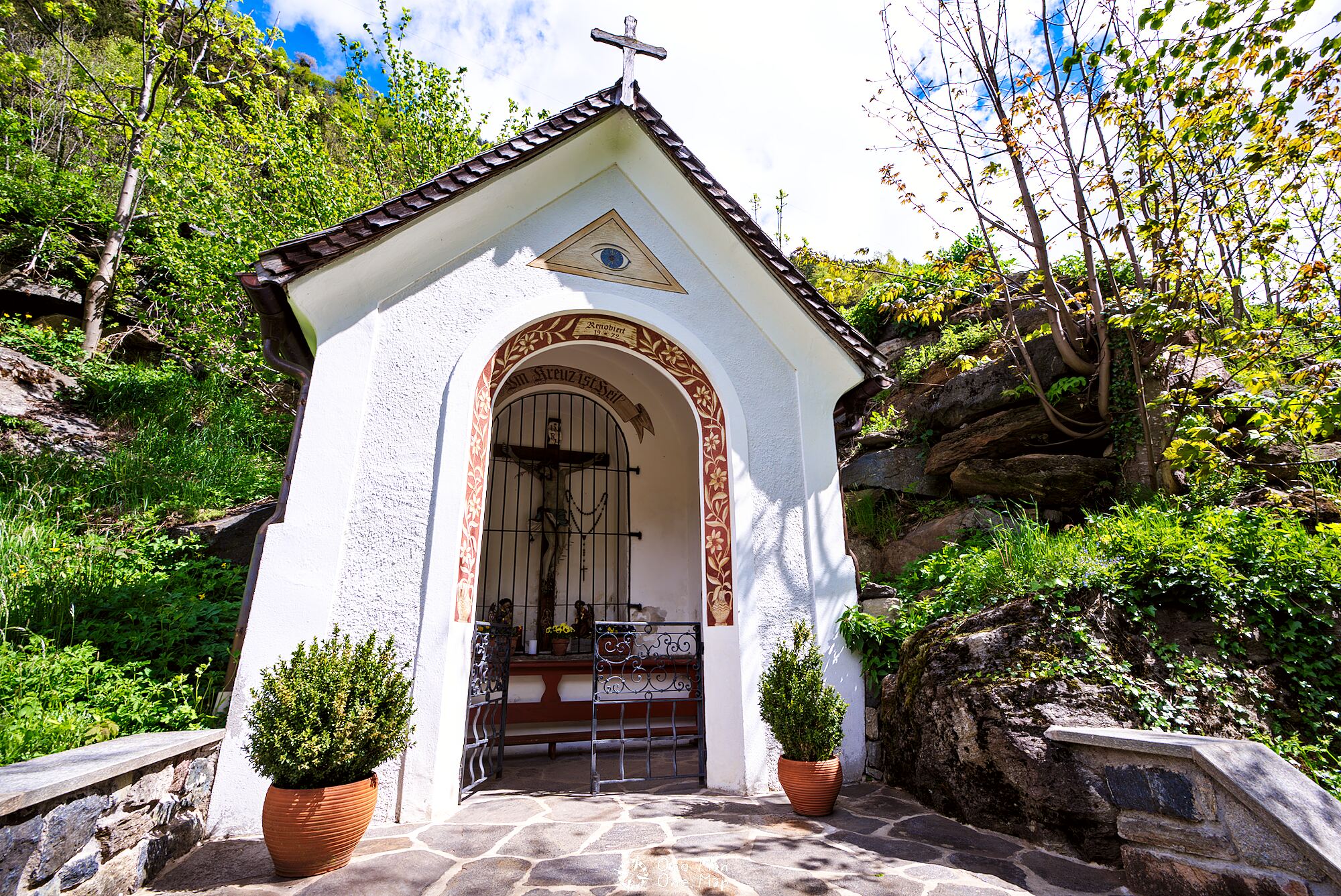
Moos in Passeier
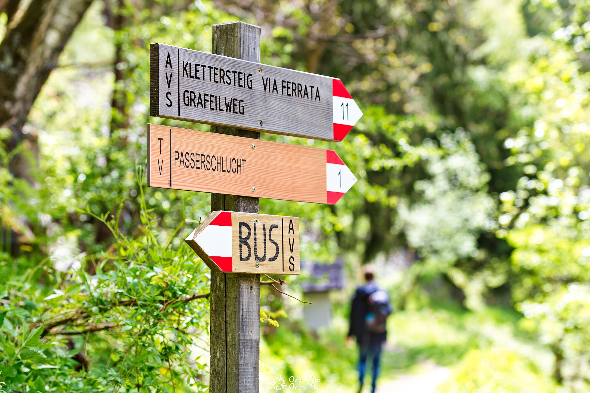
The paths separate at the small Holy-Cross-Chapel: those who want to take the public bus back to St. Leonhard follow the short climb to the bus stop in the town center. A return to St. Leonhard via the Grafeilweg path is also possible, but not particularly recommended.
Otherwise, you can also reach the aforementioned via ferrata at the Stulser waterfalls from here.
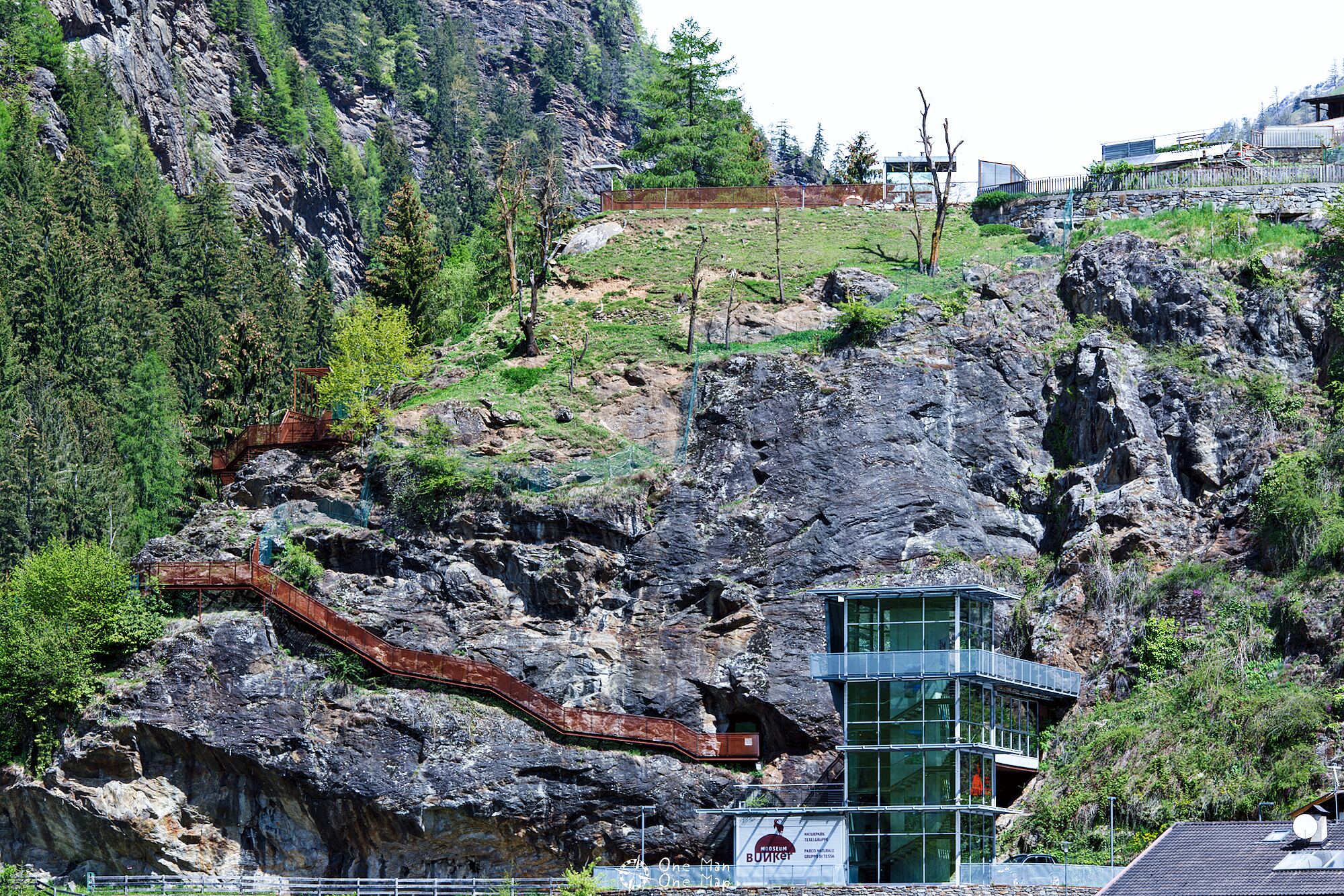
A visit to the “Mooseum” bunker museum is highly recommended. It was built in an unfinished bunker of the Alpine Wall built in the 1930s, and houses exhibitions on the history of the Passeier Valley and the Texel Group Nature Park.
This post was written by Simon for One Man, One Map. The original can be found here. All rights reserved.