Dieser Artikel ist auch auf Deutsch verfügbar. Click here to find out more about Italy!
When I stumbled upon a report about the “NATO ACE High” project for the first time and saw the pictures of the former transmitting and receiving stations, I immediately knew: “That’s where I have to go some day”. After a lot of preparation I finally stood on a mountain peak in the Italian Alps, looked at the surreal antenna constructions of “Station D.” and entered one of the last remaining sites of a formerly top secret NATO communication network.
More Lost Places can be found here!
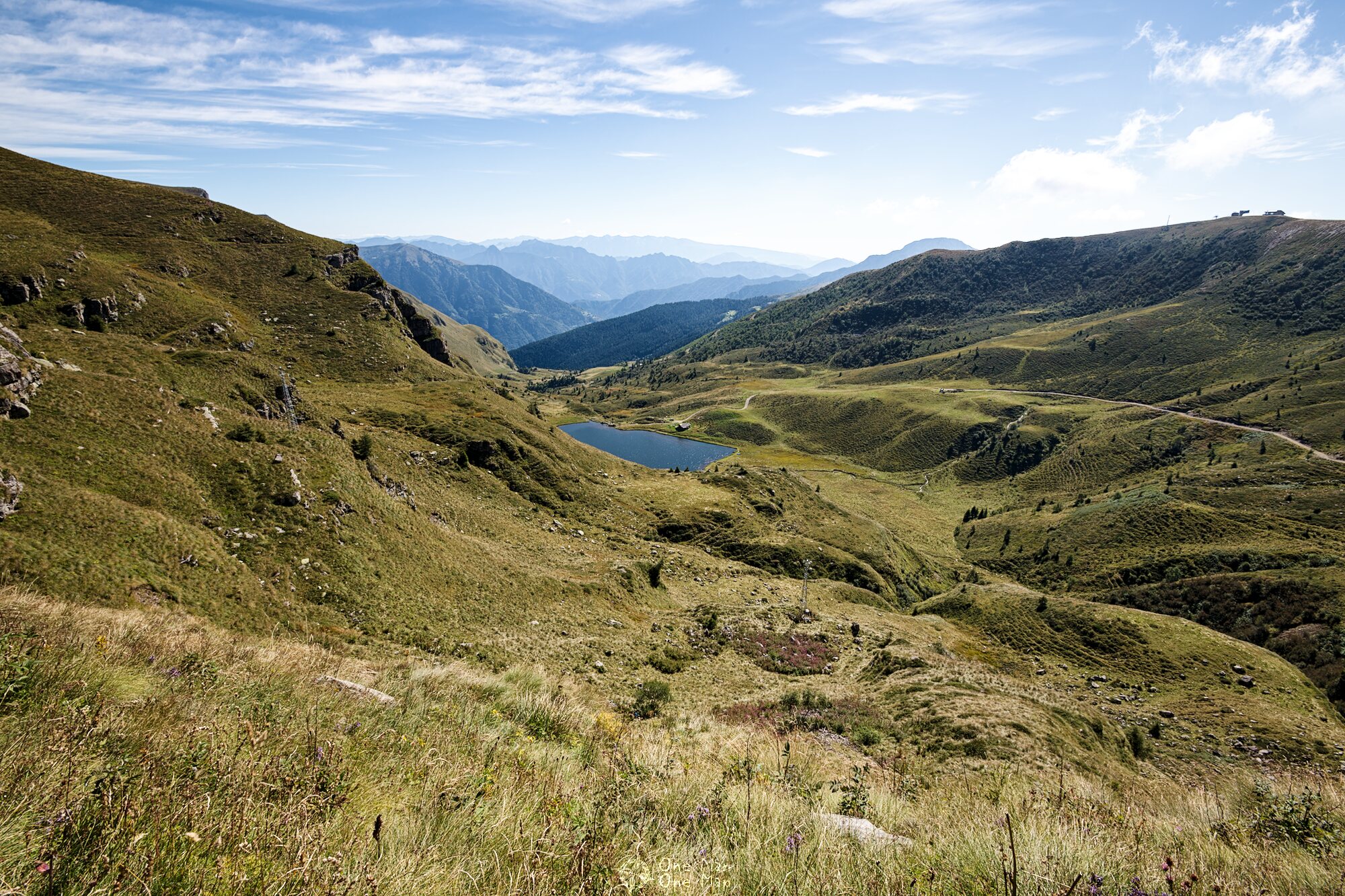
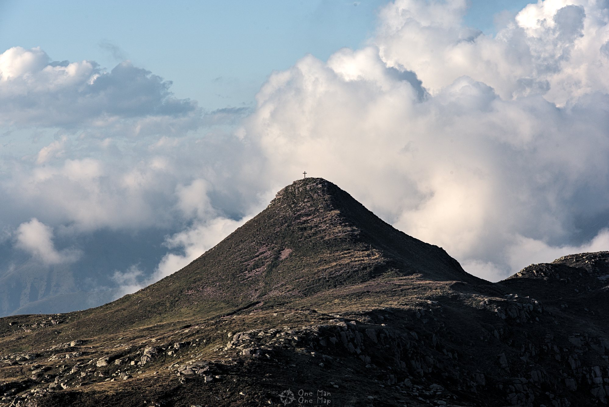
It was pleasantly warm outside when I was driving on a small mountain road somewhere in the Italian Alps on a beautiful autumn day. The operators of the nearby ski resorts could probably not expect much snow this year – again. The badly maintained road had been winding through dense forests for some some kilometers, then I crossed the tree line. From now on all I could see were the grasslands typical for this area. And in the middle of this idyllic landscape there was supposed to be a relic from the Cold War, a gigantic telecommunications station of a formerly top secret NATO communication network: secret name “ACE High”.
In 1956, the European High Command of the North Atlantic Alliance, the Allied Command Europe (ACE), commissioned the British company Standard Telephones and Cables Limited (STC) – at that time the market leader in telecommunications – to set up an almost 7,000 kilometers long core network to link all the NATO member states in Western Europe (15 at the time). All important NATO sites were to be able to securely communicate telephone, telex and computer to be able to coordinate the counterstrike against the Warsaw Pact.


Communications satellites didn’t exist yet in the 1950s and 1960s, and laying thousands of kilometers of cable for a private NATO network would have been far too expensive. The idea was therefore to construct a network of 82 main and secondary stations using radio links. The main stations would relay data between the neighboring stations and thus ensure the flow of information in all directions. In order to maximize the distances between the main stations and to save costs, the stations would preferably be located on hills and mountains and be equipped with special “troposcatter” antenna systems.
In 1958 a test network of four stations was set up in Norway, which was then expanded into the full network by 1961. The main axis ran from Northern Norway via the Shetland Islands, Scotland and the British County of Kent to the NATO headquarters in Paris, and then via Nice, Italy and Greece to Eastern Turkey. There were also a secondary route from Norway via Denmark and West Germany to Paris as well as other redundant segments.
There was also a connection to the existing communication networks of the North American allies via the Shetland Islands, Iceland and Greenland. No matter what route the Cold War would take in the years to come, the communication lines between the Western allies were now short, reliable and secure.
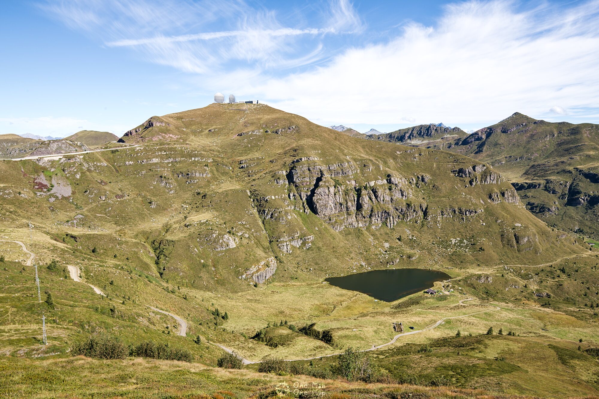
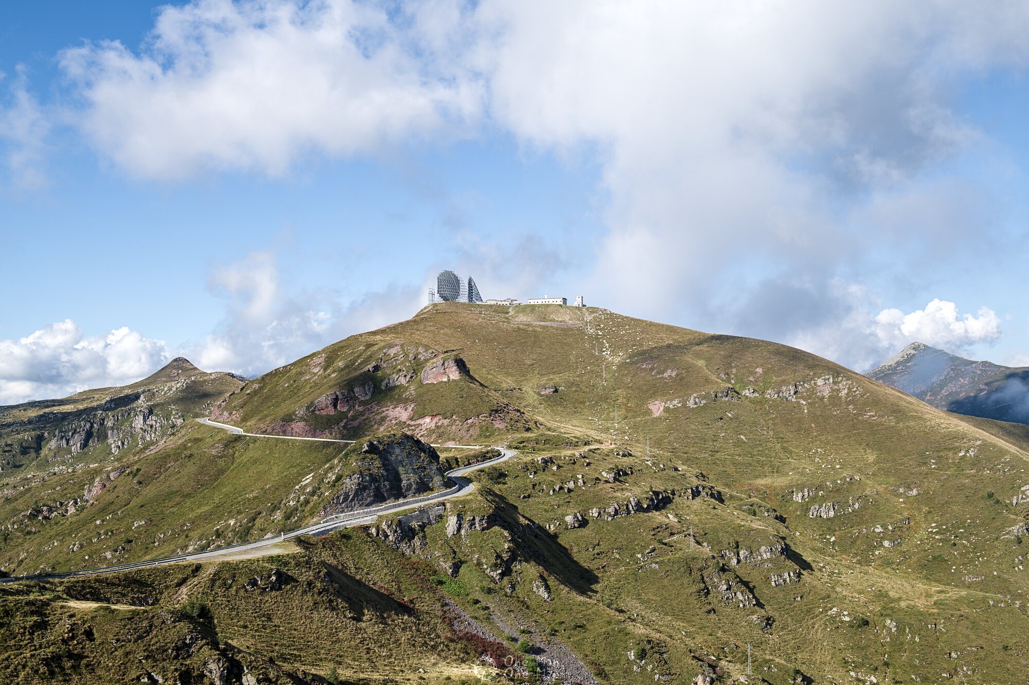
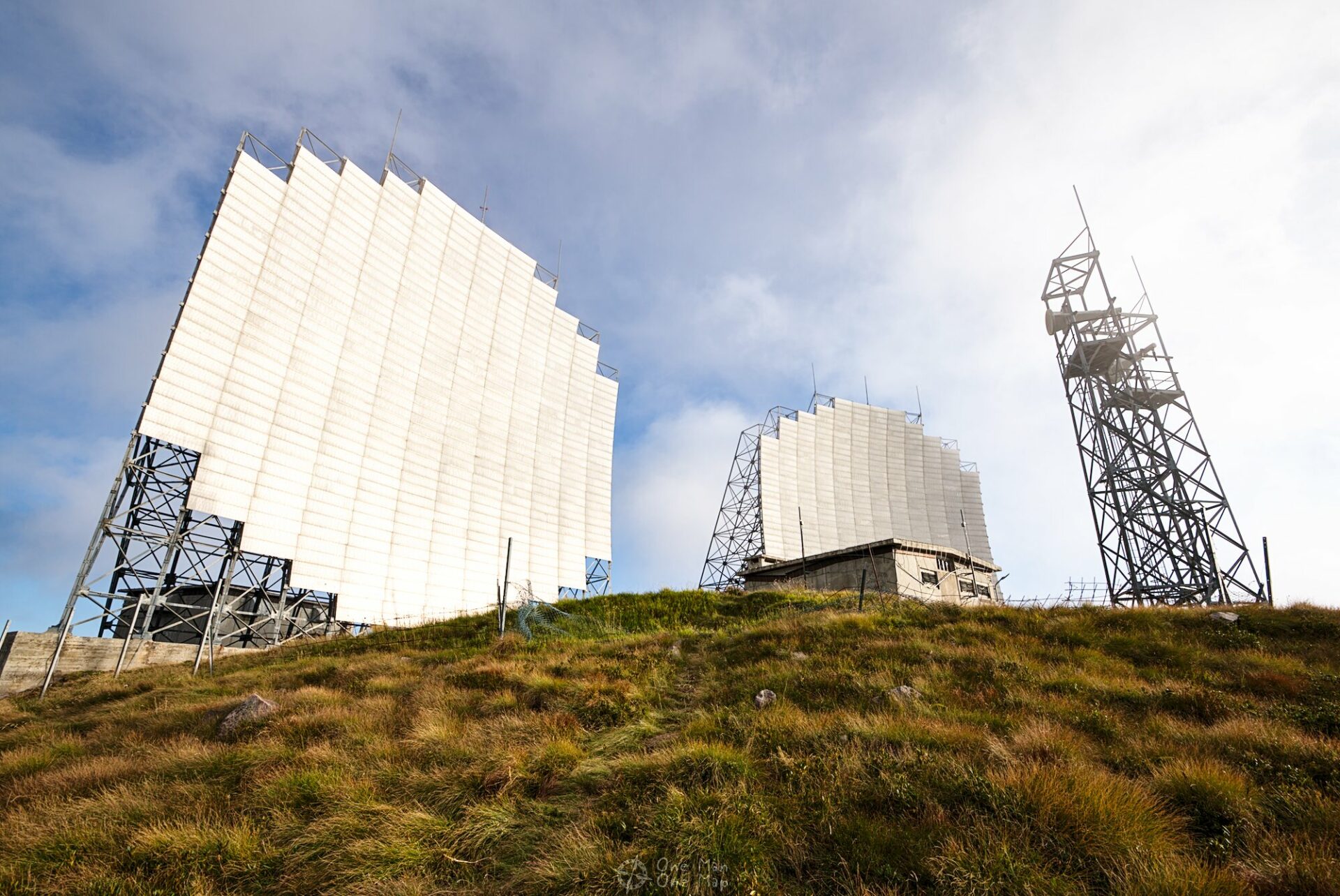
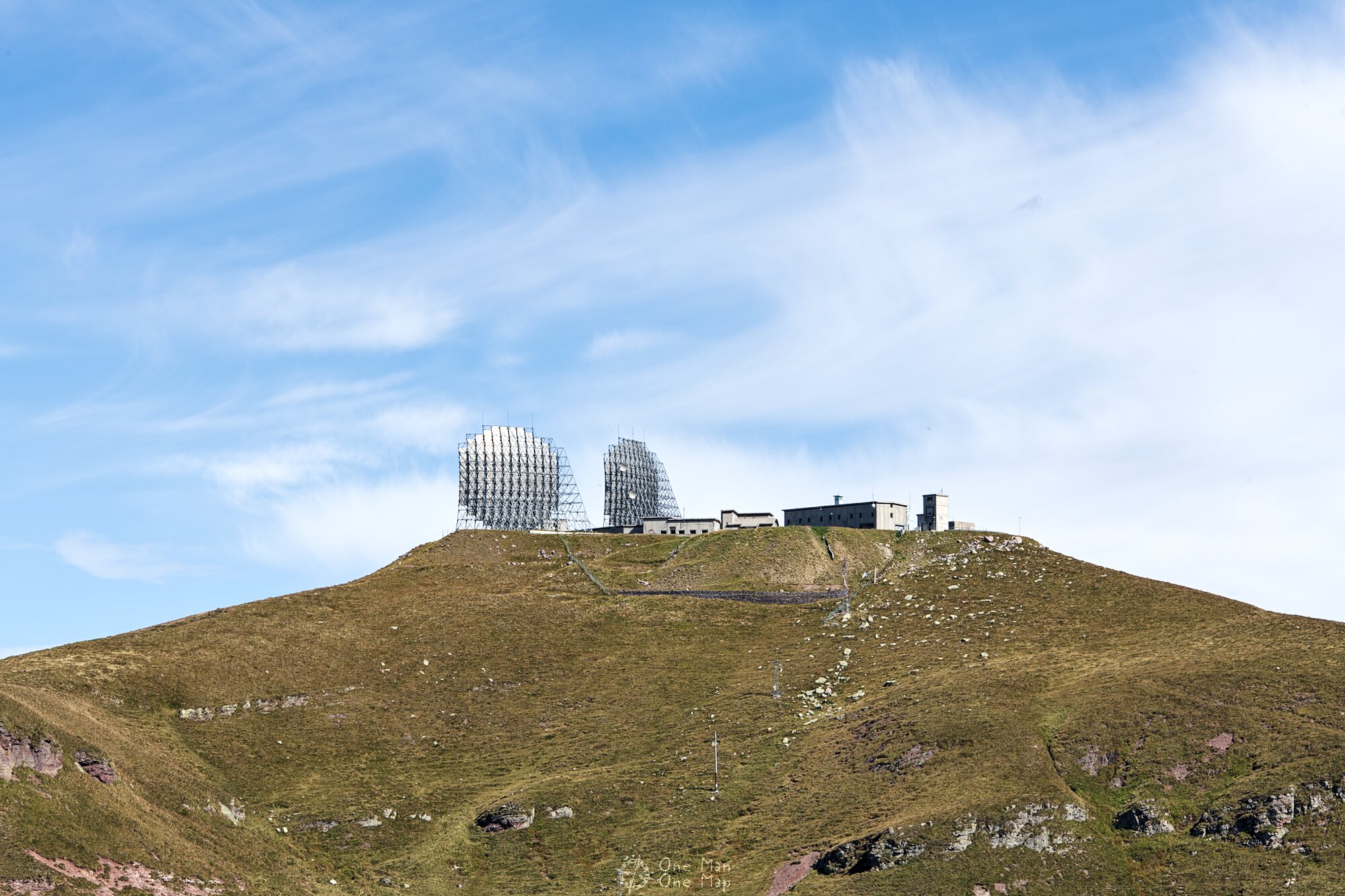
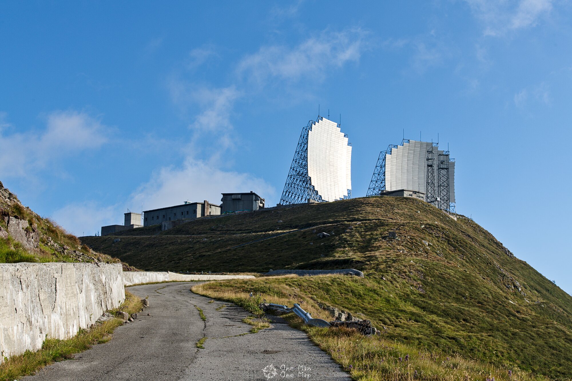
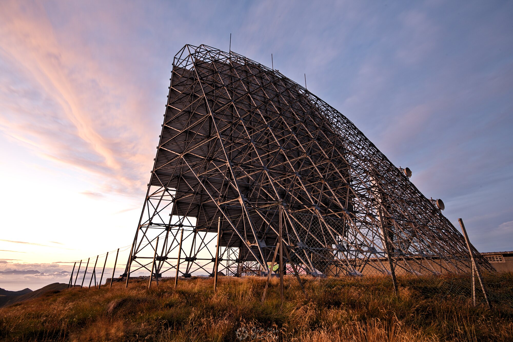
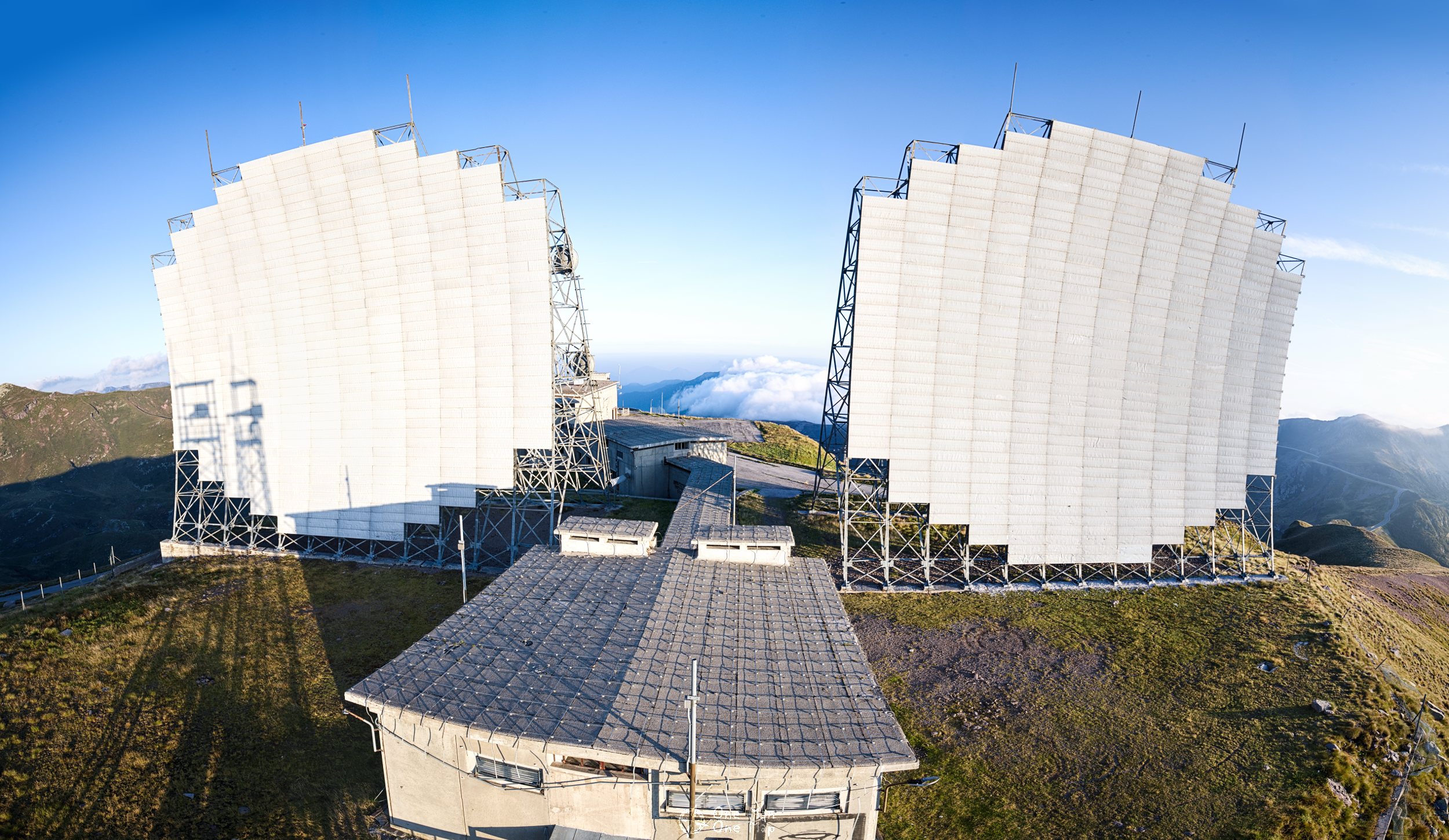
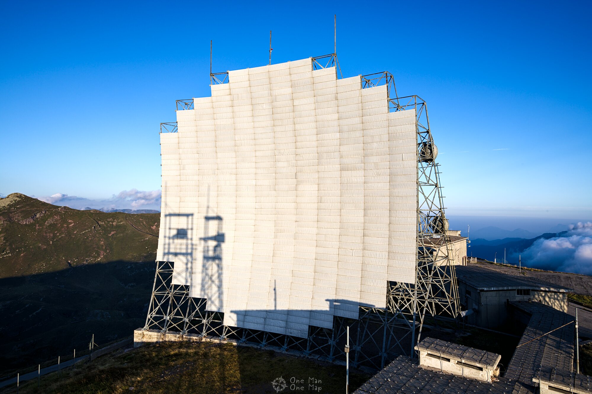
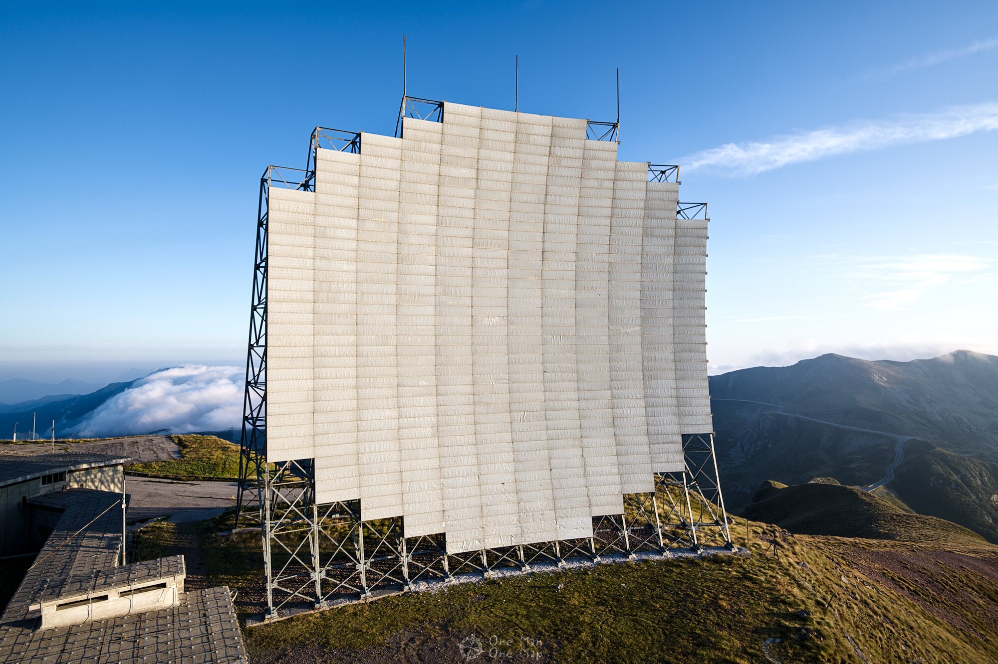
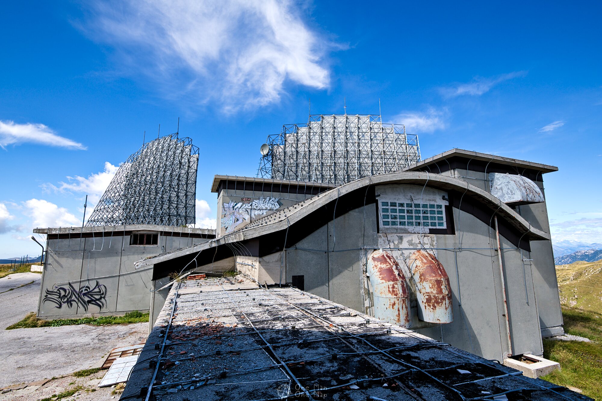
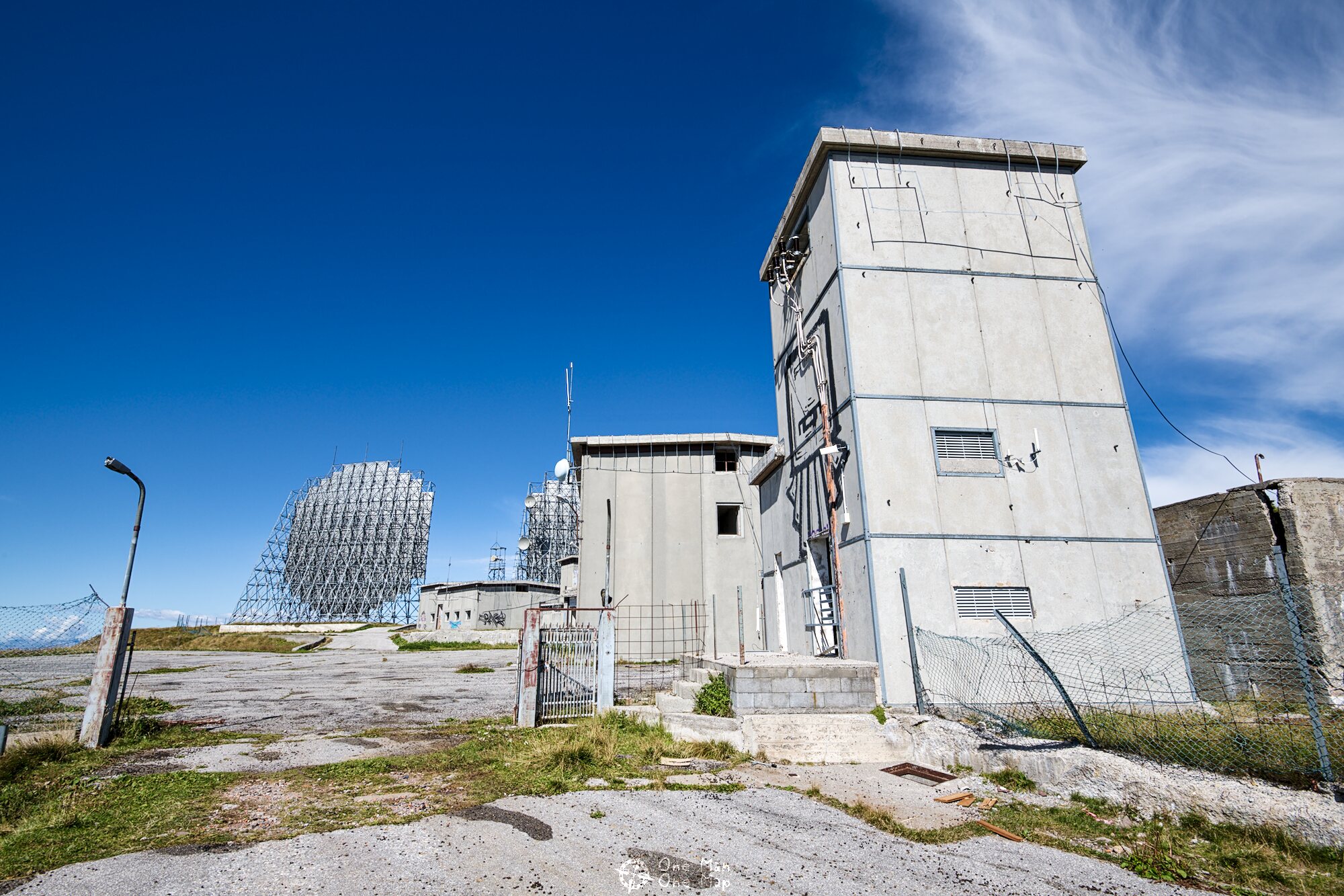
Italy played a special role in the ACE High Network. No less than 19 stations, including seven main stations, were located in the country. In the North the Alps had to be crossed, in the South (towards Greece) the Mediterranean Sea. At the time this was only possible with huge antennas at high altitudes. This is why Station D. was built in the Italian Alps. And indeed: I could already see the two huge Troposcatter reflectors on the mountain top from far away.
Tropospheric Scatter
The main stations of the network were each up to 300 kilometers apart. Even though the stations were located at high elevations, these distances couldn’t be bridged even with very high masts because microwave radio links only work “on sight”. If mountains, hills or the curvature of the earth block the free view between the antennas, a connection cannot be established. NATO therefore relied on the Tropospheric Scatter System.
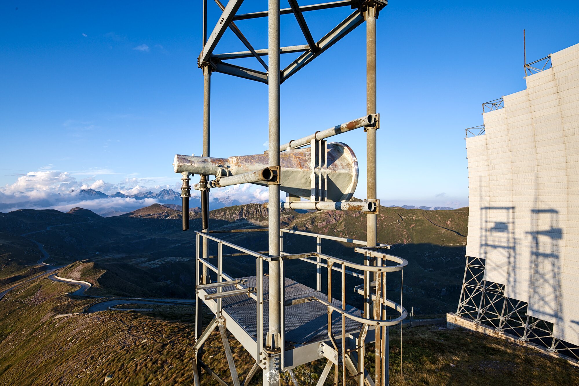
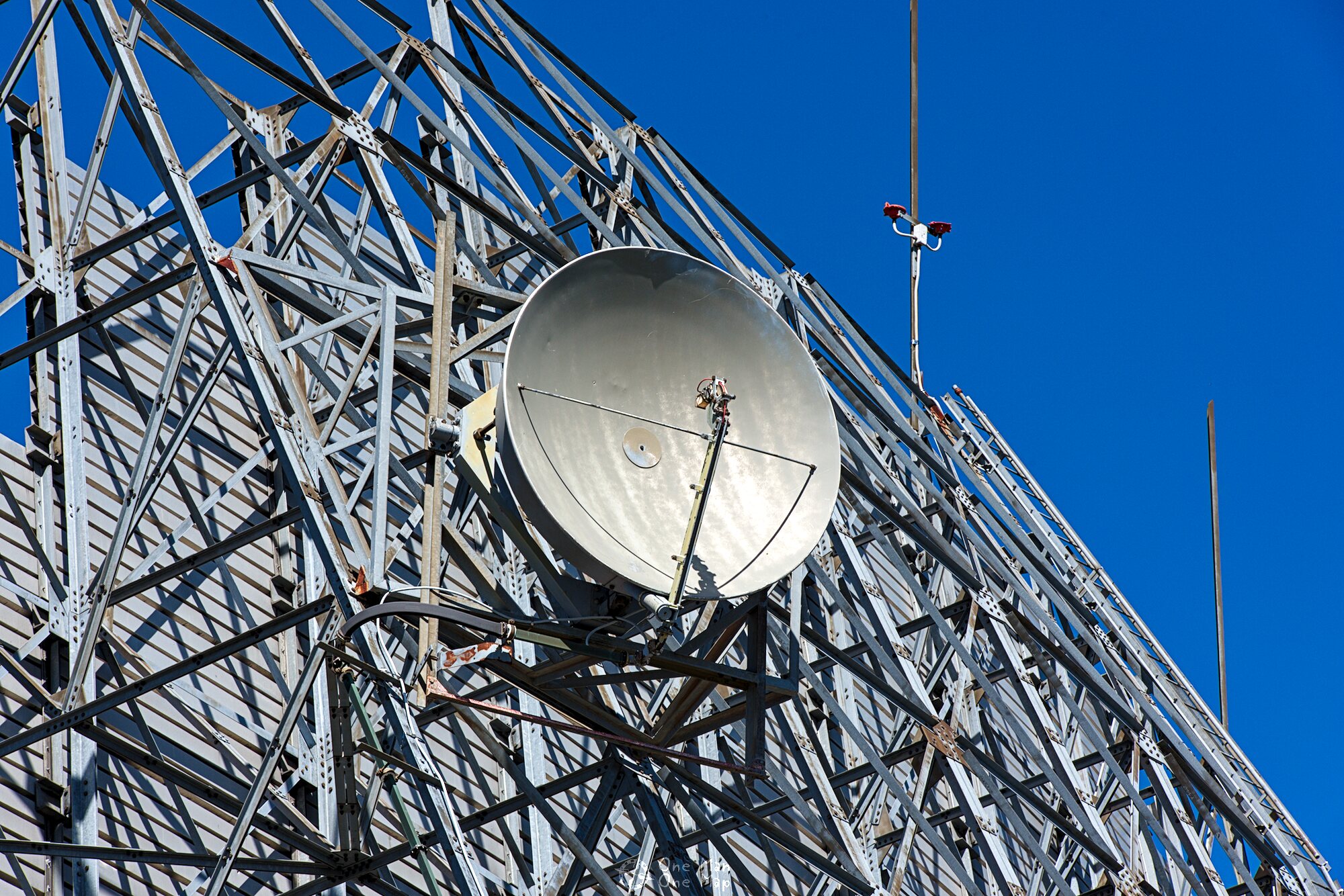
With this technique, the transmitter does not send the signal in a direct line to the receiver, but into the Troposphere, which is located 8 to 15 kilometers above the earth’s surface. Most of the transmitting power goes into space and is thus lost, but there is always some moisture in the Troposphere where the signal is scattered (hence the name). A tiny part of the signal’s energy is reflected downwards towards the receiver where it is collected by large reflectors, focussed, redirected towards a receiving antenna and amplified. The reflectors fulfill the same function as the so-called “satellite dishes” for television reception.
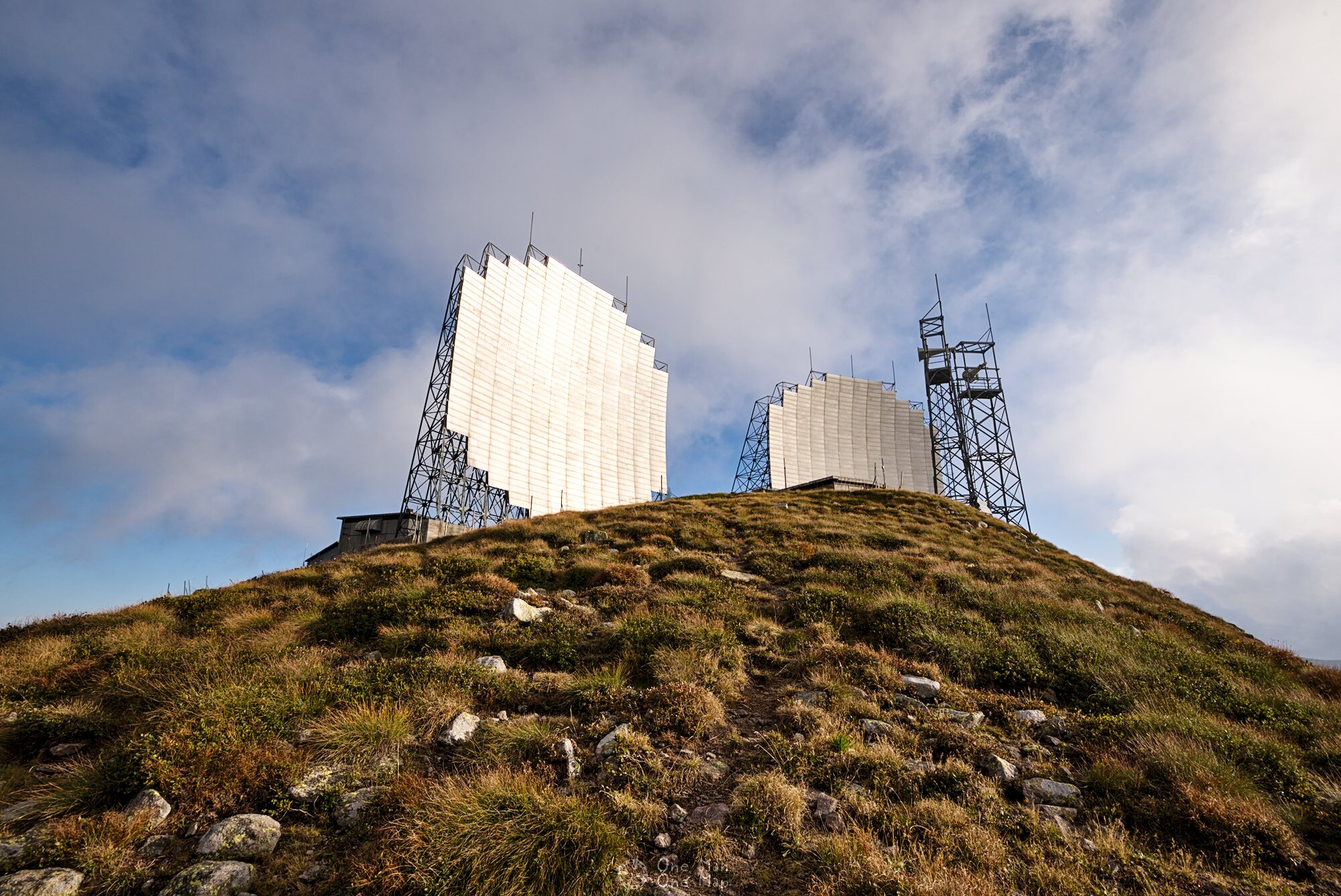
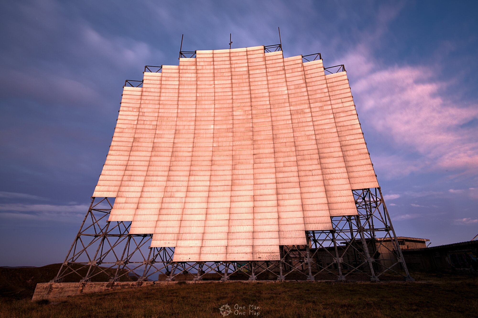
The reflectors must be aligned very precisely and the transmitting beam must be highly focussed for the transmission to work. Although the actual transmission power of the systems was only 10 to 50 kilowatts, less than that of many FM radio stations, the effective transmission power (EIRP) was up to 10 Megawatts. Due to the extreme concentration it was also hardly possible for the enemy to intercept the signal, fullfilling a second NATO requirement at the same time.
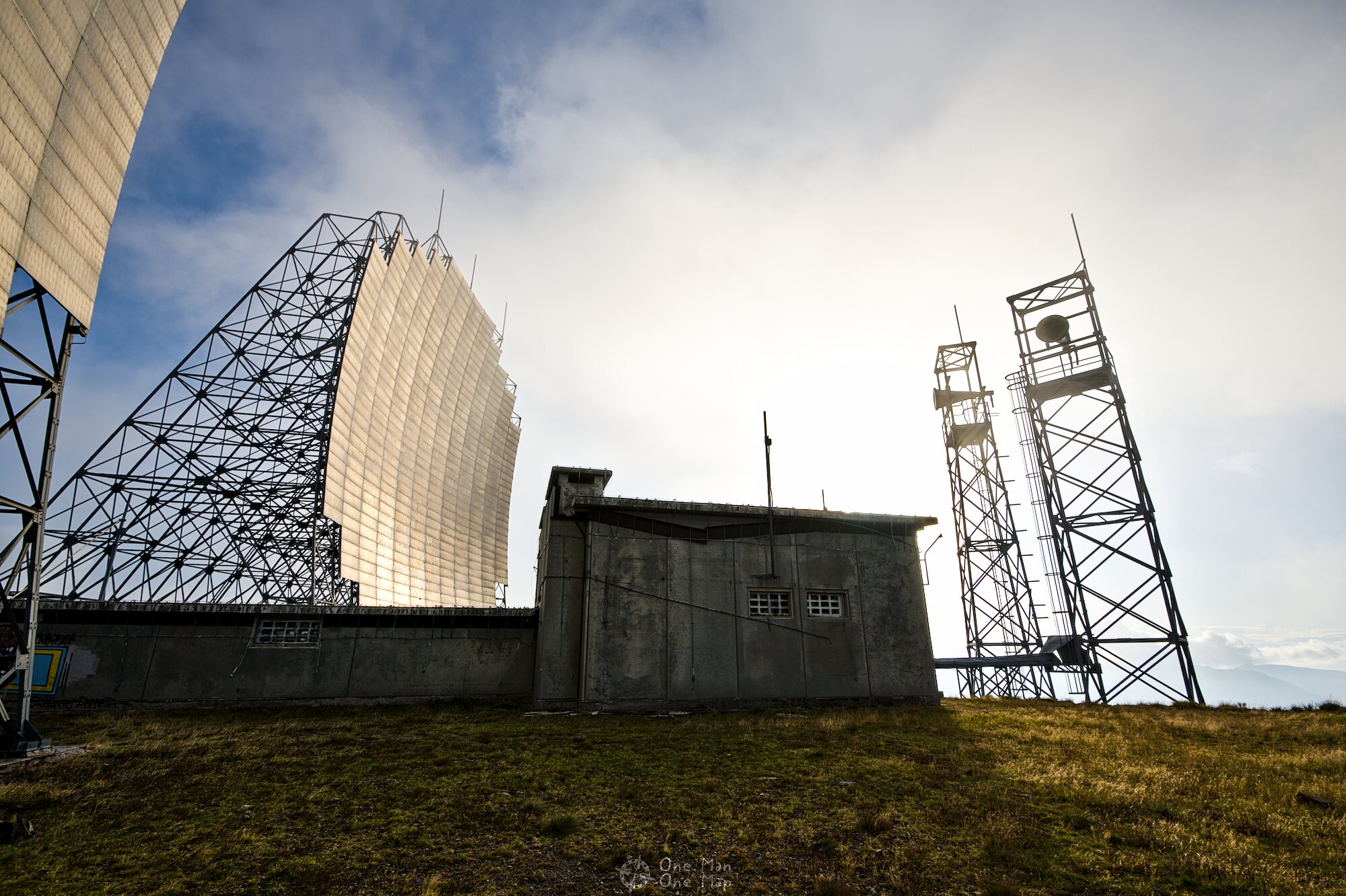
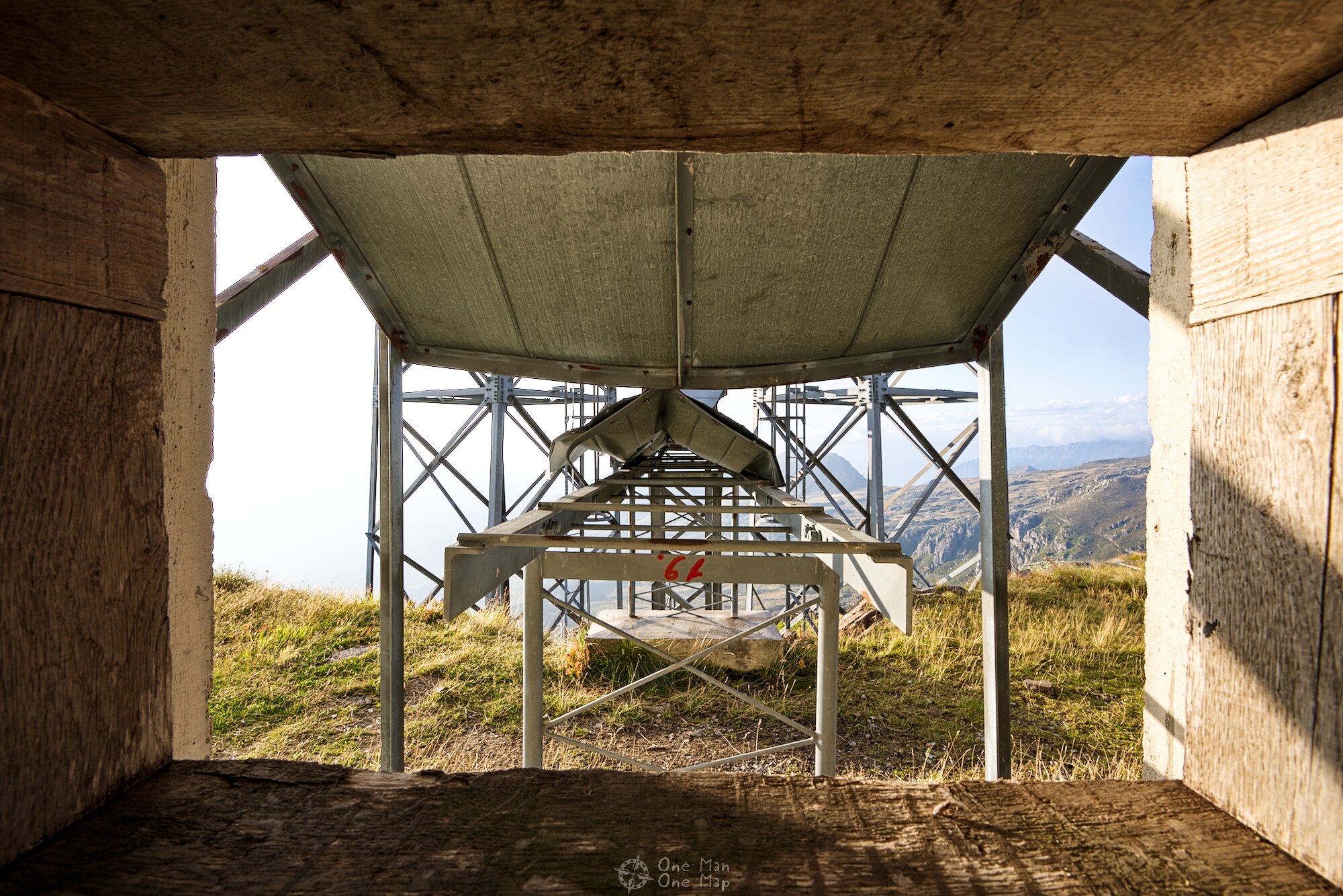
The two steel masts with the transmitters/receivers were still in very good condition, so nothing stood in the way of a little climbing. The antenna housings made of fiberglass pointed in the middle of the almost 20-meter-high reflectors and had to be aligned in such a way that the signal ended up at the receiver, in this case the station on the Feldberg mountain in Germany.


Since the conditions in the troposphere are constantly changing, there will be random interruptions of individual propagation paths. NATO therefore not only used one antenna/reflector pair each on the transmitter and receiver side, but the stations had two slightly offset installations. In addition the polarization of the signal could be switched from vertical to horizontal on each link. So there were a total of four slightly different propagation paths, one of which would always make it safely through the troposphere.
On the receiver side it was also possible to improve the signal by combining multiple signals received over different propagation paths. The redundancy also made it possible to maintain individual components and antennas without having to interrupt the services. Older NATO documents report an availability of 99.99 percent.
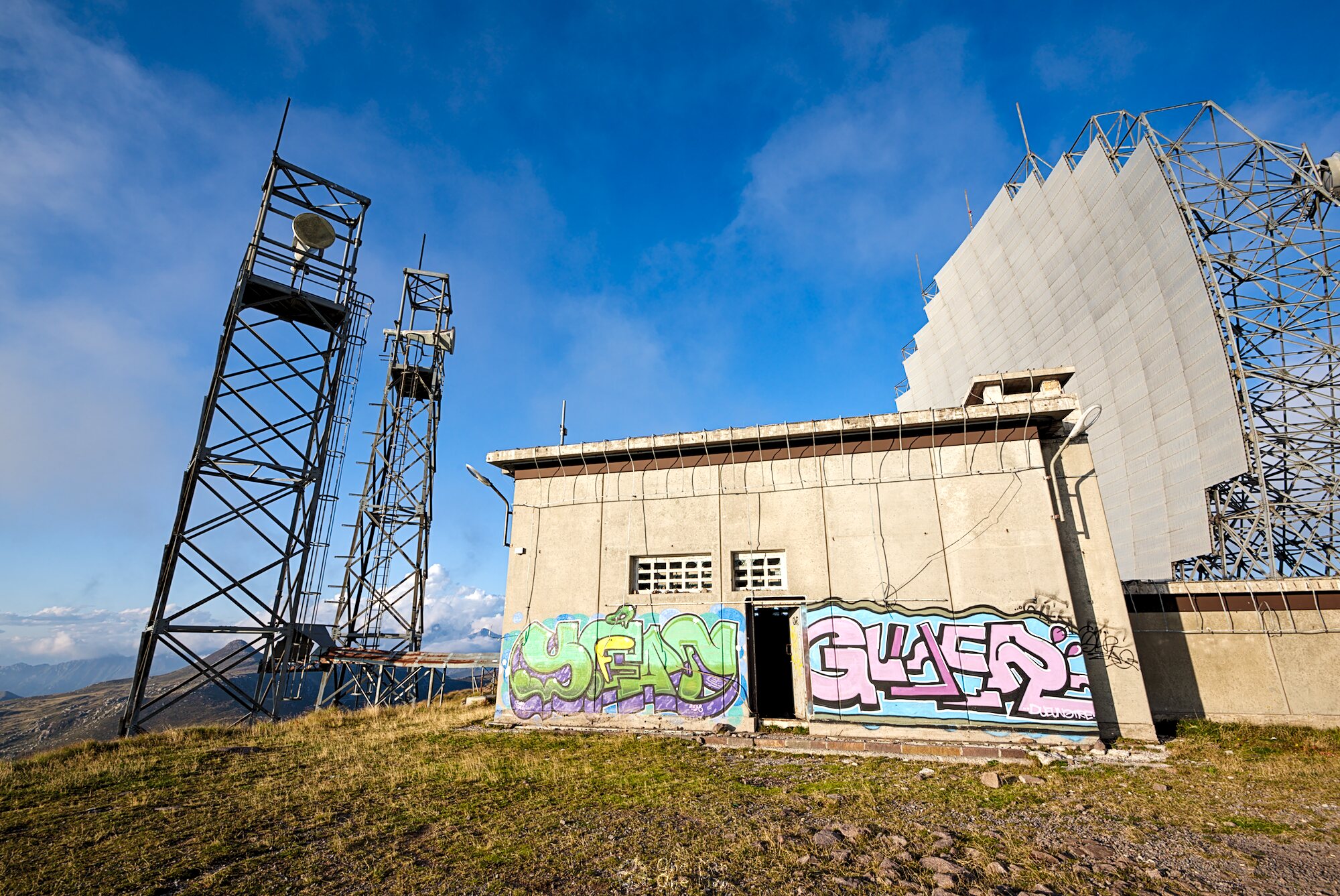
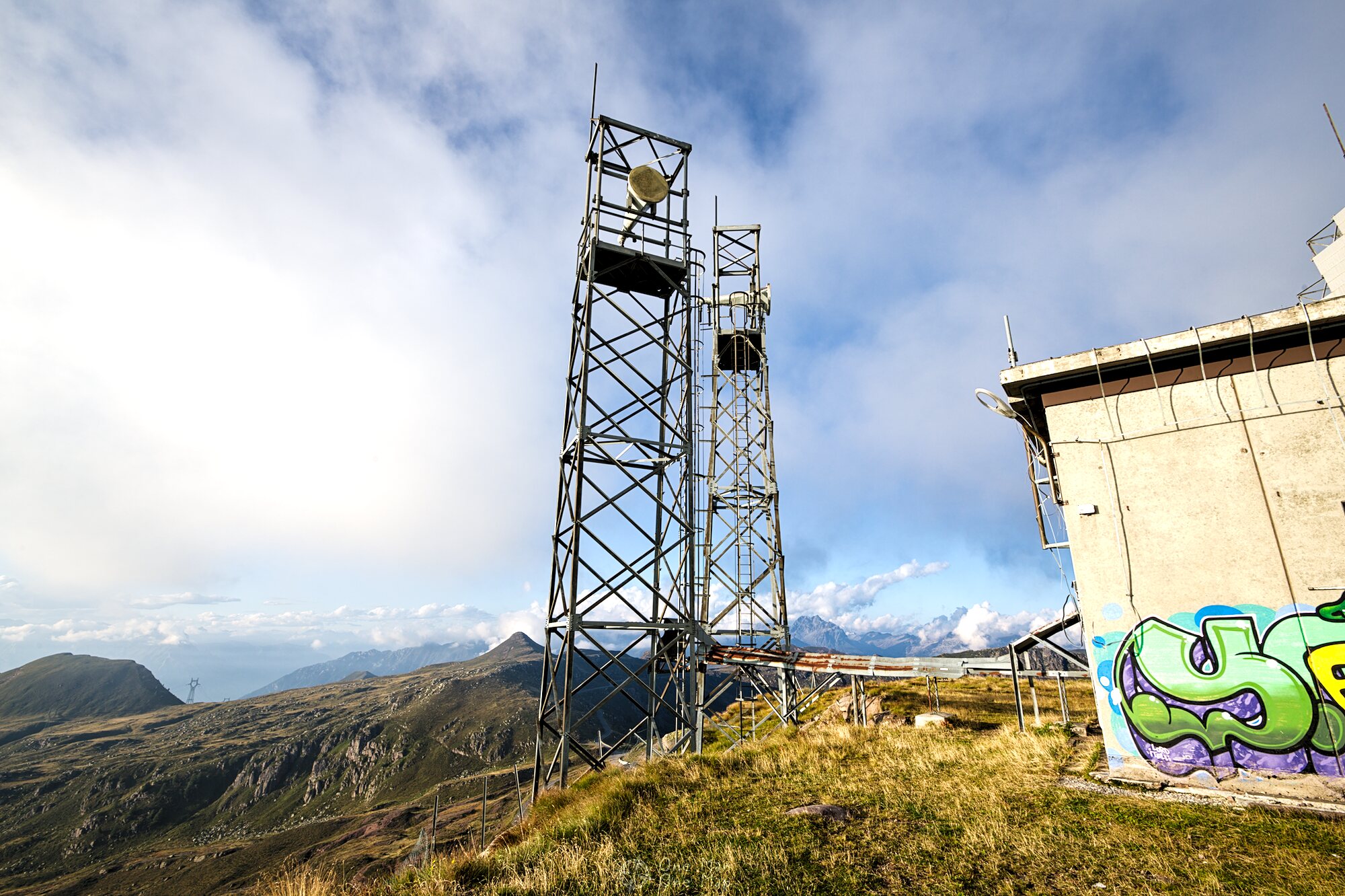
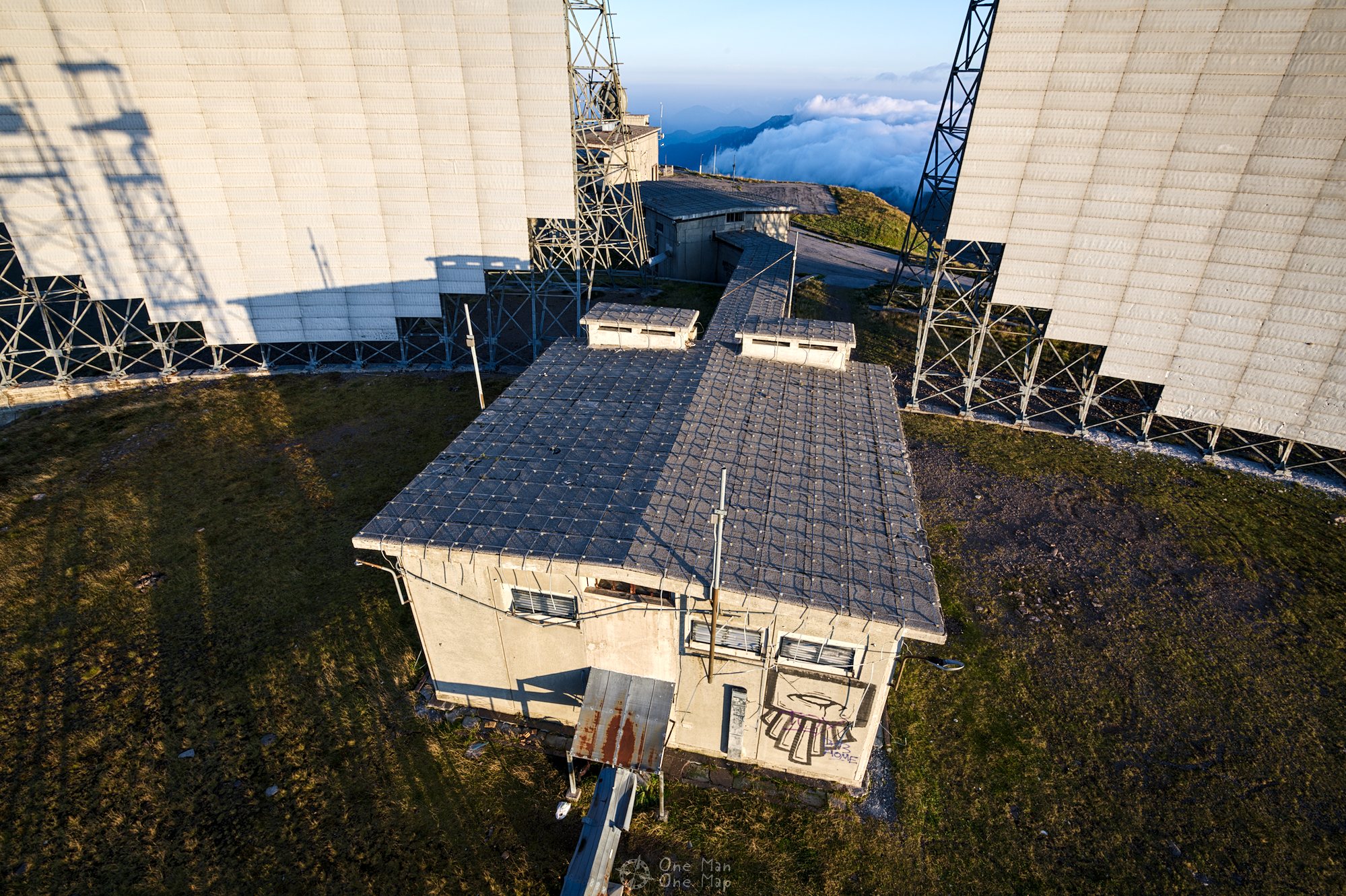
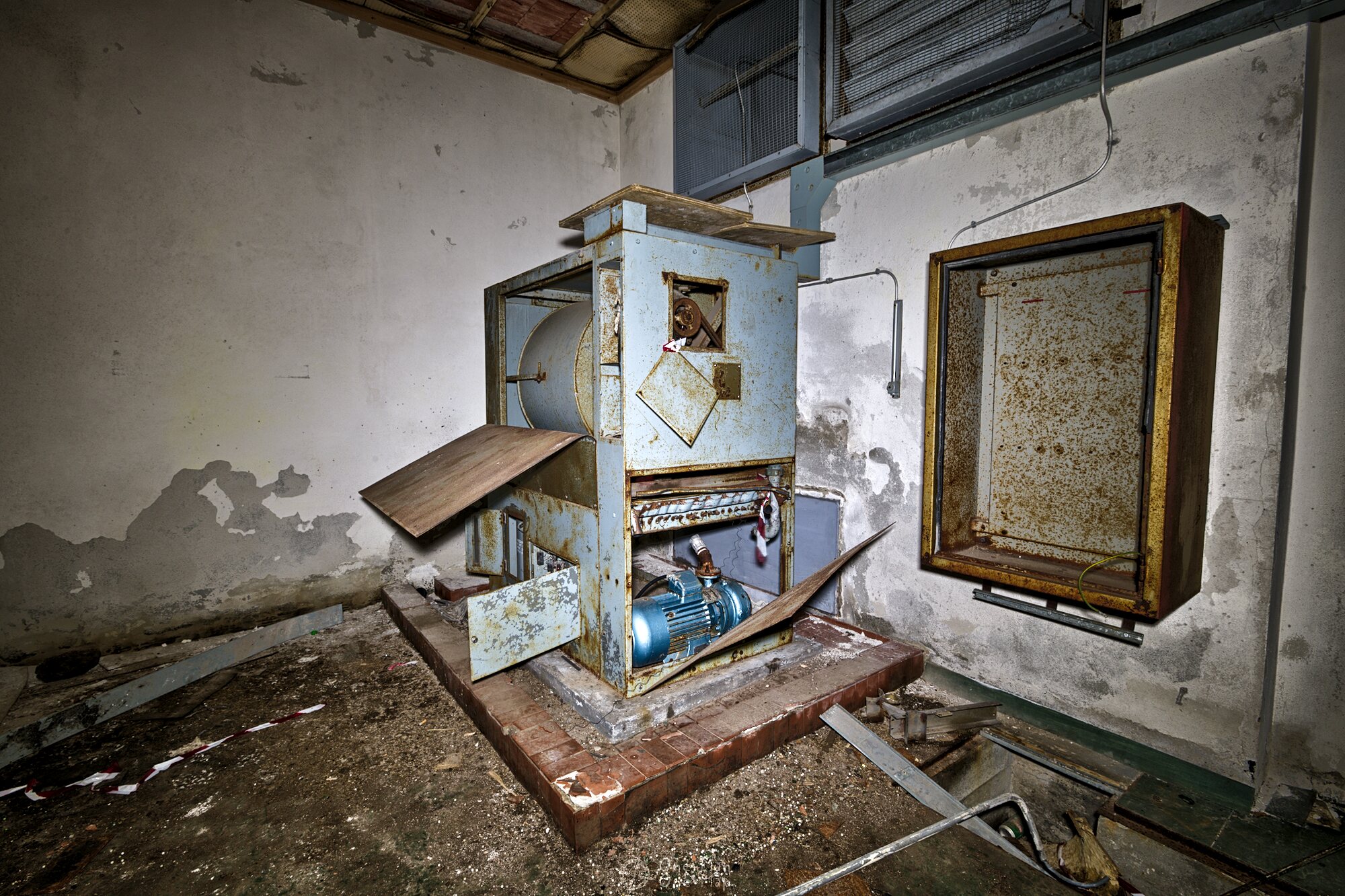
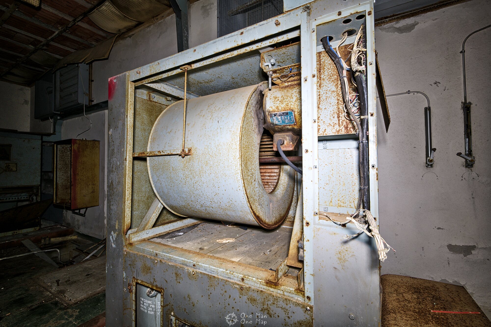
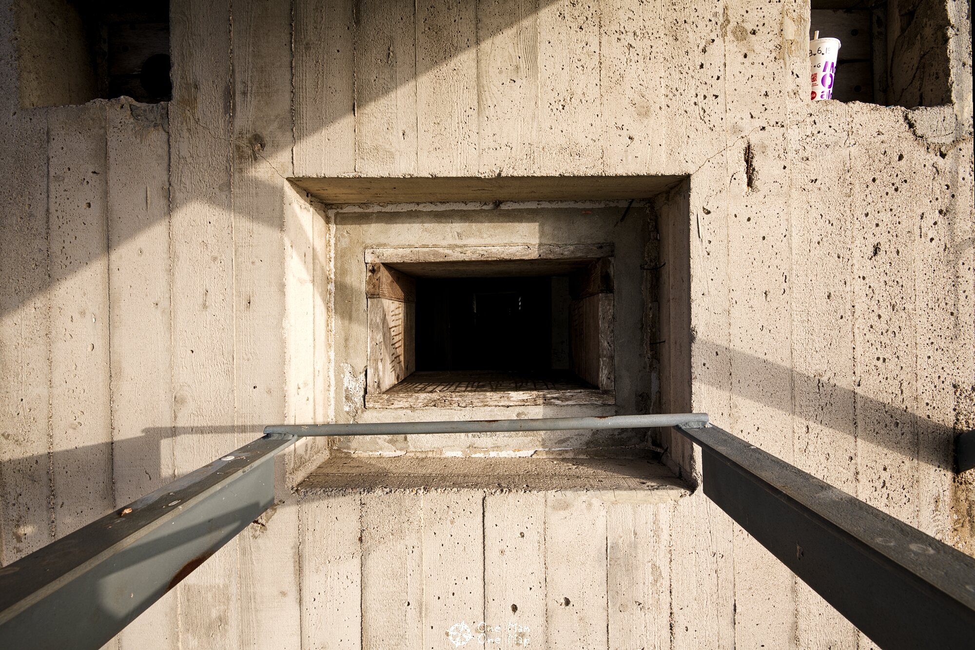
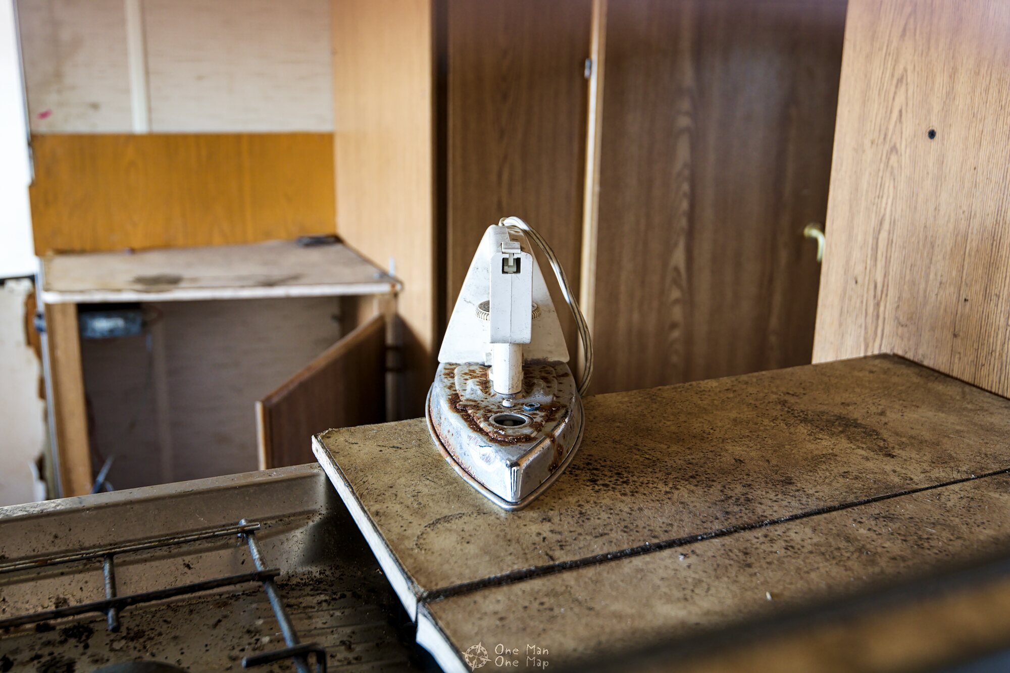
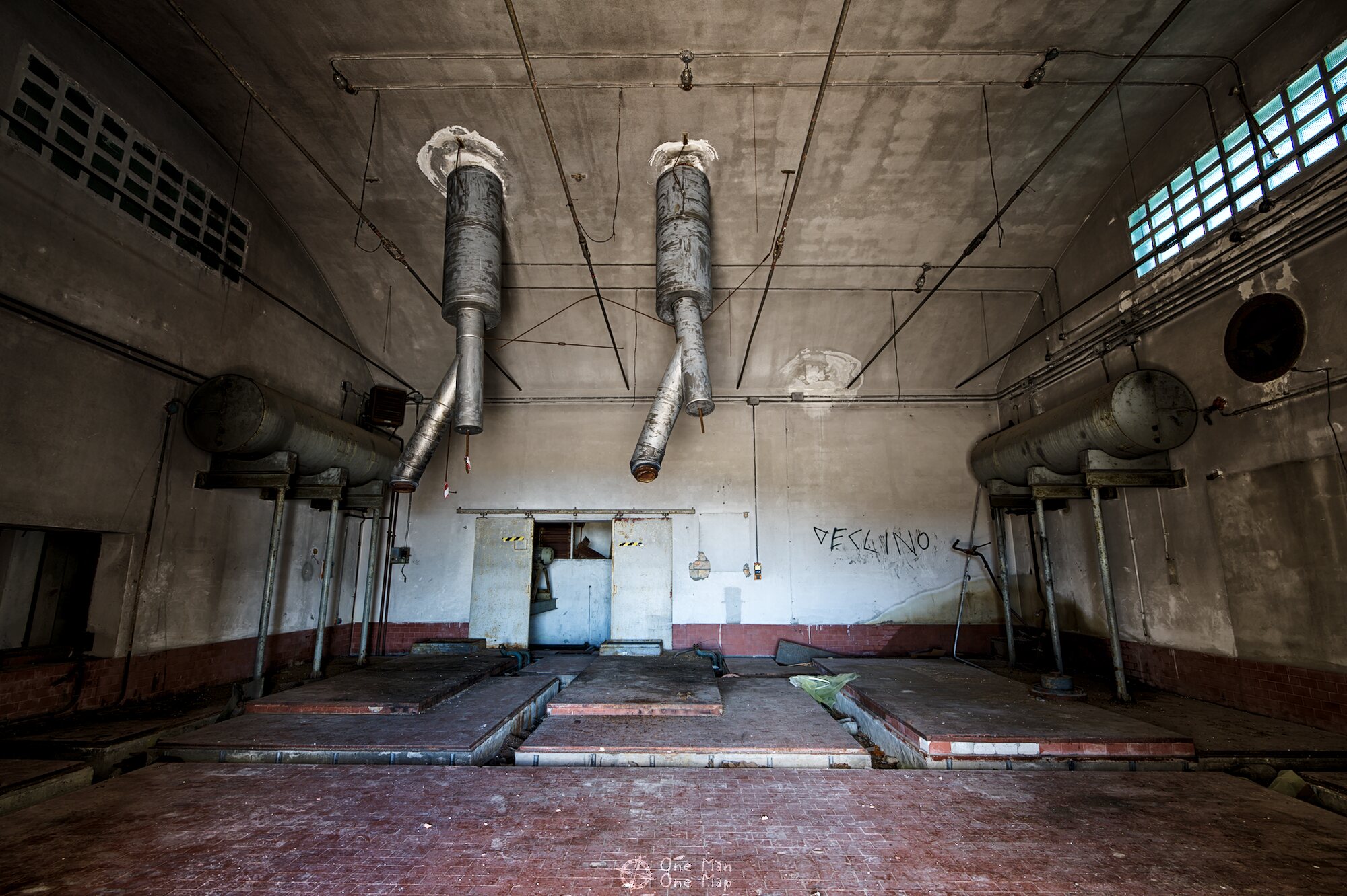
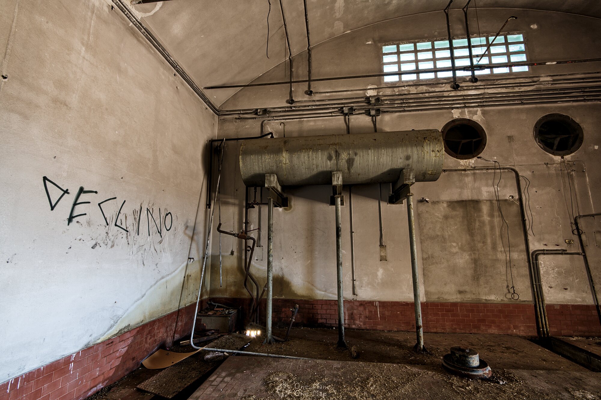
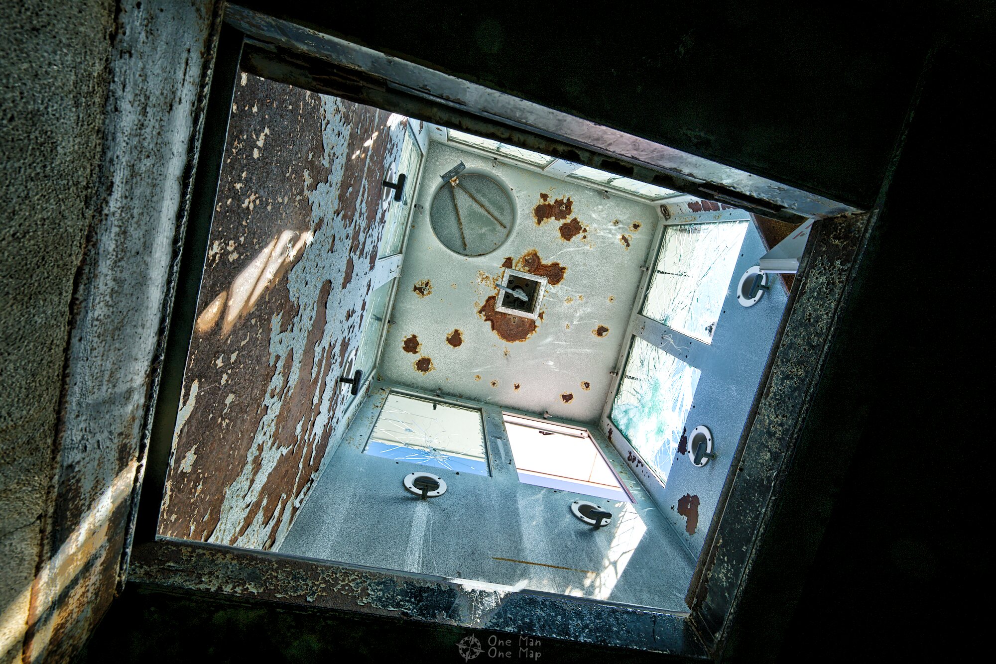
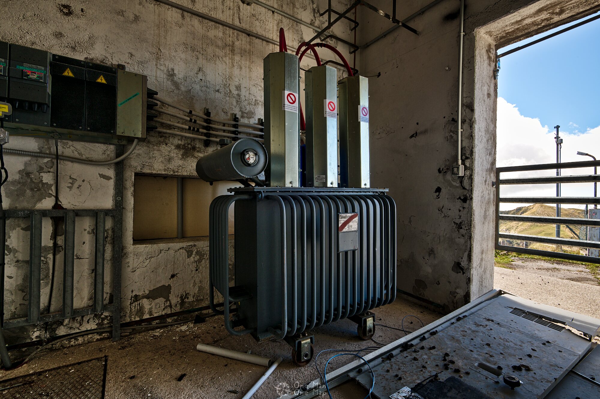
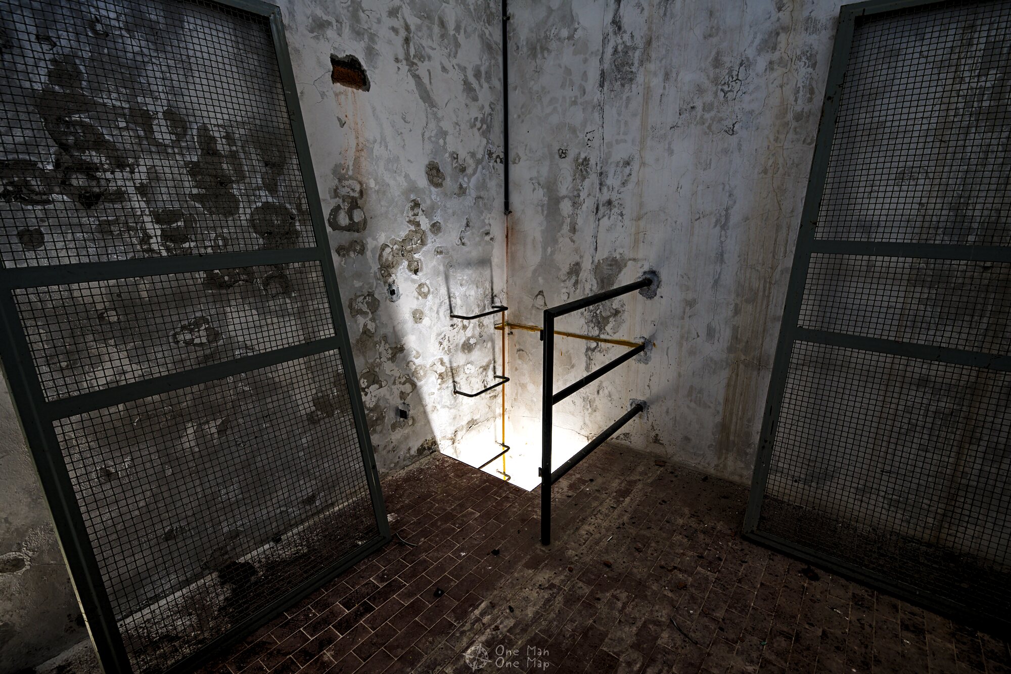
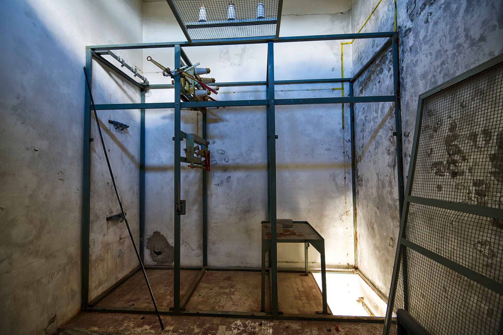
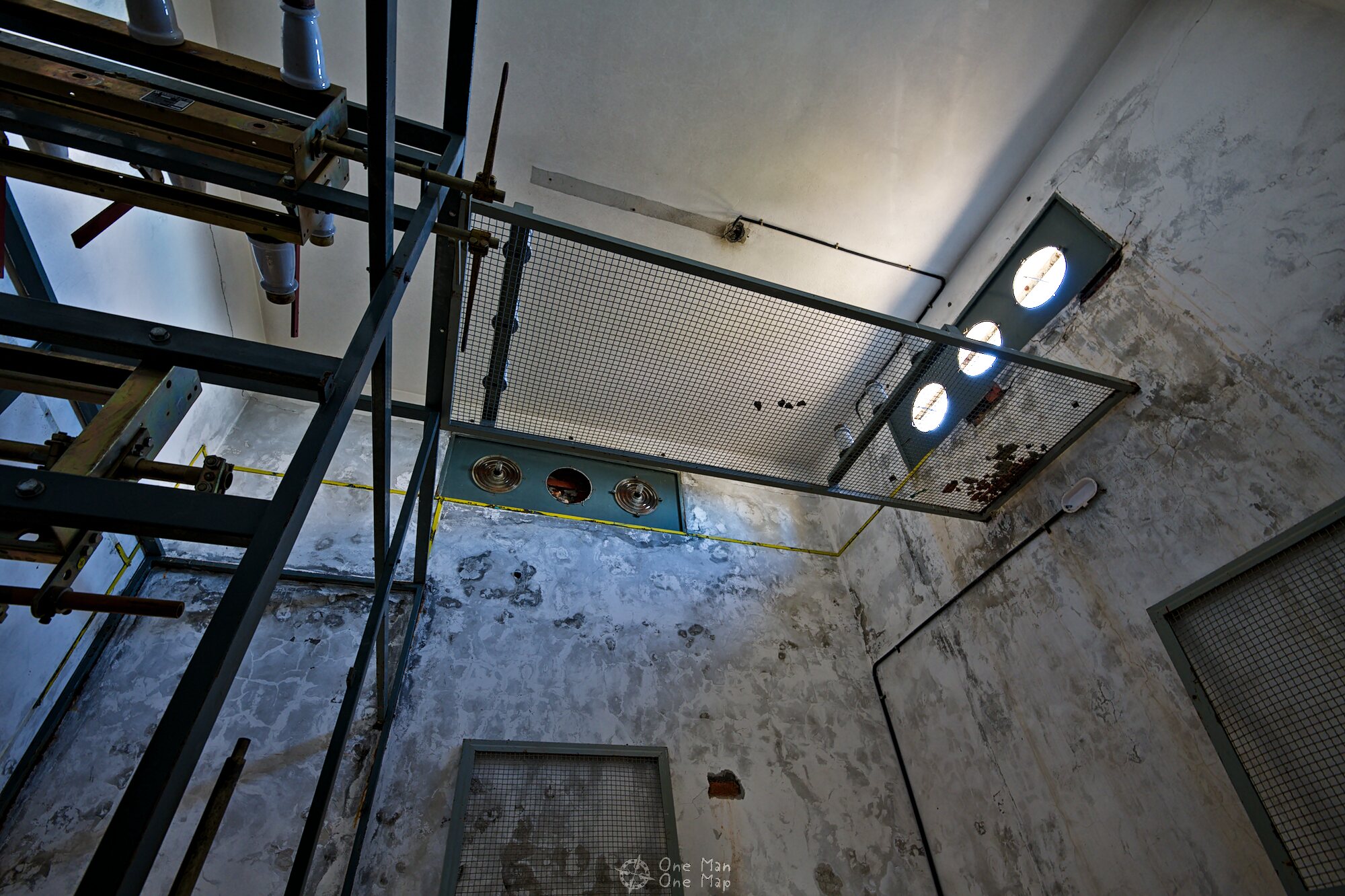
Time for a look into the holy of holies, the technical building (or at least what was left of it). NATO had probably already taken out the actual communications technology when it moved out, and then the metal thieves and vandals had helped themselves. Parts of the old air conditioning systems were still there.
The designation “ACE High” was probably derived from the frequency range of 832 to 959 megahertz. In the 1960s frequencies above 500 megahertz were still considered to be very high. Today WiFi, satellite televison and cellular networks operate at significantly higher frequencies in the Gigahertz range.
NATO was not alone with its Tropospheric Scatter system; similar communication networks existed in many regions. The Red Army operated the system SEVER, the Warsaw Pact the system BARS with stations from Moscow to Rostock in the former GDR. Civilian telecommunications providers such as British Telecom, Portugal Telecom and AT&T used the same technology for the connection of remote islands and oil drilling platforms. Some military forces also operated transportable transmitter and receiver systems.
A typical main station with two or more Tropospheric Scatter antenna systems was manned by about a dozen technicians who ensured reliable operation around the clock. The technicians were trained at the NATO Communications and Information Systems School (NCISS) in Latina, Italy, which was founded in 1959 specifically for ACE High. This training center continues to train NATO telecommunications technicians today.
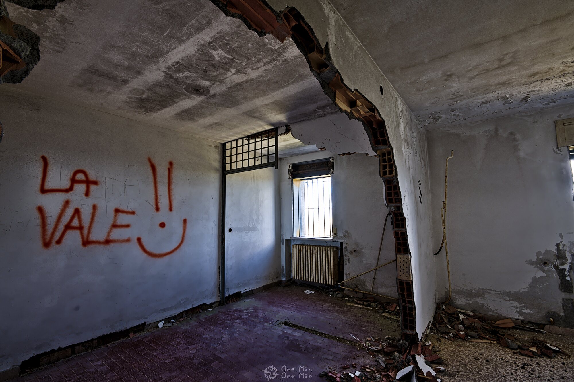
The crew had been accommodated in a two-story building. Especially during the winter months it must have been incredibly cold and boring up here. All the interior equipment had been removed, but someone had parked a caravan in the garage.
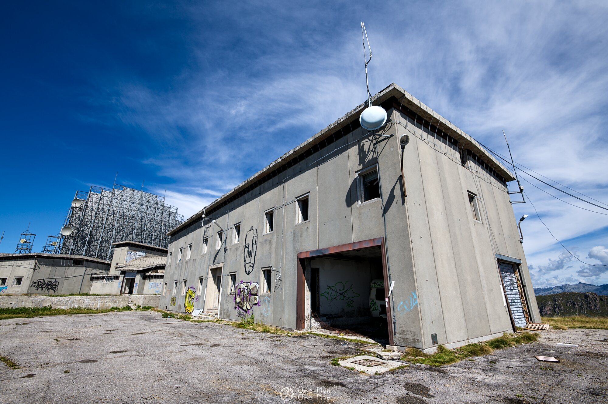


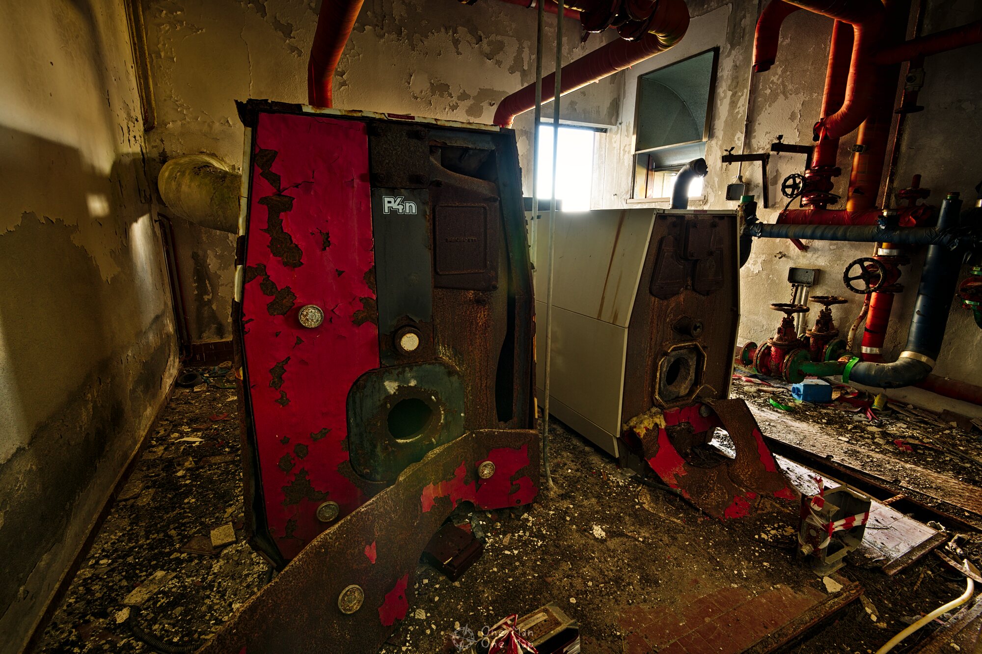
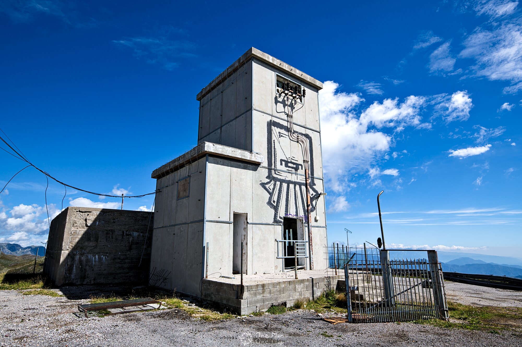
Between the technical building and the living quarters there was the supply building with diesel units, fuel tanks, heating systems, air conditioning technology and other rooms.
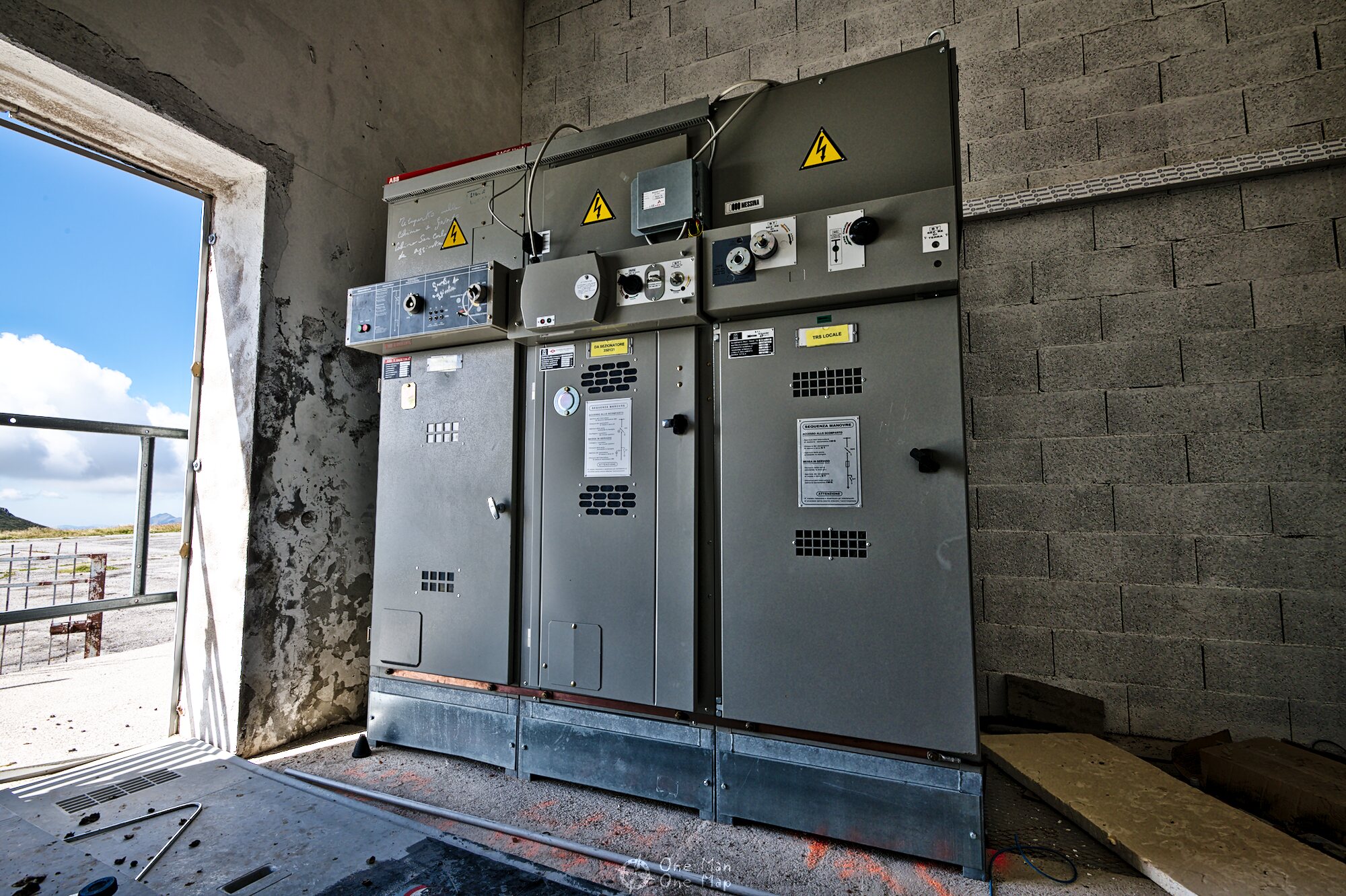
On the other side of the site, right next to the access gate, there was a power substation. It seemed to have been built much later, though, and was even partially located outside the fence. Various dates on signs and notes suggested that the last time someone had installed equipment here was in 2011, to operate a base station of a mobile phone provider. However it seemed that this base station had not been in operation for some time.
The 1970s brought great changes for ACE High. The first telecommunications satellites were launched into space, the telephone and data networks in Western Europe were continuously expanded and offered increasing capacities at falling prices. At the same time advances in the area of encryption technologies were made.
Instead of expanding ACE High any further, NATO increasingly integrated the civil and military satellite and telephone networks of its member states into the system. The main reason for this were the enormous cost for supplying and guarding the stations. Station D. in Italy was still comparatively close to civilization, with the nearest village being located only a few kilometers further down in a valley. Many stations in Norway, Alaska or on the Shetland Islands, however, had to be regularly supplied with food and fuel by ship or even by air.
In 1991, NATO finally had its own satellite “IV-A” put into orbit, followed by sister satellite IV-B in 1993. Together with other satellite systems from NATO partner countries Italy, France and the United Kingdom the Alliance now had a much more powerful system that no longer relied on a network of radio relay systems and could also be used by mobile stations on the ground, in aircraft and on ships at its disposal.
The final deathblow for ACE High finally didn’t come from the military, but from the civilian side. The frequency bands used had been allocated for a period of 40 years in 1958 and the allocation would have to be extended by 1998 at the latest. However, the frequency bands were exactly in the range that was needed for the deployment of the new GSM mobile communications system in the 1990s. It therefore didn’t come as a surprise that the countries were interested in a quick shutdown of the expensive, now obsolete stations.
At a meeting in 1995 the decision was made to already shut down the entire ACE High network in the following year. Some stations were equipped with satellite dishes and are still active military installations today. Many (e.g. those in Germany and England) were dismantled and sold, some – especially those in Italy – simply left to their own devices.
At the end of my exploration tour the sun had already set. I took another short tour around the site and enjoyed the great view of the surrounding mountains. Allegedly the operator of the local ski slopes wants to buy the site and build an observation tower up here. That doesn’t really surprise me, rarely does one get such a beautiful view from a relic of the Cold War.
But one can only hope that the installation won’t be destroyed completely and preserved for posteriority instead.


Conclusion: I have been to many Lost Places in the past, but Station D. was really something special. A secret NATO site at the top of a mountain, impressive technology from the Cold War that no longer exists today, and all this embedded into a beautiful mountain landscape 🙂 More Lost Places can be found in the corresponding category.
This post was written by Simon for One Man, One Map. The original can be found here. All rights reserved.